Possible Break in Stacy's case - Cops planning on a search tomorrow 6/5/10

Status
Not open for further replies.
I have revised my early map of the area. I have found that 7517 Grange Hall Rd is a home. 7517 WEST Grange Hall is the road leading up to the 16 acre Sportsman Club. If someone knows how to make it bigger---feel free!
View attachment 9549

attachment.php


I opened your attachment, right-clicked and chose "Copy link location."

I then quoted your post, chose the Insert Image icon in the toolbar (fourth from right) above and pasted the link by pressing Ctrl+V.
 
And thank you!

I was wondering how it worked that the search area was "next to" the Sportsman's Club based on the other maps.
 
I'm not sure I agree that the Sportsman's driveway is the only access to that property. It seems flat, has trails ... seems like a 4 wheel drive truck ought to be able to get in there HOWEVER I don't know if it could get in there and not attract attention.
 
Re Peliman #752 (Alt. Access)

In that same article that talked about the search site being "next to" the Sportsman's Club, didn't they say the ONLY access to that site is by using the road to the Sportsman's Club?

http://articles.chicagotribune.com/...07_1_kickapoo-creek-drew-peterson-blue-barrel

Heh, well I suppose I have read the comment BUT Satellite pics from 2004 show differently. In fact the neighbor from the west seemed to be going back there quite frequently.

I've read the comment if you're not a member you're tresspassing and I believe that also. BUT I don't beleive anyone who would be hiding a body would join the sportsman club to do so.

I'm looking at the hollows elevation readings also and it's quite interesting, it shows at least a 100' drop into the hollow.

Tracks in the photo show the Alt. Access being more frequently used than from the sportsmans club access.

Having said that, I don't see any reason a 2 seat ultralight couldn't land and take off from the area too. Attaching another pic to look at.

grangeAltAccess2.jpg
 
I wish I'd been able to see back roads and trails from the Ultralight Airport area but the birds eye view is not available in that area. I'll try from the search site toward the airport and see what happens.


Random thoughts:

Could the accomplice be a local? So that his (or to be fair, her) vehicle being seen back there would not be unusual or attract attention.

The Sportsman Club (based on the 7**7 West Grange Hall Road address) appears to be in Edwards, IL.

The farm (based on the 7**1 Grange Hall Road address) appears to be in Dunlap, IL.

Not sure what, if anything that means in the whole scheme of things LOL, but I'm going to try to overlay "city limits" on the parcel map.

I didn't see any news updates on the http://interceder.net/news/stacey-peterson site.

The Peoria County scanner link is offline still (again?)
http://www.radioreference.com/apps/audio/?feedId=4474
 
Just looking at all the ATV tracks in that area (Bing Map, which I understand can be old) and wondering whether one ATV rider would look all that different from another. I expect people in the area are used to seeing ATVs on the properties around there.

JMO
 
Does anyone know what this high tech equipment is that anthropologist, Harn, is recommending that LE bring in to use in the search for Stacy? I've read that archeologists have some sort of equipment they use prior to any sort of excavation to determine the location of an ancient buried village. But what exactly does this equipment see? Can it see a human skeleton? Or is it limited to only seeing artificial outlines indicating a man-made object or structure?

A friend of mine is an archaeologist that works for several Louisiana historic parks. So he routinely lectures me on all the great stuff he gets to find on the 1 or 2 days a year he gets to play with this stuff. It's called Ground Penetrating Radar or GPR. It sends electromagnetic waves into the ground and detects different materials and densities. It produces results that bring to our untrained laypersons mind a medical ultrasound scan. While it can be squirrely depending on the makeup of the soil, and local mineral content there are two things that it is absolutely fantastic at locating. Gravesites (They use it to find and map out old burial sites and graveyards all the time) and large metal objects. (such as a barrel).

The device itself looks kind of like those old classic WW2 Minesweepers, or in some cases a small lawnmower. Basically an arm that extends out from the tech with a large antennae box on the end. The operator slowly walks the device in a grid patern to map and search an area. The biggest downfall to the tech for a case like this is its availability. It's expensive specialized hardware, and the teams that operate it mainly come out of the larger universities. So it may take a week or two for LE to get one to them. (as I said my buddy the state parks archaeologist normally only sees 1 of these teams for about 2 or 3 days a year and his 2 parks are active 17th and 18th century archaeology sites).
 
http://en.wikipedia.org/wiki/Edwards,_Illinois

Edwards is an unincorporated community in Peoria County, Illinois, United States. Edwards is located on Illinois Route 8 northwest of downtown Peoria. Edwards has a post office with ZIP code 61528.[2]


http://en.wikipedia.org/wiki/Dunlap,_Illinois

Dunlap, located on Illinois 91, is a small village in Peoria County Illinois, United States. Its population was 926 people as of the 2000 census. Dunlap is part of the Peoria metropolitan area and growth in the city of Peoria is extending towards the village. There are only a handful of businesses in the village's sixteen blocks.

...

Dunlap is located at
18px-Erioll_world.svg.png
40°51′39″N 89°40′41″W / 40.86083°N 89.67806°W / 40.86083; -89.67806 (40.860786, -89.678123).[1]

The mapping link http://gis.peoriacounty.org/website/external/ does not find any parcels on "West Grange Hall Road" although there are clearly houses on that road as you go past.
 
I don't know how/if this affects things, but the parcel listing for the farm is also WEST Grange Hall Road.
 

Attachments

  • parcel list and map showing 7241 and 7517.JPG
    parcel list and map showing 7241 and 7517.JPG
    133.7 KB · Views: 10
I have revised my early map of the area. I have found that 75** Grange Hall Rd is a home. 75** WEST Grange Hall is the road leading up to the 16 acre Sportsman Club. If someone knows how to make it bigger---feel free!
View attachment 9549

2b316fce.jpg


Sorry to confuse the issue more, but according to the parcel list (see right) 75** Grange Hall Road (home) is on West Grange too.
 
I wish I'd been able to see back roads and trails from the Ultralight Airport area but the birds eye view is not available in that area. I'll try from the search site toward the airport and see what happens.

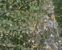
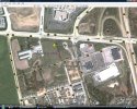
Fryes seems like the more likely location to me for ultralights. Two pics, one an overview showing both airports and tent site. The second is Warren Fryes Farms Heliport. The second is a closer up of Fryes. Expanded in a paint program it might show road names more clearly. I just made myself hungry talking about Fryes. haha

AirportsSite.jpgAirportsSiteFrys.jpg
 
Any locals know if anything is going on? It's another gorgeous day here in the Chicagoland area so far, and just thinking that maybe they are trying to be "under the radar" so to speak....LOL
 
Based on the parcel IDs, I have identified these points on map in Post 765:

0828300010 (property above 7**7 west grange hall) http://gis.peoriacounty.org/website/external/PropertyCard.aspx?ObjectID=10903

0828300011 (7**7 west grange hall) http://gis.peoriacounty.org/website/external/PropertyCard.aspx?ObjectID=10904

0828300007 (76*1 west grange hall) http://gis.peoriacounty.org/website/external/PropertyCard.aspx?ObjectID=10900

0828300005 (7**1 west grange hall) http://gis.peoriacounty.org/website/external/PropertyCard.aspx?ObjectID=10898

0828100006 (west grange hall, Big Hollow Sportsman's Club, no "house" number associated with it; "owner" listed as Peoria property owner, see below) http://gis.peoriacounty.org/website/external/PropertyCard.aspx?ObjectID=10887

Info at link to road info:
Parcel ID Property Address City State ZIP
0828100006 W GRANGE HALL RD DUNLAP, IL, 61525

Under Owner Information at that link:

Name Address City State Zip
Secured 6*** N HUNTERS TRACE PEORIA, IL 61614
 
Based on the parcel IDs, I have identified these points on map in Post 765:

0828300010 (property above 7**7 west grange hall) http://gis.peoriacounty.org/website/external/PropertyCard.aspx?ObjectID=10903

0828300011 (7**7 west grange hall) http://gis.peoriacounty.org/website/external/PropertyCard.aspx?ObjectID=10904

0828300007 (76*1 west grange hall) http://gis.peoriacounty.org/website/external/PropertyCard.aspx?ObjectID=10900

0828100006 (west grange hall, the road?, no "house" number associated with it) http://gis.peoriacounty.org/website/external/PropertyCard.aspx?ObjectID=10887

0828300005 (7**1 west grange hall) http://gis.peoriacounty.org/website/external/PropertyCard.aspx?ObjectID=10898

Info at link to road info:
Parcel ID Property Address City State ZIP
0828100006 W GRANGE HALL RD DUNLAP, IL, 61525

Under Owner Information at that link:

Name Address City State Zip
Secured 6**** N HUNTERS TRACE PEORIA, IL 61614

As to the last one---the person the tax info gets sent to is at that address. I don't think he is the owner per se. He has been on TV and is a club member. The rest of the parcels are pretty much owned by the people who live there.
 
A friend of mine is an archaeologist that works for several Louisiana historic parks. So he routinely lectures me on all the great stuff he gets to find on the 1 or 2 days a year he gets to play with this stuff. It's called Ground Penetrating Radar or GPR. It sends electromagnetic waves into the ground and detects different materials and densities. It produces results that bring to our untrained laypersons mind a medical ultrasound scan. While it can be squirrely depending on the makeup of the soil, and local mineral content there are two things that it is absolutely fantastic at locating. Gravesites (They use it to find and map out old burial sites and graveyards all the time) and large metal objects. (such as a barrel).

The device itself looks kind of like those old classic WW2 Minesweepers, or in some cases a small lawnmower. Basically an arm that extends out from the tech with a large antennae box on the end. The operator slowly walks the device in a grid patern to map and search an area. The biggest downfall to the tech for a case like this is its availability. It's expensive specialized hardware, and the teams that operate it mainly come out of the larger universities. So it may take a week or two for LE to get one to them. (as I said my buddy the state parks archaeologist normally only sees 1 of these teams for about 2 or 3 days a year and his 2 parks are active 17th and 18th century archaeology sites).

This is fascinating! Based on what you've posted, if LE obtains one of these high-tech GPR devices and a team to operate it, they could do complete coverage of the search site, which in one article was estimated to be about an acre in size, in a few days.

I would think that if there's human remains within that search site, or a metal barrel as was stated in the original TMZ article, they would be found with that type of equipment.

We could be assured that if a search was done with GPR, and nothing found, that it was a thorough search and nothing is there.

I remember that after Jaycee Duggard was found, LE used some sort of device to go over the land next door to see if there were any remains of victims of Phillip Garrido. I bet they used GPR.
 
On DP 3 day 'clear my head trip'..........didn't he go on his motorcycle?
Was his ultra light ever moved that week????
 
As to the last one---the person the tax info gets sent to is at that address. I don't think he is the owner per se. He has been on TV and is a club member. The rest of the parcels are pretty much owned by the people who live there.

I had some mistakes that gave incorrect info and fixed that post. The owner who appears to live in Peoria was the owner of the Big Hollow Sportsmans Club.

You are right ... it just means the tax statements go to that address. It is their wording that says "owner." The address is in a residential neighborhood.

ETA
It's possible that the continued existence of the Club was set up in someone's will or as a trust or something along those lines.

If anyone knows who owns the Sportsman's Club, please let us know. (eta: while following TOS of course.)
 
On DP 3 day 'clear my head trip'..........didn't he go on his motorcycle?
Was his ultra light ever moved that week????

He left and returned on his motorcycle. But I don't remember any report on whether or not his ultralight was moved that week.

I've always felt that the 3-day head clearing trip was for the purpose of disposing of Stacy's body. I also feel DP had to have help. I think he had Stacy's body stored somewhere, and when he left on his motorcycle, he met his accomplice and together they retrieved Stacy's body and proceeded to wherever they went.

One of the people who acted suspiciously is Mike Robinson. According Rick Mims, who stayed at the Peterson home for a few days, Mike Robinson showed up and gave DP a cell phone and instead of talking, they passed notes back and forth. Whether or not Mike Robinson is the accomplice or just a go-between person, acting as a courier between DP and the accomplice is not known. I feel Mike Robinson played some sort of role in helping DP.
 
I've been a dedicated follower of this case for a long time. I'm excited about the recent developments, but I'm confused on all the Ultralight conversation.

While I do believe it is possible that D.P. used the Ultralight to search out areas, I have no believe that it would have been used to transport Stacy's body, if that is being suggested. Nor would I believe he used it to travel or land in the area.

D.P. is known to be one that tries to work under the radar, or in the dark, with dark clothes and hoodies, etc. I see no scenario that he would place himself in any situation that would make him visible to the public eye, and certainly flying into the area with, or with out the body, but to bury it as possible.

And I believe that D.P. had a contingency plan in place for a very long time. He knew someday there was a risk that Stacy could spill the beans on the Savio case, so he has always been prepared to do the inevitable when the time came.

Having said that, he had to store the body somewhere for a short period of time, ahead of his "head clearing trip". At that time, assuming the body is more than an hour away, he had to have either had another vehicle to move the body, but he wouldn't do it in an ultralight because he could be seen. He either had an accompliss with a car, borrowed a car (from a friend or illegally), rented a car, or had someone move it to a disposal or burial location.

Assuming he has an accompliss, this person either has something to lose because Drew has something on him, owes Drew for past "favors", fears for his life, or is getting paid a lot of money. I believe a combination of the first two.

I believe this person also may have been given immunity, but at the same time he fears what it would do to his relationships. That accompliss has built a life on lies and is living comfortably. Even though he might not go to prison, his life would be a prison because he would lose his comfortable life for something he perhaps did years ago that D.P. helped him cover up.

It's not always the fear of going to prison that keeps people from talking, but the fear of losing your life as you know it. perhaps that person has just lost part of that life and now has less to lose, so he is talking?? That may have led to the tip now...3 years later.

JMO
 
Status
Not open for further replies.

Members online

Online statistics

Members online
186
Guests online
2,978
Total visitors
3,164

Forum statistics

Threads
592,207
Messages
17,965,021
Members
228,715
Latest member
Autumn.Doe
Back
Top