2023 Hurricane and Tropical Weather

...EXTREMELY DANGEROUS CATEGORY 4 HURRICANE LIDIA MAKES LANDFALL IN WEST-CENTRAL MEXICO... ...LIFE-THREATENING WINDS AND FLOODING RAINFALL SPREADING INLAND OVER WEST-CENTRAL MEXICO...

6:00 PM MDT Tue Oct 10
Location: 20.1°N 105.5°W
Moving: ENE at 16 mph
Min pressure: 942 mb
Max sustained: 140 mph
 

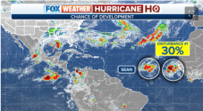
The NBC2 First Alert Hurricane Tracking Team is monitoring a tropical wave over the central Atlantic Ocean for potential development over the next several days.

Development odds with this feature have increased to 70% over the next 2 days and 80% over the next 7 days.

A tropical depression is likely to form by the end of the work week.
Of course another wave, we have 43 more days of "hurricane season".
 
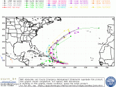
Tammy has arrived.....hopefully a fish spinner for the most part.

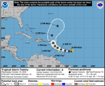
Tropical Storm TAMMY
As of 00:00 UTC Oct 19, 2023:

Location: 13.0°N 52.5°W
Maximum Winds: 35 kt Gusts: N/A
Minimum Central Pressure: 1006 mb
Environmental Pressure: N/A
Radius of Circulation: N/A
Radius of Maximum wind: 60 nm
34 kt Wind Radii by Quadrant:

1697677396190.png


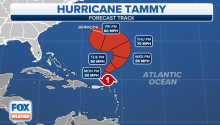
Hurricane-force winds and heavy rainfall impacted the northeastern Caribbean islands over the weekend as Hurricane Tammy made landfall on the island of Barbuda late Saturday night. But Tammy is now pulling away from the islands as it heads northwest into the southwestern Atlantic Ocean, and it could track near Bermuda later this week.

1698029893586.png
 
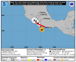
...OTIS RAPIDLY STRENGTHENS INTO A MAJOR HURRICANE......NOW EXPECTED TO BE AT CATEGORY 4 INTENSITY AT LANDFALL...

4:00 PM CDT Tue Oct 24
Location: 15.3°N 99.5°W
Moving: NNW at 8 mph
Min pressure: 960 mb
Max sustained: 125 mph

It's been an awful hurricane season for Mexico

205759_5day_cone_no_line_and_wind.png
 
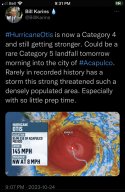
...OTIS RAPIDLY INTENSIFIES TO A CATEGORY 5 HURRICANE......CATASTROPHIC DAMAGE LIKELY WHERE THE CORE OF THE HURRICANE MOVES ONSHORE...

10:00 PM CDT Tue Oct 24
Location: 16.1°N 99.7°W
Moving: NNW at 9 mph
Min pressure: 927 mb
Max sustained: 160 mph

I cannot describe the opening sentence of the forecast discussion.

"A nightmare scenario is unfolding for southern Mexico this evening
with rapidly intensifying Otis approaching the coastline."


"This is an extremely serious situation for the Acapulco
metropolitan area with the core of the destructive hurricane likely
to come near or over that large city early on Wednesday. There are
no hurricanes on record even close to this intensity for this part

of Mexico."

Hurricane Otis Forecast Discussion
Prayers for those in the projected impact zone.
 

Staff online

Members online

Online statistics

Members online
129
Guests online
3,475
Total visitors
3,604

Forum statistics

Threads
594,697
Messages
18,010,385
Members
229,465
Latest member
Wrensparrow
Back
Top