Australia Australia - Gerard Ross, 11, Rockingham, WA, 14 Oct 1997

DNA Solves
DNA Solves
DNA Solves
https://en.m.wikipedia.org/wiki/Dave_Everett

In 1991 in Perth, Western Australia, all three - in a stunt that lasted several hours - raided the home of a theatre manager and his pregnant wife of 6 months taking the couple at gun-point in order to open the safe to gain access to the funds. They stole the money but were later caught. Everett, however, was released on bail whilst Reynolds committed suicide in prison, the third accomplice escaped capture and remained unidentified.

********
Makes you wonder where the third accomplice went. Perhaps he stayed in the Rockingham area. He was obviously a violent person. Could there be a connection to Gerard Ross's murder. I wonder if he was ex SAS too. MOO
 
You can always count on Quigley to say it how it is. About Everett [FONT=&amp]"The biggest coward in all this is this SAS-trained solider, Everett, he doesn't have a backbone - he's got a tube of custard running from his head to his bum because the only way he has ever used and the only times he has ever used the weaponry that he was trained to use by the SAS is inside the homes of WA families as he took pregnant women and children hostage. [/FONT]http://www.perthnow.com.au/news/wes...r/news-story/b6920c07f3e6a0703c428456bb7efed0

Also the Hansard description of former top cop Falconer as that peanut turnip farmer from Victoria. Just my opinion only.
Everett left the Army in 86, came back from Myanmar in 87. Cutler disappeared in 88.

Sent from my HTC 2PQ910 using Tapatalk
 
PD, do you think images got captured on camera? Do you think they need an Inquest similar to Morcome to bring out the suspects they had and all the details?

attachment.php
 

Attachments

  • GR_Discovry_Mutitions corner.JPG
    GR_Discovry_Mutitions corner.JPG
    127 KB · Views: 125
PD, do you think images got captured on camera? Do you think they need an Inquest similar to Morcome to bring out the suspects they had and all the details?

attachment.php
If that the track into the GR site, then although it's parallel to the Explosives Depot entry road, it is some distance away from it. In this picture it shows that the plantation had not been harvested. Twenty years later all those trees were being harvested. The current view on Google Maps has the entire plantations gone and cameras on poles can be seen but only around the entrance to the facility. This dirt track does go to the perimeter and follows the perimeter around before heading east to where the arrow was pointing in a previous picture. But there doesn't appear to be a camera on a pole in Google Maps that I can see where the track hits the perimeter. However there is what's looks like a large pole and camera near the gatehouse which could possibly view that track as it gets close to the facility. I'm not sure that it would pan off the entrance road though.

Sent from my HTC 2PQ910 using Tapatalk

This is now. Back in 1991 there would've been pine trees between the CCTV at the Gatehouse and the Track that leads to the GR dumpsite.
attachment.php
attachment.php
attachment.php
attachment.php
 

Attachments

  • BaldivisExplosives Reserve_GateHouseCCTV+Track.jpg
    BaldivisExplosives Reserve_GateHouseCCTV+Track.jpg
    95.1 KB · Views: 81
  • BaldivisExplosives Reserve_GateHouse+Track.jpg
    BaldivisExplosives Reserve_GateHouse+Track.jpg
    94.3 KB · Views: 87
  • BaldivisExplosives ReserveSat.jpg
    BaldivisExplosives ReserveSat.jpg
    116.4 KB · Views: 85
  • BaldivisExplosives Reserve.jpg
    BaldivisExplosives Reserve.jpg
    28.9 KB · Views: 87
Thanks, PD,I've adjusted my maps. It was the pine plantation image printed in reports that should have been inverted.

attachment.php
attachment.php


Source 1: Google maps
Source 2: Westpix

  • This image can be licensed for Personal, Editorial, or Commercial Use. Search for missing boy Gerard Ross - Crime murder scene. the spot where Gerard Ross' body was found. Picture Barry Baker The West Australian Pic taken Monday 29 October, 1997


  • By:Barry Baker Image ID:TWA-0064103 Date Reference:17 January 2017


Attachments

  • GR_Discovery_Google.JPG
    GR_Discovery_Google.JPG
    103 KB · Views: 73
  • GR_Discovery_Westpix.JPG
    GR_Discovery_Westpix.JPG
    119.2 KB · Views: 73
Thanks, PD,I've adjusted my maps. It was the pine plantation image printed in reports that should have been inverted.

attachment.php
attachment.php


Source 1: Google maps
Source 2: Westpix

  • This image can be licensed for Personal, Editorial, or Commercial Use. Search for missing boy Gerard Ross - Crime murder scene. the spot where Gerard Ross' body was found. Picture Barry Baker The West Australian Pic taken Monday 29 October, 1997


  • By:Barry Baker Image ID:TWA-0064103 Date Reference:17 January 2017


Thanks IC and PD.
Good pics


............................................
Posts my opinion unless source included. All my original text/images are my personal copyright and can't be reproduced outside of WebSleuths without my permission.
[emoji317][emoji317][emoji317]
 
attachment.php
attachment.php

Source Google maps 2017

Notice that the in the 1997 westpix image marking GR's discovery spot, there appears to be building on the corner of the Baldivis Explosives facility, just as there are in 2017.

Zooming into this corner you can clearly see. I'd still like to know what the pole in the 1997 image was doing and what the white box was on it. There doesn't seem to be any power then or in 2017.

he 2017 image shows something in the approximate position as the pole in the 1997 image.

Does anyone know what it could be? Or what the pole in the 1997 image could have been there for?
 

Attachments

  • GR_Google_Overhead_Corner.jpg
    GR_Google_Overhead_Corner.jpg
    96.9 KB · Views: 71
  • GR_Google_Overhead_Closeup.jpg
    GR_Google_Overhead_Closeup.jpg
    122 KB · Views: 70
attachment.php
attachment.php

Source Google maps 2017

Notice that the in the 1997 westpix image marking GR's discovery spot, there appears to be building on the corner of the Baldivis Explosives facility, just as there are in 2017.

Zooming into this corner you can clearly see. I'd still like to know what the pole in the 1997 image was doing and what the white box was on it. There doesn't seem to be any power then or in 2017.

he 2017 image shows something in the approximate position as the pole in the 1997 image.

Does anyone know what it could be? Or what the pole in the 1997 image could have been there for?
The Westpix image with the police cars near a police with streetsigns is at the corner of Stakehill and Baldivis roads at the entrance to that track. It is no where near your circled car on the Bush track near the perimeter fence IMO.

Sent from my HTC 2PQ910 using Tapatalk
 
The Westpix image with the police cars near a police with streetsigns is at the corner of Stakehill and Baldivis roads at the entrance to that track. It is no where near your circled car on the Bush track near the perimeter fence IMO.

Sent from my HTC 2PQ910 using Tapatalk

Yes I realise the image with the street signs of Stakehill and Baldivis is no where near the corner of the munitions centre shown in the 2017 images above.

But the overhead image, probably taken from the air is right on the intersection of the explosives facility. The same corner as above in the 2017 images. This is where the mystery pole is. The only sealed road is inside the perimeter fence of the ammunition centre. Stakehill is an unsealed road.

attachment.php

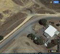
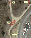
Corner of the Baldivis Ammunition facility with track leading to GR discovery.
 

Attachments

  • GR_Discovry_Mutitions corner.JPG
    GR_Discovry_Mutitions corner.JPG
    127 KB · Views: 79
Yes I realise the image with the street signs of Stakehill and Baldivis is no where near the corner of the munitions centre shown in the 2017 images above.

But the overhead image, probably taken from the air is right on the intersection of the explosives facility. The same corner as above in the 2017 images. This is where the mystery pole is. The only sealed road is inside the perimeter fence of the ammunition centre. Stakehill is an unsealed road.

attachment.php

Corner of the Baldivis Ammunition facility with track leading to GR discovery.
Stakehill road is sealed. Always has been. I used to drive that way many years before.
The picture your showing above is at Baldivis Stskehill corner. There's now a roundabout there, because the government is moving the explosive facility and about to sell the land to developers. Back in 97 it was this sweeping bend because both Baldivis and Stakehill were 80kph roads. Before the freeway and the housing developments further north went in, Baldivis Rd, and Stakehill were a major shortcut to Mandurah Rd, especially if you came via Shepperton Rd, Albany Hwy, Nicholson Rd, King Rd and Mundijong Rd from the city,which was the usual route before the freeway was built.
The picture above is not the internal road inside the facility. As there are no power poles inside the facility (it has underground power) and the security fence that runs along the perimeter road is not in the picture.
The pole with a box, I've previously posted a street view of was removed when the roundabout went in and a transformer appears on a pole a bit further down in google Street View in 2015, which doesn't have a transformer on Google Street View in 2008. This is suggestive that the pole in the 1997 images was also a transformer. The poles shown in all these pics carry 3KiloVolt transmission wires. If street lights are required at the corner, or power for houses etc then a step down transformer is required to bring the voltage down to 240 volt. In those instances an extra set of 240V wires might appear below the 3KV line, or a cable running down the transformer to underground power might be visible. The 1997 images are not clear enough to ascertain, but the sheer size of the object on the pole is IMO too big to be a camera. I note in google Street View that there is an extremely large metal pole with what looks like a camera just south of the Gatehouse of the Explosives Depot, which probably has a complete View of the whole facility and main road in and out. The roadway in and the track are mostly parallel, but back in 1997 might of had pine trees between them. However, police did want to follow up reports of a white ute, and it might well be that a white use was glimpsed between trees from the gatehouse CCTV, confirming reports from other observers, eg Tennants at the facility, passing motorists, horse riders etc. Since 1997 all CCTV by Govt, Local Authorities, and many businesses had joined the blue iris project which allows police to quickly ascertain if an area of covered and contact tape holders, or in a lot of cases access live feeds where available. It's how they got the West Perth rapist.
Considering what Everett did there, I'm surprised by what I don't see in Google Earth images.

https://www.westpix.com.au/preview.asp?image=TWA-0064099&itemw=4&itemf=0001&itemstep=1&itemx=16 (incorrectly described as the crime scene)

https://www.westpix.com.au/preview.asp?image=TWA-0064096&itemw=4&itemf=0003&itemstep=1&itemx=72 (correctly described _ same location as the above)

Some articles about Blue Iris

https://thewest.com.au/news/wa/police-cctv-database-unusable-ng-ya-146050

http://www.perthnow.com.au/news/wes...w/news-story/d55f2ffe0f9c1c3b86f3a30508c97fd4

https://www.governmentnews.com.au/2015/04/cops-eye-massive-voluntary-cctv-expansion/

https://www.securityelectronicsandn...2/09/wa-plans-integrated-state-wide-cctv-2017

Sent from my HTC 2PQ910 using Tapatalk
 
PD, do you think images got captured on camera? Do you think they need an Inquest similar to Morcome to bring out the suspects they had and all the details?

attachment.php

Stakehill road is sealed. Always has been. I used to drive that way many years before.
The picture your showing above is at Baldivis Stakehill corner. <SNIPPED>

I was wrong. I was looking at the north eastern end of the the Explosives facility where other posters marked GR dumpsite as.
In fact it is not. I just found that exact pole and corner at the Western corner of the explosives facility.
This changes everything that I assumed. If the dump site is on the western end of the Pine Plantation then whoever dumped in might've come in from Harvey Rd or Karri Street.
Now you can use Google Earth to have a better look at whatever is on that pole.
attachment.php
attachment.php
attachment.php
 

Attachments

  • PoleFoundZoomOutFurther.jpg
    PoleFoundZoomOutFurther.jpg
    110.3 KB · Views: 60
  • PoleFoundZoomOut.jpg
    PoleFoundZoomOut.jpg
    95.4 KB · Views: 15
  • PoleFound.jpg
    PoleFound.jpg
    99.2 KB · Views: 15
  • PoleFoundZoomOut.jpg
    PoleFoundZoomOut.jpg
    95.4 KB · Views: 58
  • PoleFound.jpg
    PoleFound.jpg
    99.3 KB · Views: 60
Search title: No killer, no clues and no inquest into the murder of Gerard Ross
October 01, 2013 2:20PM
Date:22 October 2016, Status: Non paywall, Time 6:46
http://www.news.com.au/national/no-...r-of-gerard-ross/story-fncynjr2-1226730066395
Speaking for the first time, the grandfather won’t be drawn on the details.

“It’s not the grisly bit … I’m not even going there,” he said. “The finding of that little boy was not something you really want to talk about.”

Despite the discovery, Miller continued to run his horses through the pines.

“It starts to get to you, wondering who’s around,” he said.

“It’s not good to know that whoever did it (is still free).”


Sent from my HTC 2PQ910 using Tapatalk
 
The officer actively in charge of the GR investigation was questioned.

The Gerard Ross murder inquiry was seen as child abuse related, I think?---Yes. Which explains why Detective Senior Sergeant Miller was assigned to it for a period?---I don't know why Senior Sergeant Miller was assigned to it, but yes; it was obviously child abuse-related.
Royal Commission into whether there has been any corrupt or criminal conduct by Western Australian Police Officers

.pdf:

https://www.slp.wa.gov.au/publicati...AF2F53EFBDC48256C32003886E2/$file/S020912.pdf
So in summary of this Royal Commission transcript: "Q2" is a prominent member of the West Australian community, and there was a deposition from a "Q1" about the Gerard Ross murder allegedly pointing a finger at "Q2". Arguments within Police whether "Q2" to be arrested or summonsed. DPP said they needed more evidence to corroborate "Q1" deposition. Capon stepped in to verify if any confession made at "Q2" interview before proceeding to charge. "Q2's" lawyer rang during the interview, so it was terminated.

Sent from my HTC 2PQ910 using Tapatalk

Q1 and Q 2 didn't have anything to do with GR. I vaguely remember the case of the prominent (sports person I think) who was eventually convicted of child abuse. Mr C strikes again, still didn't do his career any harm it seems.

However the link is critically important for me, as for the first time you have a sworn admission that the GR investigation was put with the child sexual abuse unit. Again under Mr C, so if there was any protecting of cop's son's to be done, I'm sure it was done.
 
I was wrong. I was looking at the north eastern end of the the Explosives facility where other posters marked GR dumpsite as.
In fact it is not. I just found that exact pole and corner at the Western corner of the explosives facility.
This changes everything that I assumed. If the dump site is on the western end of the Pine Plantation then whoever dumped in might've come in from Harvey Rd or Karri Street.
Now you can use Google Earth to have a better look at whatever is on that pole.

You may have found a similar pole in 2017 but the exact disposal location shown by the hand indicating with a pencil in the 1997 image was the north eastern corner, as was shown previously. I am certain of this as long as the hand with pencil pointing to the discovery spot is correct and it is the only indication of where he was found, so we must accept it as correct and not guessing.

It is the closest corner to the intersection of Stakehill and Baldivis, and could be accessed by the limestone track shown in the images.

attachment.php
attachment.php


This is the intersection of Stakehill and Baldivis roads in 1997. Limestone track near corner of Stakehill and Baldivis leading to the North East corner of the Baldivis explosives facility is cordoned off behind the police cars.

attachment.php
attachment.php
 
I did zoom into where the pole was in 1997 and got this image form 2017. It could have been a transformer, I guess but PSC seemed fairly convinced initially it wasn't and he supposedly pumped up his tires and found his way there on his motor bike . Must have been extraordinary guessing or intimate knowledge of where to look for the spot, as look how much trouble we're having to pin pint the discovery spot. My thoughts and opinions only.

attachment.php

Google maps 2017. Close up of NE corner of Baldivis Explosives Reserve.
 
PD, do you think images got captured on camera? Do you think they need an Inquest similar to Morcome to bring out the suspects they had and all the details?

attachment.php


OK. I've rotated the south west corner and changed the angle to match a helicopter taking the shot.
The corner and the tree matches IMO
attachment.php
 

Attachments

  • PoleFoundRotatedImage.JPG
    PoleFoundRotatedImage.JPG
    112.9 KB · Views: 60
OK. I've rotated the south west corner and changed the angle to match a helicopter taking the shot.
The corner and the tree matches IMO
attachment.php


I'm 100% SW corner is incorrect PD.

The 1997 westpix image below pointing out discovery with pencil clearly shows the limestone track leading from Stakehill and Baldivis corner. Kwinana Freeway isn't there in 1997 but the Serpentine River is and it is to the east of the discovery spot on the NW corner of the Munitions Facility.

The closeup you have of the SW corner (above) has the pole located before the track leading to GR but it is actually located after turning up this track in both 1997 and 2017 images. If it was on the SW corner other roads would have to be closed. It was only the limestone track shown with yellow do not cross tape. This track was at the corner of Stakehill and Baldivis on the NW side.

Also note, in the 1997 westpix image you can see a tree on the inside of the road on the NW corner, but there are no trees near the road at all on the SW corner.

attachment.php
attachment.php


Source 1: 2017 Google maps NW corner of Baldivis Explosives Reserve. Source 2: Westpix 1997 overhead map image of GR discovery position.
 

Attachments

  • GR_NW_Corner_Mutitions_2.JPG
    GR_NW_Corner_Mutitions_2.JPG
    86.7 KB · Views: 68
  • GR_Westpix_Discovery_Labelled.JPG
    GR_Westpix_Discovery_Labelled.JPG
    123.7 KB · Views: 69
attachment.php
attachment.php

Source 1: Google maps 2017 NW corner Baldivis Explosives Facility.

So I'll so back to my question for PSC which has been swamped by all these images and writing.

How was he able to find the discovery site on his motorbike, assuming anyone can go riding through the Explosive's Facility, when it is very confusing where the actual site is?

PSC were you told where to look to find GR's discovery site? If so, by whom?
 

Members online

Online statistics

Members online
66
Guests online
2,679
Total visitors
2,745

Forum statistics

Threads
603,010
Messages
18,150,271
Members
231,613
Latest member
Kayraeyn123
Back
Top