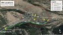
The sheriff, as well as the bulletins, described a standard grid search covering all of the ground within a 2.5 miles radius of where she was last seen. A 2.5 mile radius creates a 5 miles circle. In this Google Earth Aerial view which I posted last week, there is a 2000 foot circle. As you can see, up the shoulder of the road, as well as literally every other reasonable location that I can imagine, was search intensely, following the grid pattern. Recently, when LE conducts a grid search, the searchers carry GPS transmitters and their path is logged on a topographic map. Every anomaly or random dog hit is marked, so that it can be investigated further if a need develops. IMO
Source of aerial view: Google Earth, generated entirely in GE


")