mlhenn
Well-Known Member
- Joined
- Jul 11, 2019
- Messages
- 16,759
- Reaction score
- 74,383

Missing person search in Whitley County - ABC 36 News
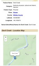
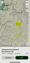
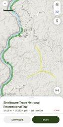
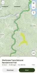
WHITLEY COUNTY, Ky. — Authorities are continuing their search for a man reported missing in Whitley County. The Sheriff’s Department identified the missing individual as 33-year-old Justin Young, who was last seen on Friday in the Devils Creek and Travis Trail areas. Deputies urge anyone with...
 www.wtvq.com

Search continues for Whitley Co. missing man
According to officials with the sheriff’s department, an award of $1,000 is being offered by Young’s family regarding information leading to his whereabouts.
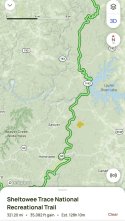
Whitley County Sheriff’s Department said 35-year-old Justin Young was last seen around 9 p.m. on Friday, June 14, in the Devils Creek and Travis Trail areas.

Officials with the Whitley County Sheriff Department confirmed that multiple, extensive ground searches have been conducted in the past few weeks.