Hurricane Irma - #2

Status
Not open for further replies.
  • #1,081
[FONT=&quot]WFLA NEWS‏ @WFLA [video=twitter;907025018273411072]https://twitter.com/WFLA/status/907025018273411072[/video]More


[/FONT]

[FONT=&quot]Hurricane Irma: Human mom and dog mom go into labor at Brooksville shelter
[/FONT]
 
  • #1,082
  • #1,083
  • #1,084
i wish it were daylight

ok i just heard at 105 thats comforting

you have to realzie I have been going all day trying to get my stuff together

i did not know utnil about an hour or so ago that it is pulling a charlie and coming right here

and we are gonna be in the worst the 12-3 part that will hit in about an hour

pls keep fallng apart you nasty huricane

CARIIS .... I wish you weren't alone. Glad you have Lady Bug-- you two hold onto each other and stay as safe as possible! No texting strangers ---- well, you can, and you would probably be forgiven for interrupting their nonsleep. :grouphug:


NIN was the first guest on Tricia's radio show tonight. it sounds like her area got hit real bad, but they left this morning and did OK. Unfortunately, she can't get back to check on her house due to downed trees, and they weren't;t very far away. http://www.blogtalkradio.com/websleuths/2017/09/11/websleuths-radio-september-10th-2017
 
  • #1,085
  • #1,086
[FONT=.SF UI Display][FONT=.SFUIDisplay]Updated list, HURRICANE IRMA/ location list: [/FONT][/FONT]
[FONT=.SF UI Display][FONT=.SFUIDisplay-Bold]CARIIS = Orlando[/FONT][/FONT]
[FONT=.SF UI Display][FONT=.SFUIDisplay-Bold]Henry2326 = Charleston, South Carolina[/FONT][/FONT]
[FONT=.SF UI Display][FONT=.SFUIDisplay-Bold]Jax49 = Jacksonville, Florida--40 miles inland[/FONT][/FONT]
[FONT=.SF UI Display][FONT=.SFUIDisplay-Bold]oceanblueeyes = south Georgia (Lee County)[/FONT][/FONT]
[FONT=.SF UI Display][FONT=.SFUIDisplay-Bold]Turanna= Jupiter/West Palm Beach[/FONT][/FONT]
[FONT=.SF UI Display][FONT=.SFUIDisplay-Bold]Shin Masamura = Lakeland[/FONT][/FONT]
[FONT=.SF UI Display][FONT=.SFUIDisplay-Bold]Momrids6 = SE GA Coast[/FONT][/FONT]
[FONT=.SF UI Display][FONT=.SFUIDisplay-Bold]Tripplogan = Jacksonville[/FONT][/FONT]
[FONT=.SF UI Display][FONT=.SFUIDisplay-Bold]Cat99 = Jacksonville[/FONT][/FONT]
[FONT=.SF UI Display][FONT=.SFUIDisplay-Bold]southernmimi = South Georgia[/FONT][/FONT]
[FONT=.SF UI Display][FONT=.SFUIDisplay-Bold]NIN (No it's not) = [/FONT][FONT=.SFUIDisplay-Bold]Bonita Springs[/FONT][FONT=.SFUIDisplay-Bold], FL 1 1/2 miles from the beach. [[/FONT][FONT=.SFUIDisplay]left home morning 9/10/2017, but there is a lot of damage in her area, could not get to her home to check][/FONT][/FONT]
[FONT=.SF UI Display][FONT=.SFUIDisplay-Bold]MaryG12 - [/FONT][FONT=.SFUIDisplay-Bold]Sarasota[/FONT][/FONT]
[FONT=.SF UI Display][FONT=.SFUIDisplay-Bold]katsrfun = Vero Beach, FL[/FONT][/FONT]
[FONT=.SF UI Display][FONT=.SFUIDisplay-Bold]KinderedSpirits = Miramar (close to Miami)[/FONT][/FONT]
[FONT=.SF UI Display][FONT=.SFUIDisplay-Bold]Lonetraveler = Wilmington, North Carolina[/FONT][/FONT]
[FONT=.SF UI Display][FONT=.SFUIDisplay-Bold]ATasteOfHoney= barrier island - Orlando now[/FONT][/FONT]
[FONT=.SF UI Display][FONT=.SFUIDisplay-Bold]SeesSeas= [/FONT][FONT=.SFUIDisplay-Bold]West Central FL, Pinellas County, half mile from Tampa Bay[/FONT][/FONT]
[FONT=.SF UI Display][FONT=.SFUIDisplay-Bold]Greater Than = Miami. [[/FONT][FONT=.SFUIDisplay]fared very well - didn't lose power][/FONT][/FONT]
[FONT=.SF UI Display][FONT=.SFUIDisplay-Bold]AC's Grandma = near Miami[/FONT][/FONT]
[FONT=.SF UI Display][FONT=.SFUIDisplay-Bold]fraudqueen= 3 streets from Ocean, north-central Florida[/FONT][/FONT]
[FONT=.SF UI Display][FONT=.SFUIDisplay-Bold]Tabirey= Myrtle Beach, South Carolina[/FONT][/FONT]
[FONT=.SF UI Display][FONT=.SFUIDisplay-Bold]bluedivergirl = near Ocala[/FONT][/FONT]
[FONT=.SF UI Display][FONT=.SFUIDisplay-Bold]Skully - just north of [/FONT][FONT=.SFUIDisplay-Bold]Tampa[/FONT][/FONT]
[FONT=.SF UI Display][FONT=.SFUIDisplay-Bold]Moxie Vi = Ocala[/FONT][/FONT]
[FONT=.SF UI Display][FONT=.SFUIDisplay-Bold]THATchick1021= [/FONT][FONT=.SFUIDisplay-Bold]Dunedin. Zone E[/FONT][FONT=.SFUIDisplay-Bold]. [/FONT][/FONT]
[FONT=.SF UI Display][FONT=.SFUIDisplay-Bold]What'sThatClue = near Orlando[/FONT][/FONT]
[FONT=.SF UI Display][FONT=.SFUIDisplay-Bold]BUF = near Orlando [[/FONT][FONT=.SFUIDisplay]Power just went out 9/10/17 @ 9:30 pm ][/FONT][/FONT]
[FONT=.SF UI Display][FONT=.SFUIDisplay-Bold]JaxFlaGirl = Callahan, FL, 20 miles NW of downtown Jacksonville[/FONT][/FONT]
 
  • #1,087
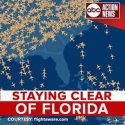
uploadfromtaptalk1505097346173.jpg
Flightwave.com
 
  • #1,088
Thanks for the list, Spellbound. I think you mean 9/10/17 not 7/10/17...but we can figure it out, :)
 
  • #1,089
  • #1,090
Thanks for the list, Spellbound. I think you mean 9/10/17 not 7/10/17...but we can figure it out, :)

:giggle: must be trying to hold onto summer! Thanks --- I was able to correct it.

Heading to bed soon, and I do feel guilty for that.. . Hope my friends will all be well by morning. See you then.
 
  • #1,091
NHC 11:00 Update:

Irma's center has moved northward across the western Florida peninsula since it made landfall earlier this afternoon, and it is now located over west-central Florida. NOAA WSR-88D radar data from Tampa Bay are showing 95-100 kt winds at an elevation of about 3500 ft, so the hurricane's intensity is estimated to be 85 kt.

Irma continues to have a large wind field, and exceptional hurricane- force wind gusts are still occurring well to the east of the center along the Florida east coast. Irma appears to be making some progress to the west of due north, and the longer-term initial motion is 350/12 kt. The cyclone is expected to swing around the eastern side of a mid-level disturbance currently located along the U.S. Gulf Coast, which should impart a north-northwestward to northwestward motion during the next 48 hours.

Due to its recent more inland push, Irma's center is now forecast to remain over Florida and then move over the southeastern United States for the duration of its existence. Due to continued land interaction and strong shear of over 30 kt, Irma should continue to lose strength and fall below hurricane intensity on Monday. The cyclone is then expected to become a remnant low over western Tennessee by day 3 and dissipate by day 4.

http://www.nhc.noaa.gov/text/refresh/MIATCDAT1+shtml/110244.shtml?

http://www.nhc.noaa.gov/graphics_at1.shtml?cone#contents
200df875f9d7370e584b90d0eded2167.jpg


Sent from my VK815 using Tapatalk
 
  • #1,092
We're getting the wind bursts from the outer band here in Myrtle Beach. By midnight it's supposed to start escalating. I'm a block from the beach and I can hear the waves crashing hard.
 
  • #1,093
We're getting the wind bursts from the outer band here in Myrtle Beach. By midnight it's supposed to start escalating. I'm a block from the beach and I can hear the waves crashing hard.
Hi- we are getting surge into Charleston. Some roads are flooded. You seeing surge yet?

Sent from my VK815 using Tapatalk
 
  • #1,094
[FONT=.SF UI Display][FONT=.SFUIDisplay]Updated list, HURRICANE IRMA/ location list: [/FONT][/FONT]
[FONT=.SF UI Display][FONT=.SFUIDisplay-Bold]CARIIS = Orlando[/FONT][/FONT]
[FONT=.SF UI Display][FONT=.SFUIDisplay-Bold]Henry2326 = Charleston, South Carolina[/FONT][/FONT]
[FONT=.SF UI Display][FONT=.SFUIDisplay-Bold]Jax49 = Jacksonville, Florida--40 miles inland[/FONT][/FONT]
[FONT=.SF UI Display][FONT=.SFUIDisplay-Bold]oceanblueeyes = south Georgia (Lee County)[/FONT][/FONT]
[FONT=.SF UI Display][FONT=.SFUIDisplay-Bold]Turanna= Jupiter/West Palm Beach[/FONT][/FONT]
[FONT=.SF UI Display][FONT=.SFUIDisplay-Bold]Shin Masamura = Lakeland[/FONT][/FONT]
[FONT=.SF UI Display][FONT=.SFUIDisplay-Bold]Momrids6 = SE GA Coast[/FONT][/FONT]
[FONT=.SF UI Display][FONT=.SFUIDisplay-Bold]Tripplogan = Jacksonville[/FONT][/FONT]
[FONT=.SF UI Display][FONT=.SFUIDisplay-Bold]Cat99 = Jacksonville[/FONT][/FONT]
[FONT=.SF UI Display][FONT=.SFUIDisplay-Bold]southernmimi = South Georgia[/FONT][/FONT]
[FONT=.SF UI Display][FONT=.SFUIDisplay-Bold]NIN (No it's not) = [/FONT][FONT=.SFUIDisplay-Bold]Bonita Springs[/FONT][FONT=.SFUIDisplay-Bold], FL 1 1/2 miles from the beach. [[/FONT][FONT=.SFUIDisplay]left home morning 9/10/2017, but there is a lot of damage in her area, could not get to her home to check][/FONT][/FONT]
[FONT=.SF UI Display][FONT=.SFUIDisplay-Bold]MaryG12 - [/FONT][FONT=.SFUIDisplay-Bold]Sarasota[/FONT][/FONT]
[FONT=.SF UI Display][FONT=.SFUIDisplay-Bold]katsrfun = Vero Beach, FL[/FONT][/FONT]
[FONT=.SF UI Display][FONT=.SFUIDisplay-Bold]KinderedSpirits = Miramar (close to Miami)[/FONT][/FONT]
[FONT=.SF UI Display][FONT=.SFUIDisplay-Bold]Lonetraveler = Wilmington, North Carolina[/FONT][/FONT]
[FONT=.SF UI Display][FONT=.SFUIDisplay-Bold]ATasteOfHoney= barrier island - Orlando now[/FONT][/FONT]
[FONT=.SF UI Display][FONT=.SFUIDisplay-Bold]SeesSeas= [/FONT][FONT=.SFUIDisplay-Bold]West Central FL, Pinellas County, half mile from Tampa Bay[/FONT][/FONT]
[FONT=.SF UI Display][FONT=.SFUIDisplay-Bold]Greater Than = Miami. [[/FONT][FONT=.SFUIDisplay]fared very well - didn't lose power][/FONT][/FONT]
[FONT=.SF UI Display][FONT=.SFUIDisplay-Bold]AC's Grandma = near Miami[/FONT][/FONT]
[FONT=.SF UI Display][FONT=.SFUIDisplay-Bold]fraudqueen= 3 streets from Ocean, north-central Florida[/FONT][/FONT]
[FONT=.SF UI Display][FONT=.SFUIDisplay-Bold]Tabirey= Myrtle Beach, South Carolina[/FONT][/FONT]
[FONT=.SF UI Display][FONT=.SFUIDisplay-Bold]bluedivergirl = near Ocala[/FONT][/FONT]
[FONT=.SF UI Display][FONT=.SFUIDisplay-Bold]Skully - just north of [/FONT][FONT=.SFUIDisplay-Bold]Tampa[/FONT][/FONT]
[FONT=.SF UI Display][FONT=.SFUIDisplay-Bold]Moxie Vi = Ocala[/FONT][/FONT]
[FONT=.SF UI Display][FONT=.SFUIDisplay-Bold]THATchick1021= [/FONT][FONT=.SFUIDisplay-Bold]Dunedin. Zone E[/FONT][FONT=.SFUIDisplay-Bold]. [/FONT][/FONT]
[FONT=.SF UI Display][FONT=.SFUIDisplay-Bold]What'sThatClue = near Orlando[/FONT][/FONT]
[FONT=.SF UI Display][FONT=.SFUIDisplay-Bold]BUF = near Orlando [[/FONT][FONT=.SFUIDisplay]Power just went out 9/10/17 @ 9:30 pm ][/FONT][/FONT]
[FONT=.SF UI Display][FONT=.SFUIDisplay-Bold]JaxFlaGirl = Callahan, FL, 20 miles NW of downtown Jacksonville[/FONT][/FONT]
I am late to the party but I was based in Orlando for the last 6 years (Windermere area). We moved north just last week and so we are safe, but the house and much of the contents are taking a battering. We are surely luckier than some as we are not "in it" but it is a fretful time to waiting to close the house sale (insert anxiety-ridden emoji face here!).
To all in the path of Irma and her long gangly arms, please be safe...and for those equipped with prayers, positive thoughts, hurricane-jinxing-voodoo or spell-casting abilities....Well, FL could use some of that!
 
  • #1,095
NHC 11:00 Update:

Irma's center has moved northward across the western Florida peninsula since it made landfall earlier this afternoon, and it is now located over west-central Florida. NOAA WSR-88D radar data from Tampa Bay are showing 95-100 kt winds at an elevation of about 3500 ft, so the hurricane's intensity is estimated to be 85 kt.

Irma continues to have a large wind field, and exceptional hurricane- force wind gusts are still occurring well to the east of the center along the Florida east coast. Irma appears to be making some progress to the west of due north, and the longer-term initial motion is 350/12 kt. The cyclone is expected to swing around the eastern side of a mid-level disturbance currently located along the U.S. Gulf Coast, which should impart a north-northwestward to northwestward motion during the next 48 hours.

Due to its recent more inland push, Irma's center is now forecast to remain over Florida and then move over the southeastern United States for the duration of its existence. Due to continued land interaction and strong shear of over 30 kt, Irma should continue to lose strength and fall below hurricane intensity on Monday. The cyclone is then expected to become a remnant low over western Tennessee by day 3 and dissipate by day 4.

http://www.nhc.noaa.gov/text/refresh/MIATCDAT1+shtml/110244.shtml?

http://www.nhc.noaa.gov/graphics_at1.shtml?cone#contents
200df875f9d7370e584b90d0eded2167.jpg


Sent from my VK815 using Tapatalk

gratefully i think she is falling off faster than expected thank you irma
 
  • #1,096
  • #1,097
ha

gusts and rain looks clear for quite a bit cool

was able to turn down volume on tv ues to hide the swishes !

thought my meighbor must have thought maybe he bought a hearing aid somewhere to

tongiht in the middle of a hurricane!!
 
  • #1,098
Statewide 4.2 million no power pls hold on here
 
  • #1,099
  • #1,100
:giggle: must be trying to hold onto summer! Thanks --- I was able to correct it.

Heading to bed soon, and I do feel guilty for that.. . Hope my friends will all be well by morning. See you then.

hi spell !!
 
Status
Not open for further replies.

Staff online

Members online

Online statistics

Members online
125
Guests online
2,188
Total visitors
2,313

Forum statistics

Threads
632,545
Messages
18,628,290
Members
243,194
Latest member
andrea.ball
Back
Top