Malaysia airlines plane may have crashed 239 people on board #3

Status
Not open for further replies.
  • #141
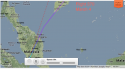
I don't know if it was one of the 'just kidding' reports or not, but originally the radar showed the plane starting to make a right (easterly) turn before it disappeared. When info came out that the plan had been tracked to the west I assumed it must have made a loop. The location from the letter certainly matches better with the initial reports. At this point I'm beginning to wonder if there really was a plane.

I thought one of the first tweets MsFacetious posted said the plane took a sharp right before disappearing also.
 
  • #142
I wonder if it is possible that MH370 crashed into the jungle of Malaysia and could be in plain sight, but no one is searching as they are focused on the Gulf of Thailand and Malacca Strait. Perhaps it could of crashed into Indonesian island of Sumatra.

I've been thinking that too. Maybe it did crash into the jungle, and not the sea. It would explain the lack the debris in any of the areas that have been currently searched. Jungles are pretty remote. No one is going to hear or see anything. I know there are a lot of indigenous groups that live in the jungles in that part of the world. But the chances of them reporting anything are slim to none. They don't make contact with anyone outside of their tribes.

And if this recent news about the plane heading towards the Malacca Strait is in fact, false, then I don't know...
 
  • #143
Here is a screenshot of FlightRader24 and then the location mentioned in the letter. You can see how the plane appears to be turning in that direction when it drops off the radar.

attachment.php

What is the red dotted line? The intended flight path? TIA!
 
  • #144
Here is a screenshot of FlightRader24 and then the location mentioned in the letter. You can see how the plane appears to be turning in that direction when it drops off the radar.

attachment.php

For me, it works. I just have a sinking feeling that is where they are.
 
  • #145
Telegraph News ‏@TelegraphNews 8h

Malaysia Airlines: US aviation authorities warned of a potential Boeing 777 'weak spot' http://fw.to/EcJlxWU
 
  • #146
What is the red dotted line? The intended flight path? TIA!

I believe it's an "as the crow flies" line from Kuala Lumpur to Beijing. The flight plan went around Cambodia to the east, not through it.
 
  • #147
Here is a screenshot of FlightRader24 and then the location mentioned in the letter. You can see how the plane appears to be turning in that direction when it drops off the radar.

attachment.php

Thanks for posting that .

Now I have never used flight radar but saw this vidoe of it .

https://www.youtube.com/watch?v=5JpbZZKqxy0

Does flightradar24 tell you what the plane is (flight number ) that seems to be in about the same location as the oil rig?
 
  • #148
What is the red dotted line? The intended flight path? TIA!

Not the flight path exactly but close - I think it draws a straight line between the departure point and arrival point. But they don't usually fly in straight lines between points A and B.
 
  • #149
For me, it works. I just have a sinking feeling that is where they are.

As much as the letter may or may not be phony, I have a feeling it is in that area as well, but on land deep in the jungle.
 
  • #150
No the flight path exactly but close - I think it draws a straight line between the departure point and arrival point. But they don't usually fly in straight lines between points A and B.

Gotcha! You have from KL - Beijing as directions.
 
  • #151
And tell me if that does not look like the tail ?

[ame="http://www.youtube.com/watch?v=M6IHdT3qE2Y"]Door and tail fragment of Missing Malaysia Airlines plane possibly found : VietNam - YouTube[/ame]
 
  • #152
I feel like it is accurate. Thank you for doing the work.

Thanks for this, I was sleuthing for this. :seeya:

It seems unlikely that no other aircraft either saw it or ran head on onto it. It must've plummeted altitude within seconds as the potential witness wrote.

:scared: Eating Mars bars and sipping diet coke, no sleep for me!

That is where the rig is. Now if you add the direction he was looking (the compass) + the distance he said it was away (50 - 70 kms).

You're welcome, popsicle and ElleElle. And correction--as Chickadea wisely noted, that red marker is where the oil rig is; the estimated location of the wreckage seen was 50-70km along the compass bearing 260˚ - 275.˚

Cool map, Belimom!
 
  • #153
  • #154
Here is a screenshot of FlightRader24 and then the location mentioned in the letter. You can see how the plane appears to be turning in that direction when it drops off the radar.

attachment.php

What time did he see the burning object and how long would it have taken to get from point A to point B? :banghead::banghead:
 
  • #155
Now that the military has denied tracking the plane to the west, have they also cancelled plans to intensify the search in that direction?
 
  • #156
Thanks for posting that .

Now I have never used flight radar but saw this vidoe of it .

https://www.youtube.com/watch?v=5JpbZZKqxy0

Does flightradar24 tell you what the plane is (flight number ) that seems to be in about the same location as the oil rig?

I can't get the program to show other planes when in database mode for past flights - only the flight number you punch in.

BUT - I did notice when checking the flight pattern of that same flight on other days: they all make a slight turn to the right, just as this one did. So the turn to the right seems to be the normal flight path - it actually is nowhere close to a straight line in the end.

This is the flight from March 4 - see that little turn to the right? They all turn there, some turns are sharper turns than others, but they all make that little turn to the right at that point in the flight.

attachment.php
 

Attachments

  • Screen Shot 2014-03-12 at 1.07.09 AM.png
    Screen Shot 2014-03-12 at 1.07.09 AM.png
    246.7 KB · Views: 212
  • #157
Even if it could it doesnt explain the radar signals .

Is it possible they do not know with radar signals belong to the plane at certain points?

Say if something jammed the transponders in the area?


There is like several types of radar as far as aviation goes. The transponder is the one that give the airline call sign, the flight number . The other main one is like old time radar sort of where it just shows you like flashing dots of a "things" buzzing along!
The tranponder in the plane can be turned off, can be changed to code a hijacking and or mayday in cockpit.

The real insane part of this is 9 countries on the planet are claiming they have nothing as far as the second basic type . You know the jazz that can track tiny missles going faster than the speed of sound!

Heck Google Earth come on folks!!!!!!

I am truly starting to believe that some nation over there hit a wrong button and the thing was accidently shot down . Its happened before (link at bottom)

Throw in satalites that can pick up a tropical wave when it is just starting and they want the world to bleive that a 300 ton machine ..............

[ame="http://en.wikipedia.org/wiki/Iran_Air_Flight_655"]Iran Air Flight 655 - Wikipedia, the free encyclopedia[/ame].
 
  • #158
  • #159
Exactly. I'm leaning more towards the jungle too.

And also, I must have missed something while skimming the threads. What is this about a letter?
 
  • #160
What time did he see the burning object and how long would it have taken to get from point A to point B? :banghead::banghead:

We don't know a time. :banghead:
 
Status
Not open for further replies.

Members online

Online statistics

Members online
110
Guests online
1,562
Total visitors
1,672

Forum statistics

Threads
632,373
Messages
18,625,407
Members
243,115
Latest member
secre_blue
Back
Top