- Joined
- Jan 17, 2004
- Messages
- 43,597
- Reaction score
- 239,940
Has LE flown the area between Coaldale & Vegas, both routes?
Google Maps
Unless the vehicles have been modified, I think they must be closer to Tonopah.


Has LE flown the area between Coaldale & Vegas, both routes?
Google Maps
There seems to be conflicting opinion, the Sheriff's office refers to a ping near Coaldale on the morning of the 28th, Log in or sign up to view, that is contradicted by a family member.
I would personally go with police info until they correct it.
Possibly they headed to Dyer area to camp, if pings did indeed come from there on the night of 27th.
Coaldale NV is an abandoned motel and gas station at the intersection of Highway 95 ( north-south main highway to Las Vega) and Highway 6 ( west-east highway from California across Nevada to Utah). That intersection is about 40 miles west of Tonopah, perhaps 46 miles west of the Tonopah Airport. There are no services at Coaldale, just abandoned and vandalized old buildings.
Dyer and Tonopah can't both be right, because they're in opposite directions. Police said just West of Tonopah.
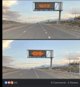
View attachment 339008
Good to know.From what I've read, they were not boondock-type camper types and were intending to overnight with friends who lived near Nellis AFB in Las Vegas. That would have been another 4 hours via Highway 95. From the family and APB postings, they sound experienced, cautious, and prepared with multiple cell type backups (phones, Apple watches, computers). Dyer isn't really a place to camp as it's a small rural farming community. There is a hot springs in the area, Fish Lake Hot Spring,but it's on a gravel road and it would have taken them away from Highway 95. I'd also think they would have alerted friends if there was such a significant change in plans for that night.
Their vehicle is listed as having a 48 gallon gas tank and claims a 440 mile range, but they were pulling a toad ( a Kia vehicle ) behind them ( don't think it was separately trailered).
The distance from Stagecoach to Nellis AFB by their presumed route is described at 409 miles, so one tankful is really cutting it too close.
Hawthorne is really too soon to have filled up, and they had probably planned for gas up in Tonopah or Beatty, both are typical gas up places on that route.
Good to know.
It is the family (daughter's) missing poster that refers to a phone ping around Dyer at 10:16 pm on the 27th. See bottom of poster...
View attachment 339009
Some people are then mixing it up with the reported morning ping in Coaldale, to become a ping in Coaldale at 10:16 pm.
JMO
It occurs to me mixing up time zones might account for the 4+ hour gap in the last apparent sighting at ~ 6:05 and the phone ping that was initially reported as 10 pm. It might actually be 7 pm if you correct for time zones.
Flyer stated as outdated. Here's more recent.Good to know.
It is the family (daughter's) missing poster that refers to a phone ping around Dyer at 10:16 pm on the 27th. See bottom of poster...
View attachment 339009
Some people are then mixing it up with the reported morning ping in Coaldale, to become a ping in Coaldale at 10:16 pm.
JMO
Good to know.
It is the family (daughter's) missing poster that refers to a phone ping around Dyer at 10:16 pm on the 27th. See bottom of poster...
View attachment 339009
Some people are then mixing it up with the reported morning ping in Coaldale, to become a ping in Coaldale at 10:16 pm.
JMO
What time difference are we talking about? Aren't OR, and NV in the same time zone? It's only AZ that doesn't observe DST?This has been nagging on my brain trying to figure out why there's such a huge gap of time from the 6:05 sighting in Luning to the 10pm ping in Coaldale for such a short distance. I didn't give the time zone difference a thought, but makes complete sense.
However, could they have been anywhere within the 50 mile radius of Coaldale tower before the ping? But even if this was the case, I don't think that would explain the 4 hour difference.
What time difference are we talking about? Aren't OR, and NV in the same time zone? It's only AZ that doesn't observe DST?
What time difference are we talking about? Aren't OR, and NV in the same time zone? It's only AZ that doesn't observe DST?
I can't believe they would have gassed up anywhere else without leaving a sighting or a debit/credit card use. Last use of card was for gas (and snacks) in Stagecoach NV before they headed south.Maybe that's what they did - drove into Tonopah to get gas, then drove back towards Coaldale Junction and headed to Dyer. Police have their last ping a few miles West of Tonopah. Family has a ping near Dyer?
What time difference are we talking about? Aren't OR, and NV in the same time zone? It's only AZ that doesn't observe DST?
Ah, okay.Flyer stated as outdated. Here's more recent.