CorallaroC
New Member
- Joined
- Dec 5, 2008
- Messages
- 438
- Reaction score
- 2
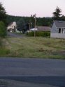
On that Friday when Lindsey disappeared, had it rained recently in McCleary? What were the road conditions like that evening?
Would there have been a lot of slippery muddy places if she had needed to dash through someone's yard, or around buildings?
And of course my biggest question of all, were the creeks canals and ditches flowing with water at the time?
Would there have been a lot of slippery muddy places if she had needed to dash through someone's yard, or around buildings?
And of course my biggest question of all, were the creeks canals and ditches flowing with water at the time?