Found Deceased CA - Fang Jin, 47, flew to LA from China, train to Palm Springs, Morongo Basin, 21 Jul 2023, w/ John Root Fitzpatrick, 55, (fnd dec.), 30 Jul ‘23 #3

  • #481
Oooh, good catch. When I look at it that way, I see what could be the spine (still held together by interlocking components and maybe still some collagen). I can see why some of you are thinking the lower part might be the pelvic region. Surely they found the long bones of the legs if this much was still in place.

I'd like them to be able to rule out a broken leg or similar for JRF.
Looks like spine to me as well. Almost thought it could have been a foot-if you squint and look at it, thought foot with tib/fib (lower leg bones -tibula, fibula for non medical-sorry).
 
  • #482
Tropical Storm Hilary arrives in Southern California, Palm Springs areaI'm not sure if this media has been shared yet, but there was ferocious flooding in Anza Borrego in August 2023. This could explain the distance of the bodies from the truck, and the position of one of the bodies "wrapped" around rocks, as it would be if it were washed away in a flood, and got snagged on rocks.
 
  • #483
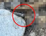
At the bottom of this image, just above the large white boulder, it almost looks like bone is coming out of the grey fabric, like an arm coming out of a t-shirt sleeve.
JRF2.jpg
 
  • #484
I'm not seeing long bone segments that would correspond to tibia or fibula. The calcaneous is a kinda non-descript squarish bone and doesn't really stand out. But we can't be really sure because of the heavy pixilation.

I found this quote in the first CBS 8 report: "CBS 8 also obtained photographs of the remains depicting a skull and jawbone separated from other remains nearby." The article puts the skull and the mandible very close together as in photo #1, and not associated with photo #2. That helps me.

I also noticed that short pale structure on the left edge of photo #2 that Interested_But_Confused sees. It could be a rib section, or possibly clavicle segment. I think it's too thin to be upper humerus in a healthy adult male. That could go along with this representing the upper shoulder-spine region associated with the T-shirt.

I'm thinking that things in a common area travel together, so it makes more sense for me for this to upper shoulder/ body associated with the T-shirt that would be worn over it.
 
Last edited:
  • #485
I also noticed that short pale structure on the left edge of photo #2 that Interested_But_Confused sees.
SBM

The area I was talking about isn't on the left edge, it's this area in the middle of the picture. It looks a bit like bone exiting from a tube of fabric.

JRF2.1.jpg
 
  • #486
SBM

The area I was talking about isn't on the left edge, it's this area in the middle of the picture. It looks a bit like bone exiting from a tube of fabric.

View attachment 458207
I see what you are saying. There is a sort of triangular, tubular area to the right of a fold of fabric and it looks sharply cut off. The color change is subtle, but I see it as matching the grey of the left side fabric, and not the tannish-brown of the skeletal material. The pixilation is very heavy there, so I can't see if it connects farther right with anything but it looks sharply cut off in the non-pixilated corner. It almost looks as if the fabric is caught in it.

I also think there is more gray fabric admixed with bone/tissue in the pixilated areas as if the shirt is twisted.

(Edited to describe area of interest)
 
Last edited:
  • #487
snipped.

This is really interesting. Somehow, ever since FJ's body was reportedly found, I've had the notion that they were apart when they died, but now it seems they may have been together.
I’m attempting to catch up on posted comments, few days behind so this may have already been addressed but initial reports indicated that the remains of JRF were located near his truck. However, further reported details on location areas of truck and remains seem to contradict earlier “nearby” information. Just my opinion, it’s not likely that differing information was not intentional to mislead (not that you’ve claimed such) but possibly miscommunication or more likely varying interpretations on terms of “nearby” or in the “same general area” especially considering the vast size- 100 yards for some while others may perceive areas within 10 miles is in the same general area. Honestly, until LE provides specific details not sure of reliability of information on locations. Again, not intentional and the CBS8 reporting has been absolutely amazing but their information is only as good as the details being shared in statements from LE and interviews with individuals associated with case.

I’m probably repeating what’s already been posted on the topic or there’s been updated information.

JMO
 
  • #488
Back to the truck location

I re-listened to the video by attorney David Schmidt and re-read the written report. Schmidt specifically said the truck was south of Harper Flat. There is also video of someone on a dirtbike driving Fish Creek Wash and asking a passing Jeep if they had seen an abandoned blue pickup truck, a blue Toyota. The response is muffled and not clear and the dirtbike rider does not further clarify the issue other than to repeat that LE said it would have to be helicoptered out.

So no new information from CBS 8, and we are all waiting for the LE report.
 
  • #489
Back to the truck location

I re-listened to the video by attorney David Schmidt and re-read the written report. Schmidt specifically said the truck was south of Harper Flat. There is also video of someone on a dirtbike driving Fish Creek Wash and asking a passing Jeep if they had seen an abandoned blue pickup truck, a blue Toyota. The response is muffled and not clear and the dirtbike rider does not further clarify the issue other than to repeat that LE said it would have to be helicoptered out.

So no new information from CBS 8, and we are all waiting for the LE report.
That's excellent information and there are posts on the Anza-Borrego Wonders FB page with similar info.

Using the basic Park road map (see below), it seems to me that if the truck is SOUTH of Harper Flat, the only way to get there is by Pinyon Canyon road which then turns into Hapahapa Flat Road and then into Fish Creek Road. The sign may just say Pinyon Canyon Road because that's apparently popular.

To get to Pinyon Canyon, one an take the red and yellow highway which is the Historic Corridor and recommended for first time visitors to the park OR the Plum Canyon turnoff (which may be actually signed as Pinyon Canyon). ANYWAY, they would have been pretty close to Julian (for the ping) if they did it either way.

So, they go up south of Harper Flat (and I see that there's a drop off point for hikers to hike across Harper Flat/into Pinyon Wash. At one point, that road becomes a one way road - so you either have to stop at the Drop Off point and turn around - or continue onward over many small roads to one of two main routes back to a "main road." I figure it's one way because it's too narrow to have two-way. I don't know where this alleged fence is.

I can think of some "issues" that drivers would face up there. If continuing on to the section that's one way going east and if deciding that was a mistake, what does one do? Make an illegal turn and try to go back, hoping there's no oncoming traffic? Back up the road as far as possible (which is likely legal, although dangerous) and find a vantage point to observe when to put one's truck back in the two-way section?

It's odd but the only other case of this type that I've read about (newish truck badly damaged by fall off the road) involved an attempt to back up, wherein the driver miscalculated where his rear tires were and both went off the road - whole truck ended up in a heap far below. Since we know they needed a copter to take JRF's truck out, I can easily imagine such a fall. But then what?

They'd be near Harper Flat and if they had this park map, they might try to cross it and walk out via Pinyon Wash. Pinyon Wash would be slightly more visited than most of the rest of that area, so a good choice. They could also have just walked back along the road and tried to flag someone for help, as well. That one hairpin turn looks like a doozy. If that's where the crash occurred, then the two passengers (possibly injured?) were very close to Harper Flat and to Pinyon Wash.

This is the standard map given out by the park to visitors, AFAIK. As the crow flies I figure it's about 6 miles, across Harper Flat, down Pinyon Wash, to Highway 78. Looks like they made it as far as Pinyon Wash to me, given what we know. It's looking to me like poor judgment in roads chosen, being on a narrow mountain road, and crash the truck to the point where it was inoperable. While the crashed truck is only noted after the Hurricane, IIRC, this theory has it that the pair lost use of it on July 24 or thereabouts and tried to walk out. Whether it was move by water, later, will help the Coroner figure out some theories. I'm guessing no cell service until they get near the bottom of Pinyon Wash.

There are a bunch of youtubes about "Pinyon Mountain Trail" (and some of those feature offroading in Pinyon Wash). But here's one that is of Pinyon Mountain Road (the first little bit is further up the road, but it shows how a regular dirt road becomes...well, I've linked it below the map.

AnzaBorrego.jpg


  • #490
You cannot drive the small Pinyon Canyon ( which is off of Pinon Wash) into or across Harper Flat.

The EASIEST way to get south of Harper Flat is to take Split Mountain Road off of Highway 78, and follow the Fish Creek Wash road all the way to Hapaha Flat. This actually meets up with Pinyon Mountain Road, where the photo you have posted shows The Squeeze and then there is the Heart Attack Hill, which really requires 4x4, experience with rock crawling, a second vehicle, and optimally a couple of spotters. That segment is one way only, going east. I really do not think they would have ended up on Pinyon Mountain Road. I cannot fathom trying to drive that in the dark.

Again, the Fish Creek Wash offers spectacular walls, fossils, wind caves, geologic formations and Native American habitation traces and is where I would want to visit.

My feeling all along has been that Pinyon Wash, northwest of Harper Flat was quite accessible to locals and the truck would have been more easily found earlier, possibly even earlier than the flooding had it been there.
 
  • #491
SBM

The area I was talking about isn't on the left edge, it's this area in the middle of the picture. It looks a bit like bone exiting from a tube of fabric.

View attachment 458207
I can't help but to see a pair of cargo pants, or at least one pant leg section ( I may be seeing this because my husband often wears a pair that are just like what I am picturing and even the pockets would align properly) I feel like I see this piece of material that tapers to the section you have circled to a brown boot, with the heel probably blurred out some due to nearby bones ( boots worn by JRF as seen in earlier photos taken by JF). This detail actually is part of why I think it may be the side of a pair of pants, also why they easily found his wallet/ID. My hubby would carry his wallet in the side pocket if wearing these fpr putdoor things since it can be secured with a button or velcro. You could be correct tho about seeing a tee-shirt, It's just hard for me to unsee after holding it in my mind for quite some time and folding a pair of my hubbys so many times.
 
  • #492
I can't help but to see a pair of cargo pants, or at least one pant leg section ( I may be seeing this because my husband often wears a pair that are just like what I am picturing and even the pockets would align properly) I feel like I see this piece of material that tapers to the section you have circled to a brown boot, with the heel probably blurred out some due to nearby bones ( boots worn by JRF as seen in earlier photos taken by JF). This detail actually is part of why I think it may be the side of a pair of pants, also why they easily found his wallet/ID. My hubby would carry his wallet in the side pocket if wearing these fpr putdoor things since it can be secured with a button or velcro. You could be correct tho about seeing a tee-shirt, It's just hard for me to unsee after holding it in my mind for quite some time and folding a pair of my hubbys so many times.
We also don't know what else bone or gear-wise might be underneath all this, deeper in the gritty sand and gravel. Two-dimensional heavily pixilated photos may not be resolveable.

Clearly, however, LE has the answer, so that's really all that counts.
 
  • #493
A SIM is just the "key card" that allows your phone to connect to a cell network, and tells the network which services you've purchased. It can be a physical card or a digital e-SIM but the way it functions is the same. If you have an international cell phone plan it just means your service provider has already given you a SIM that can work around the world, without the need to purchase a new SIM in every country. A data SIM isn't wi-fi, it connects through the cell network just like any other SIM; it simply provides internet only, without phone calls or texting. Any SIM-based service will ping off cell towers.

Wi-Fi only has a range of a few hundred feet without using signal boosters. Other than using a satellite or SIM-based Wi-Fi hotspot, the only way to get Wi-Fi to the middle of a desert is by first running cable internet to the location. That may be what the Berber tribe you visited have done, which means their Wi-Fi signal should be just as good as the Wi-Fi in any home or office.

I've seen differing reports about the amount of Wi-Fi coverage at Anza-Borrego, including one report indicating there's free Wi-Fi across the entire park. But if Fang was connecting using the park's free Wi-Fi I assume LE could have checked for that and would already know. In which case LE's comment about not receiving any pings from Fang's phone would technically be true, but also be slightly disingenuous.

JMO
You're right, and I was so tired when I posted last night, err actually this morning, I meant to say the data ( not wifi) out there in the Sahara Dessert. My plan allows free text and unlimited data so I will often use my hubbys hotspot to call home on whatsapp or some type of VOIP to avoid the 25c a min charge for using straight cellular service. I've never looked at my detailed cell phone bill to see if this shows a connection ( as it does in other cases like making a direct call). So I understand what you're saying. I hope if there are ways to track that, and i surely hope that LE has been through the records from the park or whatever else is involved. Though I believe they've done a good job thus far, taking careful steps to preserve evidence in case anything was foul play from the start. Which has been a problem in some cases where it turns out foul play was involved and LE did not take this same type of care I feel like they have taken in this case - even with a lot of the evidence not shared with the public.
 
  • #494
You cannot drive the small Pinyon Canyon ( which is off of Pinon Wash) into or across Harper Flat.

The EASIEST way to get south of Harper Flat is to take Split Mountain Road off of Highway 78, and follow the Fish Creek Wash road all the way to Hapaha Flat. This actually meets up with Pinyon Mountain Road, where the photo you have posted shows The Squeeze and then there is the Heart Attack Hill, which really requires 4x4, experience with rock crawling, a second vehicle, and optimally a couple of spotters. That segment is one way only, going east. I really do not think they would have ended up on Pinyon Mountain Road. I cannot fathom trying to drive that in the dark.

Again, the Fish Creek Wash offers spectacular walls, fossils, wind caves, geologic formations and Native American habitation traces and is where I would want to visit.

My feeling all along has been that Pinyon Wash, northwest of Harper Flat was quite accessible to locals and the truck would have been more easily found earlier, possibly even earlier than the flooding had it been there.

I know. That's why I placed the truck up on the road - at the drop off point (before the one way section). The truck is stuck somewhere south of Harper Flat - but the two humans leave and try to walk out.

For example, if in getting into or out of that parking spot, JRF managed to damage his truck and had to leave it there, they would have WALKED out by one of two ways (back along a long road or down across Harper Flat and likely into Pinyon Wash - as there might be more people there, it's on the map, the road is named the same thing and it's relatively well known. Keep in mind that if he had continued eastward on that same road system - it would have been winding, isolated ONE WAY roads with many side roads - it's like a web of roads. I'm pretty sure GPS navigation systems don't give directions in places like that.

If they did this, their total walk out would have been around 5-6 miles. They would have taken all their water and essentials, accounting for LE not finding enough water in the truck. If they got stuck after the one way road began (also possible, very narrow, maybe he tried to turn around and had a disastrous accident), it might be a bit more.

I am speaking ONLY about what it would take to walk out of there - which is what I'm thinking they had to do. They did not drive out. And the most logical way they would drive UP is via the park's road system. IMO.

The truck is wrecked and found south of Harper Flat. That leaves them stranded south of Harper Flat. I know I would likely take the road back (on the theory that it's a bit higher and there could be other vehicles and maybe some cell service). But maybe they decided to "see more" and hike out to the highway - a mere 6 miles away. Some seasoned hikers say their pace in Pinyon Wash, in the heat, is 30 minute miles (given the terrain). But, it is also a likely place to run into off-roaders. The drop-off point for that hike is plainly marked on the map. I believe this is the map most widely available at kiosks etc in Anza-Borrego. Without the map, I am truly curious how they even found a way to get to "South of Harper Flat."

But that's where the truck became unuseable according to the video you linked (LE info) and they had to make a decision to walk out. It seems they chose the most direct route to the 78 (which is also adjacent to the most populated part of the park). I get why they went that route. Walking across shadeless Harper Flat (1.5 miles maybe at that western side near Pinyon? would have been grueling in the heat. Hard to estimate how far exactly down Pinyon Wash, but estimates have been posted here - about 2.5 miles maybe? It has lots of wiggly bits that make it longer. OTOH, they could have followed the more gently sloping Harper Canyon - we do not know the location of the bodies, but it seems from where the searches were held that it was one or the other. 4 miles in 115-117F heat without shade could be 2 hours out there - enough to cause heat stroke. Indeed it would very likely be causing heat exhaustion and cognitive issues after 1 hour. And they weren't wearing hiking shoes. They likely tried to stay together.

Anyway, that picture fits the facts as we know them. Main thing we don't know is where they were car camping. It's possible they camped south of Harper Flat, too, and then found the truck inoperable for some reason. But I think the same road would have been taken and I think that if they were found on the south side of Harper Flat, it's reasonable to believe that with a wrecked truck, they had to walk.

IMO.
 
  • #495
Bumping thread . . .

threadBumpEmoji.gif
 
  • #496
You cannot drive the small Pinyon Canyon ( which is off of Pinon Wash) into or across Harper Flat.

The EASIEST way to get south of Harper Flat is to take Split Mountain Road off of Highway 78, and follow the Fish Creek Wash road all the way to Hapaha Flat. This actually meets up with Pinyon Mountain Road, where the photo you have posted shows The Squeeze and then there is the Heart Attack Hill, which really requires 4x4, experience with rock crawling, a second vehicle, and optimally a couple of spotters. That segment is one way only, going east. I really do not think they would have ended up on Pinyon Mountain Road. I cannot fathom trying to drive that in the dark.

Again, the Fish Creek Wash offers spectacular walls, fossils, wind caves, geologic formations and Native American habitation traces and is where I would want to visit.

My feeling all along has been that Pinyon Wash, northwest of Harper Flat was quite accessible to locals and the truck would have been more easily found earlier, possibly even earlier than the flooding had it been there.

That route might be a bit more complicated for someone new to the area - although it gets around the problem of the one way road. However, then I wonder when the ping on the Julian tower occurred - because that southeastern approach to Harper Flat would not likely ping Julian tower the way a phone in a car traveling west on the 78 to the Pinyon Canyon turnoff might do.

I agree it would have been found earlier if it had been in popular Pinyon Wash - one of the more hiked/offroaded/bouldered place on the south side of 78, judging by reports on 3 different trail sites.

So the question is why did he choose to drive along south of Harper Flat, unable to get easily to Pinyon Canyon without traversing the 1.5-2.0 hot and open surface of Harper Flat.

IMO


Looks like spine to me as well. Almost thought it could have been a foot-if you squint and look at it, thought foot with tib/fib (lower leg bones -tibula, fibula for non medical-sorry).

I would need a reason for that long bone-looking thing (which I believe to be vegetable matter) to be so blackened. If I'm looking at what I think you're looking at. Also hard to know the scale.

Without scale, we can't know if that branch-like thing (if a bone) is a long bone of the arm or the leg. But my imagination does to go spine for that blurred part and yes, that object has the shape of a bone (but I can't see either end of it, which is needed to know what it is).

IMO
 
Last edited:
  • #497
ADMIN NOTE:

Please read Websleuths Terms of Service (TOS, aka The Rules) that every member agrees to upon registration. They are readily available as they are linked in my signature.

Posts based on random social media are not allowed and have been removed (along with all responses based on them).

Please follow our rules. Thank you.
 
  • #498
  • #499
In the article from CBS 8 above, directly quoted from them:

CBS 8 obtained satellite photos of the Harper Flat area taken on October 2. The broken-down truck was not observed in the photos.


Just speaking regarding the confusion as the exact location of the vehicle, and where it may have been located.

Edit to add from the information in the PDFs, the truck was found on 9/4/23. (Can’t remember if we had the exact date previously).
 
Last edited:
  • #500
Access denied for the pdf documents, certainly because I'm not in the US...
 

Staff online

Members online

Online statistics

Members online
124
Guests online
1,641
Total visitors
1,765

Forum statistics

Threads
632,314
Messages
18,624,588
Members
243,083
Latest member
Delmajesty
Back
Top