CA - Jonathan Gerrish, Ellen Chung, daughter, 1 & dog, suspicious death hiking area, Aug 2021 #5

Status
Not open for further replies.
  • #581
@RedHaus ~ JG may have researched all those trails, but he traveled only one of them on Sun. Either he downloaded the Hites Cove Rd map from AllTrails or he was using his memory of it to set forth on HCT OHV. Simplest premise. IMHO.

Why else "hike" on an Access Road?
I still can’t see how they got from Hite Cove to the base of Savage Lundy. I can see the maps where the trail is marked but looking on Google maps in 3D there is virtually no sign of a viable road/trail until part way up near Devil Gulch where SL is more clearly defined.
BBM

Well, perhaps the answer to that question is: To access a Mine? And maybe that is all they intended to do that day... check out a mine and go home. IMO.

Mines
In my 9/8/21, T#3, P#763 I reposted the mine research done by @eptichka83 (T#2, P#292 & P#400), given JG had posted in his AllTrails logs information about mines he visited (recall, JG had labeled those hikes by mine, not trail names, IIRC). So here is a briefer summary for this discussion - may mean more to us now.

There are three mines on the route the family took. Source: Mining Towns in the Western United States

1. Liberty Lode (manganese): Off Hites Cove Road before the parked truck location
2. Blossom #1 (gold): About halfway on "the loop", just off of the South Fork Trail
3. Devils Gulch (gold): At the base of Savage-Lundy Trail

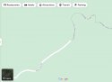
Below is a map image Eptichka83 created from imgur.com. Previously I circled the Liberty Lode mine, where you can see a faint switchback trail up to it.

But now that I ponder this further, and with our new found knowledge of these trails, etc., I wonder if the family's goal was to check out the Devil's Gulch Goldmine.

... Park where they did, go down the Savage-Lundy trail, check out the mine, and hike back before it got too unbearable. But what if they encountered someone or something at the Devil's Gulch mine that caused the beginning of the end for the family? While a tragic outcome, that kind of intent makes some sense to me, IMO.

upload_2021-9-8_0-43-0-png.311782
Good idea - but why go on such a hot day with your child and your dog? They only live on Hite Cove Road so could do it anytime. Later in the year maybe when the weather is more suitable?
 
  • #582
Hmmmm. I like this mine idea, @RedHaus. I agree with half your theory. What if Jon had researched these mines, but this Sun they took a jaunt based on his memory of the area? It follows. HCR to HCT OHV to South Fork or that direction. The plan. Maybe not to see the mines with baby and dog but "hey, I know a nearby walk we can do!" Sounds like my husband when I push him to come up with something :)
 
  • #583
BBM
And you know, @MrsEmmaPeel, how many times have we all read "Investigators said...Gerrish had been researching the Hites Cove hike on a phone app on Aug. 14"? from this article: Investigators have ruled out 2 causes of death in case of Mariposa family, but still have no answers

But... what does that really mean --- "the Hites Cove hike"?

Given our research sleuthing into the crazy trail and road names in that area:

A. Did JG research the Hites Cove OHV Trail (the 'access road' that starts at junction of Hites Cove Road, near where the truck was parked)?
B. Did JG research the Hite Cove Trail that starts at a trailhead on Route 140 and is a very popular trail, especially for spring flowers?
C. Did JG research the Hites Cove Trail / Hites Mine Trail that starts near Yosemite Cedar Lodge further down Route 140?
D. Did JG research all of the above on 8/14?

Sometimes I just wonder if their intent was to do "B" based on JG's research, and somehow got confused, disoriented, distracted, etc. and ended up doing "A" on 8/15.

Reattaching my map in case it helps anyone follow along this crazy question, that to me seems perfectly reasonable at this point? :confused:

Why would he research all those others when he lived less than two miles from HC Ohv trail. Like I said in thread one, they could have walked to the trailhead. So maybe they did plan to go down it in their truck.

I suspect though they knew the dirt road was closed, I bet before or after buying their house, they checked out the entire Hite(s) Cove Road.
 
Last edited:
  • #584
Hmmmm. I like this mine idea, @RedHaus. I agree with half your theory. What if Jon had researched these mines, but this Sun they took a jaunt based on his memory of the area? It follows. HCR to HCT OHV to South Fork or that direction. The plan. Maybe not to see the mines with baby and dog but "hey, I know a nearby walk we can do!" Sounds like my husband when I push him to come up with something :)
Postcard from Google Earth


Google Earth
#googleearth
 
  • #585
BBM


... Park where they did, go down the Savage-Lundy trail, check out the mine, and hike back before it got too unbearable. But what if they encountered someone or something at the Devil's Gulch mine that caused the beginning of the end for the family? While a tragic outcome, that kind of intent makes some sense to me, IMO.

If you accept the fact that prints consistent with a family and dog were found going down HC, then I don't think that theory makes sense. MOO
 
  • #586
I do agree that the single post of the carrier is very unusual..this whole disaster is very unusual. Was the carrier something very expensive and snobby ultra gear? titanium etc? I mean is this carrier of some interest to most of their friends? the post sticks out like a sore thumb in a way...because it doesn't say anything really.
Snipped for focus
I'm assuming by "carrier", you mean "baby carrier". While expensive (like high quality backpacks), they aren't snobby or ultra or titanium or any of those things. They let families go on hikes together even until the child is 4-5 or so.
IMO the way the baby carrier might be significant in this case is that it might have persuaded the couple to hiker longer and in conditions they hadn't hiked previously. A baby carrier is different from one of those kangaroo pouches you put on your front, in that the baby is not snugged up against you, and it's behind. Also, framing, as in a pack, makes heavy loads feel lighter. Those two things combined might have persuaded the couple that they'd be cooler than other hikes they'd done that summer and they could go longer because the baby would feel lighter. In short, the baby carrier may have caused them to make some unfounded assumptions. There was no baby carrier that was ever going to make the day cool enough or the baby light enough to not be a burden on that day.
 
  • #587
rsbm
... Park where they did, go down the Savage-Lundy trail, check out the mine, and hike back before it got too unbearable. But what if they encountered someone or something at the Devil's Gulch mine that caused the beginning of the end for the family? While a tragic outcome, that kind of intent makes some sense to me, IMO.
Thanks for revisiting the mine theory. One other piece of information was the detailed weather tracking posted in the previous thread. There may have been a thunderstorm passing over the SL trail late Sunday afternoon that might have obscured any footprints or paw prints from them going down the SL trail that morning.
 
  • #588
Snipped for focus
I'm assuming by "carrier", you mean "baby carrier". While expensive (like high quality backpacks), they aren't snobby or ultra or titanium or any of those things. They let families go on hikes together even until the child is 4-5 or so.
IMO the way the baby carrier might be significant in this case is that it might have persuaded the couple to hiker longer and in conditions they hadn't hiked previously. A baby carrier is different from one of those kangaroo pouches you put on your front, in that the baby is not snugged up against you, and it's behind. Also, framing, as in a pack, makes heavy loads feel lighter. Those two things combined might have persuaded the couple that they'd be cooler than other hikes they'd done that summer and they could go longer because the baby would feel lighter. In short, the baby carrier may have caused them to make some unfounded assumptions. There was no baby carrier that was ever going to make the day cool enough or the baby light enough to not be a burden on that day.

what I meant was was the carrier notable in some way ..like hey I got that new ultra light baby carrier that is backordered for months...that kind of thing..like you would post it because you got one and its cool..
I just thought maybe it's not unusual to post it because there is something exciting about it...mOO
 
  • #589
I like it, @RickshawFan. We're so focused on why take a baby, and you've turned it to: we can take the baby, farther, lighter, easier! I've always wondered if the first section went too well and suckered them in.
 
  • #590
  • #591
@RickshawFan agree with you that the carrier may have been the impetus for altering their sense of ability (we can go further) and may even have been the impetus for the hike itself, to try it out, as someone else mentioned awhile back. However, I'm not sure I agree that it would be lighter. The kangaroo carrier they are pictured with last year looks like an Ergo baby carrier, a soft structured baby carrier, IMO. Those weigh almost nothing (I have one). Though I never saw the picture of EC's showing the baby backpack, I also have one of those (Osprey brand) and they can easily add ten pounds. I am unsure if the felt experience is lighter for some with the backpack (to me, it's more). You can wear the Ergo on your front or back. Backpack would definitely be cooler, as you're not skin to skin and the material breathes more, but definitely would have been hot for both.
 
  • #592
Postcard from Google Earth Google Earth
#googleearth

What this map showed me the first time I saw it, was how hard it might be to see the SL switchbacks from the River. Depending on the year of this map, the vegetation on the South Fork Trail seems to lead straight into and up the Savage Lundy Trail for a bit.
 
  • #593
You did your homework and have a much better understanding of the situation as revealed in the past posts than most first time commenters. Re- your comments. Yes, first time parents... been there, learned a lot. Not only can I not imagine those conditions with a baby, I don't hike myself in those conditions. I suggested staying down at the river overnight, if necessary. Sometimes it stays 100F there well after it gets dark, my point being wait until it cools off, but I don't think it would be a good idea to try to do the Savage Lundy trail in the dark. In those conditions, wait until first light. Can't say if they were looking for other people, but I think the place to find other people would be the Hite Cove OHV trail. That's by far the most heavily traveled. Finally, the "seated position" of JC vs heat stroke. I don't know exactly what "seated position" means, but certainly it doesn't mean face down. My thought is it just means they looked at the position of his body (surely feet out in front) and thought "he was seated when he died." Maybe he was propped up with his back against something, or his posterior was on a rock with his feet out in front. We don't know, and they'll probably never release that kind of detail. MOO

Thanks for your thoughts and the compliment! @Lex Parsimoniae Agree, I can't imagine hiking in those conditions either, even without a baby! I've done a fair amount of backpacking, but always grateful for cool temps when making big climbs and when backpacking in Kauai and Eel River found the heat especially visceral. Visited Sedona, AZ one year and just walking around town in 100+ weather was enough to sap my energy. Agree, I wouldn't think SL could be done in the dark, just can really imagine making a poor judgment call to hike back Sunday midday because staying might have felt more formidable (though likely wasn't, MOO). Good point about finding other people on HC OHV vs going on the Southe Fork trail - I was thinking more if they thought they might find people in the river on such a hot day.
 
  • #594
What this map showed me the first time I saw it, was how hard it might be to see the SL switchbacks from the River. Depending on the year of this map, the vegetation on the South Fork Trail seems to lead straight into and up the Savage Lundy Trail for a bit.
Here is a pic looking from where the vehicle was parked at the top of the fork in the road looking down towards Devil Gulch.
Postcard from Google Earth


Google Earth
#googleearth
 
  • #595
I like it, @RickshawFan. We're so focused on why take a baby, and you've turned it to: we can take the baby, farther, lighter, easier! I've always wondered if the first section went too well and suckered them in.

Agree...that certainly could have been a factor to consider, but at SOME POINT in this hike the infant, being more susceptible to HS, must have shown that *all is not well* with this journey (dog too?). That would *TRUMP* any positive impressions about how much easier it was to hike with this new pack.
I maintain (MOO) that this took place fairly early on (END OF THE FIRST SECTION +/-) and I would doubt they would want to press on at that point. Being a lighter pack, it could have enabled them to travel faster and FARTHER, BUT it wouldn't change the amount of TIME it would take for the infant to get sick from heat. At that point it wouldn't matter how *light the pack was*, they needed to make a decision and fast. Just speculation on my part, but it would seem at 1hr out +/- , they would be in a position to either go back up HC (2 miles) or forge ahead for 5 more miles (river+SL) which would add an additional hr or two back to the truck...in rising HEAT. MOO
 
  • #596
well, well, well. if you're using Google Maps (I know, I know it's not a hiker's map.) look what Hites Cove Rd turns into . . .
 

Attachments

  • HCR to ?.jpg
    HCR to ?.jpg
    45.7 KB · Views: 58
  • #597
well, well, well. if you're using Google Maps (I know, I know it's not a hiker's map.) look what Hites Cove Rd turns into . . .
I thought this was already known?
 
  • #598
Here is a pic looking from where the vehicle was parked at the top of the fork in the road looking down towards Devil Gulch.
Postcard from Google Earth


Google Earth
#googleearth
This whole area looks like the type of place anything could happen. There was nothing particularly nice about the California Gold Rush either (1848–1855).
 
  • #599
what I meant was was the carrier notable in some way ..like hey I got that new ultra light baby carrier that is backordered for months...that kind of thing..like you would post it because you got one and its cool..
I just thought maybe it's not unusual to post it because there is something exciting about it...mOO
I don’t think it was unusual, or significant that they posted the picture of the baby carrier. My friends and I often post pictures of new equipment (boots, backpacks, tents, etc. before we hike or go on a backpacking trip.
 
  • #600
I thought this was already known?

On AllTrails HCR OHV is an extension of Hites Cove Rd. It is as well on the MariposaTrails.org and the Upper Merced River Watershed Council maps.

Point is, I'm not convinced the GCs knew this area as well as some of you think. Nothing that's been stated so far proves that to me. After a year of Covid and childbirth, and a few years of rental property investment, they could still be learning. No shame in that. These are big wild spaces.

What I do know for certain is that the trail names are confusing and the various maps are too.
 
Status
Not open for further replies.

Members online

Online statistics

Members online
96
Guests online
2,358
Total visitors
2,454

Forum statistics

Threads
632,761
Messages
18,631,406
Members
243,289
Latest member
Emcclaksey
Back
Top