CANADA - Lucas Fowler, Australian & g/f Chynna Deese, American, murdered, Alaska Hwy, BC, Jul 2019

Status
Not open for further replies.
  • #141
A third body has been discovered close to where Australian man Lucas Fowler and his American girlfriend were murdered in British Columbia.

Royal Canadian Mounted Police revealed the information today saying it is unclear if the two scenes are related.

Officers were called to a truck fire south of the Stikine River Bridge on Highway 37 when a passing motorist told them they had just seen what they believed to be a body at a nearby Highway pullout.

Attending officers located the body of a deceased male and a separate investigation has now commenced.

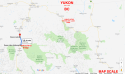
Highway 37 links to Highway 97, where LF and CD were found dead on Monday.

Third body found near where Australian man and girlfriend were killed
 
  • #142
Actually, Dease Lake is 10 hrs drive away, more like 500 miles.
 
  • #143
Can anyone help to put this on the map?

Here is the best I can understand with Hwy 37 intersecting Alaska Hwy and a bridge. Where was the burning car and where was the body?

View attachment 194157

I think that this is the location referenced in the article, where a bridge on Highway 37 crosses the Stikine River : 59.2564044,-125.9738953

There doesn't seem to be a street view for this stretch of road.

These events are possibly unrelated, but perhaps just coincidentally they have both occurred very close to rivers.
 
  • #144
Actually, Dease Lake is 10 hrs drive away, more like 500 miles.

So the car fire is another unrelated event and not "near" the murdered tourists from Australia and the USA?
 
  • #145
  • #146
This third body could be related IMO - either as another victim or the possible perpetrator (suicide and burned truck to destroy evidence). Not wanting to dramatise as it could be completely unrelated, but the distance is still close enough that I would guess the police would want to eliminate both these scenarios.
 
  • #147
I think that this is the location referenced in the article, where a bridge on Highway 37 crosses the Stikine River : 59.2564044,-125.9738953

There doesn't seem to be a street view for this stretch of road.

These events are possibly unrelated, but perhaps just coincidentally they have both occurred very close to rivers.

When I put those numbers in, it takes me to the same place as 20km South of Liard Hot Springs.

Hwy 37 and the Alaska Hwy burned out car is found? Where was the victim? Red dot is where victims were found.

upload_2019-7-20_2-29-46.png
 
  • #148
  • #149
ADMIN NOTE:

The Alaska Highway is not the Highway of Tears and all victims of the Highway of Tears have been women, not couples who have been shot and left at the side of the road. Liard Hot Springs is over 1000 kms from Highway 16.

Please stop bringing in extensive details of the Highway of Tears. It has its own forum and we don't want to get it all blended in here.
 
  • #150
This third body could be related IMO - either as another victim or the possible perpetrator (suicide and burned truck to destroy evidence). Not wanting to dramatise as it could be completely unrelated, but the distance is still close enough that I would guess the police would want to eliminate both these scenarios.

It wouldn't be the first time that a vehicle was burned in BC to cover-up a vacationer's death.
 
  • #151
  • #152
Maybe they are connected. Timelines will make a difference.

When were the Australian/USA bodies found, when was the first report to RCMP, when was the family notified, where was the van when the family was notified?

We'll know for sure when there is a third similar unusual event.

upload_2019-7-20_2-47-1.png
 
  • #153
no guys you got me wrong the thing i was talking about was what i quoted for the new body not the case in this thread those two cases are 40 minutes apart

the actual case of this thread as i reported two pages back is like 10 hour drive apart , that case is like a state away from that highway of tears as the mod said its not even resonable to expect a connection anyways its been covered a lot
 
Last edited:
  • #154
no guys you got me wrong the thing i was talking about was what i quoted for the new body not the case in this thread those two cases are 40 minutes apart

the actual case of this thread as i reported two pages back is like 10 hour drive apart , that case is like a state away from that highway of tears

Seven hours - most likely unrelated.
If related, bizarre. Some nutbars wreak havoc across a lot of territory.

There's something spontaneous about these murders. No one plans to murder the owners of a stalled vehicle on the side of the road. They decide on the spot that they've wanted to murder, and this is an opportunity. The motive can be opportunistically looking for a female victim.
 
  • #155
Seven hours - most likely unrelated.
If related, bizarre. Some nutbars wreak havoc across a lot of territory.

There's something spontaneous about these murders. No one plans to murder the owners of a stalled vehicle on the side of the road. They decide on the spot that they've wanted to murder, and this is an opportunity. The motive can be opportunistically looking for a female victim.
i agree its just odd isn't it, i mean you couldn't pick a worse couple fo rob and murder i mean they are basically backpackers in the middle of nowhere, mostly they never have much cash and there would be no atm's nearby
so its really bizarre if it is a robbery
 
  • #156

According to Google Maps, the Stikine River crosses highway 37 approximately 52km south of Dease Lake. I'm assuming that's where the Stikine River Bridge is.

Furthermore, 37 never hits 97. 97 ends at the Yukon border; it becomes highway 1 and intersects 37 west of Upper Liard in Yukon.

In short, trying to link these crimes just because they've all occurred on through roads in the wilds of BC, albeit hundreds of miles apart, is ... trying way too hard.
 
  • #157
When I put those numbers in, it takes me to the same place as 20km South of Liard Hot Springs.

Hwy 37 and the Alaska Hwy burned out car is found? Where was the victim? Red dot is where victims were found.

View attachment 194161

Sorry, it seems that when I was over the Stikine River Bridge, the coordinates on my browsers address bar were still showing for where LF and CD were found so I had copied and pasted the LF/CD crime scene location againin error. The correct coordinates for the Stikine River Bridge are : 58.0428845,-129.9493607.

I agree that the distance is too far apart to suggest any likeliness in a connection, but it can't be ruled out at this stage. I'm not a local so am unaware of how often unconnected homicides like this happen on the Canadian highways, but it does strike me as odd that these crimes have occurred less than a week apart in a very sparsely populated region.
 
  • #158
Here's the best I could do with annotating Google Maps. Please note that BC highway 16/Highway of Tears is nowhere near making it onto this map at this scale. Also note mileage scale at bottom right.

edited to correct highway number.
 

Attachments

  • bc-yukon border.png
    bc-yukon border.png
    469 KB · Views: 24
Last edited:
  • #159
  • #160
Following.
 
Status
Not open for further replies.

Members online

Online statistics

Members online
150
Guests online
2,892
Total visitors
3,042

Forum statistics

Threads
632,282
Messages
18,624,288
Members
243,074
Latest member
nousernameimagination
Back
Top