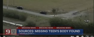
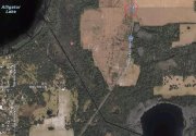
I can’t find my old post on this topic from last spring or a confirmation of his travel direction but my thought has always been that along that rural stretch of Hickory Tree, SS thought he might be able to reach Alligator Lake by turning West down a farm lane or some passage. If he tried, that could have been the cause of his shredded/flat tire. In a plan B/C he might have also considered dropping her in the canal between Alligator Lake and smaller lake to southeast. Either way the alligators would have been his accomplices in destroying evidence. I refer to this area as plans B/C, because I think plan A might have been to leave her somewhere near the church/school, as many of you have suggested.
28.19084° N, 81.20246° W = approximate area where body was found in St. Cloud and across road the sandy area where he changed tire (red circle around blue “body”). Source: my markings in Apple Map app screen shot.
View attachment 543777


