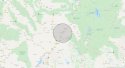
Does anyone have Google Earth? Can you still draw distance circles on it? I'd love to see a 20 mile radius around 565 Pioneer Road, Rexburg, Idaho. See if we see any potential disposal sites. Jmo
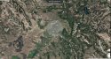
I'm not sure exactly what makes a good disposal site, nor how to draw a circle on Google Earth, but using Google maps, the measure distance, and my somewhat limited knowledge of the area a few possibilities jumped out at me:
1) The St Anthony Sand Dunes that we talked about the other day. Certainly Alex and crew could have hauled their load into the sand dunes. I'd assume digging a hole would have been easier than most places and also less likely to attract attention as out of line.
2) Not sure if a river, lake, pond, etc is a good place, but there are several possibilities along that line within 20 miles.
3) West of town in the country bordering highway 33 that another poster talked about looks like it has a ton of potential in land that isn't going to see much in the way of people traversing it now or even during the summer. (This might be the best option they had, in fact.)
4) Some mountainous areas to the south east which I believe are national forest land would provide some possibilities for disposal.
5) Depending on what you're looking for I suspect that if you evaluated the land that falls within the 20 mile radius you're thinking of that the amount of land that is rural (defined as no more than one or two houses within a half mile or something like that) would be a pretty big percentage, at least 50% and maybe as high as 70-80%. I'm just pulling numbers out of the air, but whatever the percentage is it is large (more than half). Yes, dumping a body in the middle of a wheat, corn, or (more likely here) potato field wouldn't be the smartest move, so a lot of the open land wouldn't be ideal, but there is also no shortage of good disposal sites.


 jmo
jmo
")
