- Joined
- Feb 27, 2005
- Messages
- 3,868
- Reaction score
- 21,692
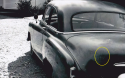
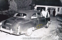
I walked down old bedford from the angle looking for the Barkers house.After a walk of about .5miles ,to my surprise there were two houses on my right There was a sign in the middle of the dirt road that said end of trail.The road turned to asphalt and first mail box #read 8,no name,the next one #4 with a name plate above reading the Barkers.I said wow, their still alive!I thought maybe the people living in #8 cut the same deal, as the Barkers did with the feds.There was a blue tarp covering the main section of the house roof.We had a rain wind storm 3 weeks ago and many trees ,branchs came down,but there was no roofing activity or sign of life.On either side of main house were step back foundation jogs,running across 12-16 feet.I determined the jog on right was the kitchen because of how the driveway entered the property and the window that Barb glanced out of to see Joan run in her drive way.Barbs house, I figured was set back 150 feet from the road,add 20 feet for the road spacing,and Joan parked 30 feet down her 60 foot driveway ,police photos guesstimate.So Barb had to visually navigate a 200ft plus veiw with many trees and bushes on her property plus the pines,hemlocks on either side of Joans driveway.I stood on the other side of the road looking at Barbs, then looking where i thought Joans driveway cut in from photos, going back and forth for what seemed like 30 min.and concluded Barbs veiw was challenging.Barb might have been able to see a car at the end of Joans driveway,but her neighbor#8 would have a birds eye veiw of Joans driveway!I went to 1957 aerial photos and zomed in ,it shows the right side of Joans driveway is well screened.
Non-evergreen trees would have lost most, if not all of their respective leaves so non-line-of-sight views would not be as restrictive as would be in summer days.