I found some USGS (US Geological Survey) historical data for water levels at Chocolate Bayou.
I looked for Austin Bayou, but they don't seem to take measurements on that waterway. They do have some 2005 water quality data for Austin Bayou at FM 2004. The USGS number for Austin Bayou at that location is 08078720.
I only included that information in the event someone else can navigate the USGS better than I can and find more data for that location.
Chocolate Bayou is considered to be in the Coastal Basin watershed. My assumption is that would also be the classification for Austin Bayou rather than being a part of the Brazos River watershed.
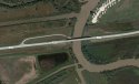
The USGS number for Chocolate Bayou is 08078000. Their map shows their reading takes place on Chocolate Bayou a few miles north of FM 2004.
The USGS site provides precise lat-long for both the Chocolate Bayou and Austin Bayou data points if anyone wants to tinker with the exact distance from the available USGS data on Chocolate Bayou to the spot on Austin Bayou where Jubal Alexander's body was discovered.
The gage heights and discharge rates for Chocolate Bayou and Austin Bayou could be considerably different in terms of height and volume.
What may be comparable is the rate of rise and the time frames for rise and fall due to rainfall in their watersheds. Chocolate Bayou seems to be the best option for something comparable.
Chocolate Bayou is noted as having rainfall measurements available at USGS, but those measurements are noted "Eqp" for the relevant time frame. "Eqp" is "Equipment malfunction."
http://waterdata.usgs.gov/tx/nwis/uv?site_no=08078000&format=gif&period=31
I selected date parameters of April 23--May 3.
Using the Table option, I see a maximum gage height of 17.67 at 8:00 pm (2000 hrs) on April 25. The water level and discharge rate fall briefly and rise again by the 27th of April.
Chocolate Bayou gage heights (feet):
April 27 - 9:45 am: 14.49
April 27 - 11:45 am: 15.15
April 27 - 5:30 pm (1730): 16.73
April 27 - 10:00 pm-11:30 pm (2200-2330):
17.11 - Max. gage height from 4-27 -- 5-3
May 3 - 9:00 am: 11.32
May 3 - 6:00 pm (1800): 11.03
One of the early articles states the fisherman who discovered Jubal's body arrived at the boat ramp "early" that morning on the 27th.
Going strictly from memory, I think he returned to the boat ramp at around 6:00 pm when he checked on the pickup and discovered the body.
The times of 9 am and 6 pm may not be precise, but close enough to get a sense of what water levels may have been like on the bayou that day as compared to days back to the 27th.
I have no idea what is normal with regard to water levels on Austin Bayou. I am aware thar Brazoria County experienced some flooding in April, indicating that overall conditions were not normal.
If the data from Chocolate Bayou is relatively comparable, it would indicate that water levels and rates of discharge on Austin Bayou on the 27th if April were likely higher than normal and peaked sometime that evening.
I don't know if higher than "normal" water levels and rates of discharge would make boating/fishing on Austin Bayou inadvisable or undesirable from April 27 to May 3.
It does seem that utilization of the boat ramp for that time period could have been below normal for that time of year, reducing the number of opportunities for someone to notice Jubal's pickup if it was at that location the entire time.
I remember reading on the kayak website (linked earlier in this thread) that the writer was on Austin Bayou when water,levels were higher than normal.
He wrote about the current at that level being strong enough that they had to set up a take-out spot rather than paddle back as originally planned to where they put-in at the FM 2004 boat ramp.