CA - Jonathan Gerrish, Ellen Chung, daughter, 1 & dog, suspicious death hiking area, Aug 2021 #4

Status
Not open for further replies.
  • #961
off-subject from discussion of the "seated" position, since you appear to have significant familiarity with mariposa, do you know how many properties gerrish owned in that area and how many were rentals? moo.
Four - three Airbnb- addresses all found online.
Juvenile or not previous discussion has been that the backpack carrier was new and the supposed picture confirmed 6:45 as a sort of starting point for the timeline.
  • Picture uploaded at 6:45
  • Family’s vehicle spotted on the road at 7:45
Assumption is drawn from photos that Jonathan previously carried the baby in a kangaroo carrier.
I’m open to correction here so:
1. The family vehicle was spotted on the road at 7.45.
2. Someone in LE had a hunch they may have been going to the Hites Cove Trail as they had bought a property near there in July.
3. The vehicle was discovered at a ‘less common entrance’ to the HC Trail with more visitors usually selecting the entrance on Highway140 if that was the intention.
4. They were reported missing at 11pm on Monday by Rosanna Heaslett or the nanny - depending on which media reporting you read.
5. The trailhead where the car was parked was only a couple of miles down Hites Cove Road from their recently purchased property.
6. Lots of people seemed to know they enjoyed hiking on weekends.
7. Local people knew that it would be folly to hike those particular trails at that time of year.
My questions are to the super-sluethers here:
1. On what road and in what direction was the vehicle travelling?
2. When did this person(s) report this to LE?
3. Wasn’t it apparent to anyone else they may have been hiking to HC before LE had their hunch?
4. How long would it take for someone who knew they hadn’t returned home to drive a couple of miles to the trailhead and see the vacant vehicle?
5. Wouldn’t someone have responded to the pic of the backpack and asked where they were thinking of going?
6. If LE have reported JG used a phone app to research HC trail the day before, where did they get that info if they haven’t been able to access his phone?
 
  • #962
Tagging

@RedHaus , @fred&edna , @Pumphouse363 , @Babs24 , @ItalyReader because you all seemed interested in knocking around a third-party scenario.

Fair warning: this is not my comfort zone. I’m pretty convinced at this point with a cascade scenario similar to the one I proposed in thread 1. I’m also very much out of my element wrt maps and most things chemical, which will come up in the following hypothetical scenario. My own bailiwick is more human behavior and language.

However, I am moved by the persistence of some posters on this thread that the G-C family would absolutely not deliberately or mistakenly put themselves or their child and dog in danger. Here, I assume they would not. I also assume no intentional attack on them. This is a hypothetical scenario that assumes both of those suppositions are true.

JG’s and EC’s child is growing. It’s been hot in CA, and they have noticed the baby getting hot and uncomfortable in the carrier they’ve been using. So they research and order a new pack. Its benefits are a sun shade and less body heat contact between the baby and the wearer. It arrives on Saturday. JG fits it to himself, finds it comfortable, does some research, and talks with EC about a hike for early next morning to try it out.

Sunday morning, they consult the weather forecast. All looks good for a test run of the pack in the early hours. They prepare and pack up. Their chosen destination is Hite’s Cove, a trail they know. But upon arrival, they change course and decide to try out the switchbacks on Savage-Lundy. It would be a better test of the pack on the steep terrain of the switchbacks (map people: is it true that the switchbacks are steeper than HC?). They’ll head back up after an hour or so with plenty of time to get back to the car before it gets hot.

A mile or so into the switchbacks, the dog starts protesting ( maybe vomiting? Refusing to walk? Idk.) JG has had the dog on a leash and the baby on his back. He takes the baby off, noticing the baby is not looking good, either. Could it be the heat? EC thinks it might be. She has the water and starts squeezing it out of the bladder on the baby and dog. She notices JG has sat down and she’s feeling sick herself. This can’t be heat! She has to get out of there…she’s the only one still functioning. She starts to head back to the car/help, but succumbs several yards away. It’s about 9:30/10:00am.

Really spitballing about what happened next/before they arrived. Hang in there with me while I spit ball.

1. Hours before the family arrived for their short hike, ?? came to spray some toxin in the area to kill vegetation to make room for a grow. It wouldn’t be on the switchbacks but some higher elevation. The spray would have to have settled onto the switchbacks. The area is known not to be used, except in early spring for wild flower viewing, so a late summer plant for a fall harvest might work…idk.

2. ?? Returns early Monday (or any time after the area becomes safe after the spray) for a second application or just to check on things but notices a car there. Following prints, ?? discovers the family on the trail. Panicked, ?? not only does not report their deaths but obscures evidence. ?? knows better than to disturb the family at the scene but does obscure footprints leading down S-L. (Again in need of map people here: would ?? have had to access keys and move the car in order to suggest the trail the family took was HC…would there be any point in doing that?)

?? hopes enough time will pass that the toxin in the spray will be obscured in any toxicology tests due exposure/decomposition. Mariposa County is responsible for managing/reporting public health hazards, and this scene is surely going to get some attention…

All MOO and speculation.

Alright, my WS friends. Chime in.


Hi Parsnip!
I’m willing to hear any idea - believe me!

I believe any good brainstorming session should include plenty of out-of-the-box thinking!


I agree there must have been some reason that they were on this grueling walk. MOO.


They could have been forced, but in my opinion a forced walk is a remote possibility - but still, possible. MOO


I also agree with others that it would be unusual to find a grow so close to the trail in an area that had been burned and still had very little growth of any kind. But of course it’s still possible. MOO.


I find it more likely that they could have simply misgauged the difficulty and found themselves in a situation far from what they were expecting, a trail that was far longer, and on a day that was far hotter.


I think all of us have been surprised at some points in our lives that reality is sometimes drastically different than what we expect prior to confronting it in person.


Example 1 - I once decided when I was 20 years old to climb Aspen Mountain from the base in summer. We had very little hiking experience and simply set off from town following the grassy ski slopes up. The mountain extended much further back than was visible to the eye. We made it to the top but the reality of the climb was much farther than we expected. This sounds obvious and one could say we were young and foolish and that would also be correct - but the appearance was deceiving.


Example 2 - Last week we took a hike that looked to be 20 mins up on foot from the center of another town. Instead there was an error in calculation and it took almost an hour to follow the path to the top.


I’m sure you all can think of your own experiences in encountering realities different from your expectations.


When I look at the Savage Lundy trail on maps and even on Google Earth, it’s hard for me personally, non-expert as I am, to gauge how difficult or long or steep it is.

I might even think it is a quick shortcut to the top where the truck was parked. *Especially if it was a little known trail with few first hand accounts or records. I might have thought it was quick short switchbacks on a gradual grade - from what I’ve learned here the trail is not at all simple or short.


All MOO.
 
  • #963
off-subject from discussion of the "seated" position, since you appear to have significant familiarity with mariposa, do you know how many properties gerrish owned in that area and how many were rentals? moo.
Four - three Airbnb- addresses all found online.
Juvenile or not previous discussion has been that the backpack carrier was new and the supposed picture confirmed 6:45 as a sort of starting point for the timeline.
  • Picture uploaded at 6:45
  • Family’s vehicle spotted on the road at 7:45
Assumption is drawn from photos that Jonathan previously carried the baby in a kangaroo carrier.
I’m open to correction here so:
1. The family vehicle was spotted on the road at 7.45.
2. Someone in LE had a hunch they may have been going to the Hites Cove Trail as they had bought a property near there in July.
3. The vehicle was discovered at a ‘less common entrance’ to the HC Trail with more visitors usually selecting the entrance on Highway140 if that was the intention.
4. They were reported missing at 11pm on Monday by Rosanna Heaslett or the nanny - depending on which media reporting you read.
5. The trailhead where the car was parked was only a couple of miles down Hites Cove Road from their recently purchased property.
6. Lots of people seemed to know they enjoyed hiking on weekends.
7. Local people knew that it would be folly to hike those particular trails at that time of year.
My questions are to the super-sluethers here:
1. On what road and in what direction was the vehicle travelling?
2. When did this person(s) report this to LE?
3. Wasn’t it apparent to anyone else they may have been hiking to HC before LE had their hunch?
4. How long would it take for someone who knew they hadn’t returned home to drive a couple of miles to the trailhead and see the vacant vehicle?
5. Wouldn’t someone have responded to the pic of the backpack and asked where they were thinking of going?
6. If LE have reported JG used a phone app to research HC trail the day before, where did they get that info if they haven’t been able to access his phone?
One thing is very clear to me. In evaluating the hypothetical scenario I proposed, multiple responders have been able to point to prior posts and discussions to poke holes in it. Speaking for myself, I don’t see much if any ground that hasn’t already been covered, given the information we have. MOO
I think you made a good hypothesis that, perhaps, they didn’t do the entire trail. We are assuming, based on the photo of a backpack and a sighting at 7.45 that they went straight to the trailhead and began their hike. They may have driven somewhere else first.
 
  • #964
Hi Parsnip!
I’m willing to hear any idea - believe me!

I believe any good brainstorming session should include plenty of out-of-the-box thinking!


I agree there must have been some reason that they were on this grueling walk. MOO.


They could have been forced, but in my opinion a forced walk is a remote possibility - but still, possible. MOO


I also agree with others that it would be unusual to find a grow so close to the trail in an area that had been burned and still had very little growth of any kind. But of course it’s still possible. MOO.


I find it more likely that they could have simply misgauged the difficulty and found themselves in a situation far from what they were expecting, a trail that was far longer, and on a day that was far hotter.


I think all of us have been surprised at some points in our lives that reality is sometimes drastically different than what we expect prior to confronting it in person.


Example 1 - I once decided when I was 20 years old to climb Aspen Mountain from the base in summer. We had very little hiking experience and simply set off from town following the grassy ski slopes up. The mountain extended much further back than was visible to the eye. We made it to the top but the reality of the climb was much farther than we expected. This sounds obvious and one could say we were young and foolish and that would also be correct - but the appearance was deceiving.


Example 2 - Last week we took a hike that looked to be 20 mins up on foot from the center of another town. Instead there was an error in calculation and it took almost an hour to follow the path to the top.


I’m sure you all can think of your own experiences in encountering realities different from your expectations.


When I look at the Savage Lundy trail on maps and even on Google Earth, it’s hard for me personally, non-expert as I am, to gauge how difficult or long or steep it is.

I might even think it is a quick shortcut to the top where the truck was parked. *Especially if it was a little known trail with few first hand accounts or records. I might have thought it was quick short switchbacks on a gradual grade - from what I’ve learned here the trail is not at all simple or short.


All MOO.
You’re absolutely right! We all make mistakes. I think we take chances with our own mortality - but not with our loved ones. I’ve also made terrible decisions but I’ve also been much more circumspect with my children and animals when making those decisions.
 
  • #965
I think you made a good hypothesis that, perhaps, they didn’t do the entire trail. We are assuming, based on the photo of a backpack and a sighting at 7.45 that they went straight to the trailhead and began their hike. They may have driven somewhere else first.

RSBM for focused response

In all fairness to the others on this thread, this not my original hypothesis. I just wove it into the scenario because it seems plausible to me.

ETA: My goals in the scenario were to implicate an unknown third party; account for the footprint evidence described by LE; keep the family on a short hike in the morning; provide a rationale for the hike; and posit a cause for sudden death for all individuals. I used bits and pieces of the ideas of others on this thread to do that.
 
Last edited:
  • #966
Exactly, when performed it becomes part of the report.
I find nothing stating tox’ is Required in all autopsies as I assume all to. It be “complete” autopsies. Moo
I think toxicology tests are often done to rule out or include contributing factors to the COD. There were toxins found in the nearby river so they need to rule out any contact the family or the dog may have had with algae bloom.

Even if the ME found signs of cardiac arrest or other organ damage, they still need to wait for lab results to determine everything that could have contributed to that, besides prolonged exposure to the heat.

Also, sometimes they discover an undiagnosed condition that contributed to a person's death, such as a thyroid disorder. Not that it has anything to do with toxicology results, but it's something to consider. Imo
 
  • #967
Well, @Auntie Cipation there is always Carbofuran. A very small amount can kill a human instantly. It is used widely among grow operators and is devistating to animal / bird populations. It was I who posited a spray trap scenario off trail way back. This audubon article stoked that.

This Brutal Pesticide Creates a 'Circle of Death.' So Why Is It Making a Comeback?

p.s. many pesticides can kill quickly at the right dose and duration of exposure. That is by design, right?
Yes, pesticides kill by design. But there are many laws, including during the formulation process, designed to keep those products from harming people.

Of course people can and do die from pesticide exposure, but not commonly (IMO) and for me the combination of dosage that would be needed to harm humans, together with the necessity that it not be identifiable either by autopsy nor in the environment surrounding their found location, puts this very low on the list. Also of course adding in the low likelihood of illicit activity at that location or that anyone would intentionally want to harm this family.

MOO

A few other thoughts based on recent posts:

Yes they approached the trail from the "local neighborhood" end rather than from the touristy highway, which would have been far out of their way. Per maps, the actual Hite Cove is about halfway along the trail.

So -- do the folks who start from highway 140 typically do an out-and-back hike on this trail? Or do people stage a car at the far end (ie where this family parked)?

Did JC/EC have a second car and if so was it at home? If not, where was it?

Do the Jerseydale/Mariposa local hikers ever use this trail/trailhead? If not, why not?

Just fyi, I'm headed out on a daylong drive shortly, won't be able to check back to the thread until evening in my motel.
 
  • #968
You’re absolutely right! We all make mistakes. I think we take chances with our own mortality - but not with our loved ones. I’ve also made terrible decisions but I’ve also been much more circumspect with my children and animals when making those decisions.

I beg to differ. I endangered my children, almost to the point of death, a handful of times or more. In Guatemala, Mexico, breastfeeding poorly, at a county fair when I let my 8 yr old bungie jump. . . . All terrible decisions based on inexperience, poor judgement, idiocy. Now, I would never take a child to places I once took my children. I posted this up thread.
 
  • #969
One thing is very clear to me. In evaluating the hypothetical scenario I proposed, multiple responders have been able to point to prior posts and discussions to poke holes in it. Speaking for myself, I don’t see much if any ground that hasn’t already been covered, given the information we have. MOO

Amen! But here we are. . .
 
  • #970
I think toxicology tests are often done to rule out or include contributing factors to the COD. There were toxins found in the nearby river so they need to rule out any contact the family or the dog may have had with algae bloom.

Even if the ME found signs of cardiac arrest or other organ damage, they still need to wait for lab results to determine everything that could have contributed to that, besides prolonged exposure to the heat.

Also, sometimes they discover an undiagnosed condition that contributed to a person's death, such as a thyroid disorder. Not that it has anything to do with toxicology results, but it's something to consider. Imo
Absolutely agree.
Imo, environmental toxin tests got rushed in the event public safety was at risk.
To my knowledge, Mariposa had no reported environmental deaths in the days leading up to Gerrish- Chung deaths, and none since. Thankfully.
All toxins must be ruled out.
 
  • #971
Wild idea, BUT - could they have been tased by someone?
 
  • #972
I beg to differ. I endangered my children, almost to the point of death, a handful of times or more. In Guatemala, Mexico, breastfeeding poorly, at a county fair when I let my 8 yr old bungie jump. . . . All terrible decisions based on inexperience, poor judgement, idiocy. Now, I would never take a child to places I once took my children. I posted this up thread.
I’m assuming that you didn’t set up the bungee jump by yourself? Presumably there were other more experienced people organising it. I wouldn’t let my child to a bungee jump but, nevertheless, other people must have considered it ok or they wouldn’t have allowed it. I’m not sure about breastfeeding but don’t think this is remotely comparable to what’s happened here. MOO no disrespect to you or the family intended
 
  • #973
Four - three Airbnb- addresses all found online.

I’m open to correction here so:
1. The family vehicle was spotted on the road at 7.45.
2. Someone in LE had a hunch they may have been going to the Hites Cove Trail as they had bought a property near there in July.
3. The vehicle was discovered at a ‘less common entrance’ to the HC Trail with more visitors usually selecting the entrance on Highway140 if that was the intention.
4. They were reported missing at 11pm on Monday by Rosanna Heaslett or the nanny - depending on which media reporting you read.
5. The trailhead where the car was parked was only a couple of miles down Hites Cove Road from their recently purchased property.
6. Lots of people seemed to know they enjoyed hiking on weekends.
7. Local people knew that it would be folly to hike those particular trails at that time of year.
My questions are to the super-sluethers here:
1. On what road and in what direction was the vehicle travelling?
2. When did this person(s) report this to LE?
3. Wasn’t it apparent to anyone else they may have been hiking to HC before LE had their hunch?
4. How long would it take for someone who knew they hadn’t returned home to drive a couple of miles to the trailhead and see the vacant vehicle?
5. Wouldn’t someone have responded to the pic of the backpack and asked where they were thinking of going?
6. If LE have reported JG used a phone app to research HC trail the day before, where did they get that info if they haven’t been able to access his phone?

1. Hites Cove Road, towards the trailhead. No other specifics of travel direction that I’m aware of.

2. Not in MSM, a question for LE.

3. A question for witnesses/people involved.

4.?

5. We know Ellen uploaded the photo at 6:45 am, I haven’t read of what, if any, responses she received. I don’t even know where exactly she uploaded it to. (Does anyone know?) The photo’s caption was something like ‘ready for the day’, if I remember correctly.

My view only, but if a friend were to post that on Instagram, for example, I may only see that the next time I check my feed, which is infrequent. If she posted it in a ‘story’, the photo would be gone in 24 hours. So, by the time people noticed them missing, the photo would be gone. (But LE could retrieve it.)

This is all speculation as I don’t know where she uploaded it to.

6. Warrants were issued for Jonathan’s phone, and also for apps etc. It may have been Alltrails that supplied that information, imo. ETA: link to Alltrails lifeline information. What is Lifeline?
 
Last edited:
  • #974
Wild idea, BUT - could they have been tased by someone?
A taser would leave distinctive burn marks, and LE reported that the bodies had no signs of trauma.
 
  • #975
A taser would leave distinctive burn marks, and LE reported that the bodies had no signs of trauma.
Perhaps today we’ll get an update.
I’m 100% convinced the truth lies in the much awaited toxicology reports. Moo, of course.
 
  • #976
View attachment 315527 View attachment 315530
Yes, pesticides kill by design. But there are many laws, including during the formulation process, designed to keep those products from harming people.
RSBM
You are very trusting about pesticides, @Auntie Cipation... ;)

Of course I do not know what country you are in so your experience may be different than in the U.S. and certainly 3rd world countries where banned pesticides end up.

Pesticide use is only as safe as how the users store and use them. Many users (e.g. homeowners, farmers, workers, etc.) can be quite lax in safety requirements for themselves, their families, pets, and workers and may not understand the risks at hand. And while there may be regulations in the U.S. controlling the manufacturing, storage, disposal and use of pesticides, abuses occur all the time that result in inadvertent acute injuries or acute death to plants and animals (including humans).

Further, misuse of pesticides is rampant by those intending to kill animals - witness coyote bait traps that can kill domestic dogs off leash on trail (in Maine this is not only legal, but hunters are reimbursed by the State for 'expenses'); lethal Carbofuran used by illegal grow ops in Mexico and the U.S. to fend off unwanted animals / people; bald eagles killed by eating carrion (e.g. rodents, predators, etc.) poisoned by farmers who intentionally lay bait, sometimes found right next to the carrion.
(See the Audubon article I posted earlier today if you want to learn more).

So the misuse of a pesticide is always a possibility when a death or injury presents itself consistent with that kind of exposure. The key of of course is HOW would the G-C family be exposed? WHERE could they have been exposed? WHAT were they exposed to and at what dosing? and WHEN were they exposed before they died? All that said, I don't disagree the odds of the G-C family being killed or seriously weakened from pesticide exposure are very low. But right now, IMO, it is a possibility.

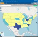
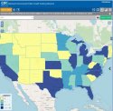
Here are some CDC maps from their National Environmental Public Health Tracking Network that may be interesting to you and others here.

1. 2017 (latest year of data) deaths from pesticides by State. You'll see CA had 1 death.
National Environmental Public Health Tracking Network Query Tool

2. 2017 (latest year) Major Effect Illnesses from Exposure to all Pesticides by State. You'll see CA had > 3-16 major effect illnesses.
National Environmental Public Health Tracking Network Query Tool

p.s. while I am not a Toxicologist, I have a graduate degree in Environmental Health and know a bit about this topic.

ETA: fix graphics and to add RSBM
 

Attachments

  • CDC EPHTN Pesticide Acute Death by State 2017.JPG
    CDC EPHTN Pesticide Acute Death by State 2017.JPG
    109.4 KB · Views: 4
  • CDC EPHTN Pesticide Major Illness by State 2017.JPG
    CDC EPHTN Pesticide Major Illness by State 2017.JPG
    119.8 KB · Views: 5
Last edited:
  • #977
Perhaps today we’ll get an update.
I’m 100% convinced the truth lies in the much awaited toxicology reports. Moo, of course.

Moo. Not thinking environmental toxicity...

Truth in regard to the cause of death of parents, I can see this. Perhaps with the dog as well. The baby toxicology reports may not clarify CoD.

We may know CoD from tox reports but LE still uncertain of how to classify this family death.

Moo. All Moo.
 
  • #978
  • #979
Not much info but we now know what has been ruled out.
The list of items RULED OUT:
see above link for more

Gun or any other type of weapon

Lightning Strike

Carbon Monoxide

Carbon Dioxide

Cyanide Exposure

Illegal Drugs / Alcohol

Suicide
 
  • #980
So let’s make a list of what has not been ruled out:

Murder
Heat stroke
Toxins (environmental)
 
Status
Not open for further replies.

Members online

Online statistics

Members online
63
Guests online
2,317
Total visitors
2,380

Forum statistics

Threads
632,756
Messages
18,631,231
Members
243,279
Latest member
Tweety1807
Back
Top