Found Deceased IN - Abigail (Abby) Williams, 13, & Liberty (Libby) German, 14, The Delphi Murders 13 Feb 2017 #132

DNA Solves
DNA Solves
DNA Solves
Status
Not open for further replies.
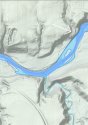
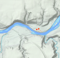
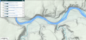
Regarding the sandbar below the house at the end of the road, I see there is a ditch, which begins just a bit south of CR 200 (near PTI Machining) and empties into the creek on the east end of the house. I think the sandbar is probably ditch debris.

Those can be really big and I wonder if that one can make much of a difference to the water level.

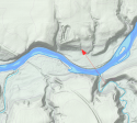
Regarding the size of the crime scene, I though I read the taped off area was approximately 1/3 acre. I can't find that article...

The 1/3 acre from Down the Hill is mentioned in this post by Yemelyan.

Found Deceased - IN - Abigail (Abby) Williams, 13, & Liberty (Libby) German, 14, The Delphi Murders 13 Feb 2017 #129
 
Thank you! I didn't even know where to begin looking for it.
From Yemelyan's same post:

The ravines are not deep here but we do have ravines and small hills, the creek ran through there real close to the crime scene, it was down in the lower gully, I guess you could call it, where the bodies were found and there were two hills on each side plus one on the other side of the creek.

I'm not quite sure what KR means by "two hills on each side plus one on the other side of the creek." What two hills on each side? We know there are hills, but two on each side, not including there one across the creek? Where are they? I've flipped back and forth on Google map 2D/3D to see the contours, and looked at the topographical maps, but I don't understand.
IIRC the area from the cemetary down to near the water was an old gravel quarry.
MOO this led to berms two berms and possibly a third as they dug down.
 
IIRC the area from the cemetary down to near the water was an old gravel quarry.
MOO this led to berms two berms and possibly a third as they dug down.

I was wondering if an old gravel quarry (if it exists) is located further east right near the road that turns into the driveway. But nothing indicating disturbed ground is evident on maps that I’ve noticed. Do you recall the source regarding an old gravel quarry? Wouldn’t a quarry have some sort of access even in the horse drawn wagon days? The hill down from the cemetery is extremely steep according to RL’s walk down the path.
 
Last edited:
I was wondering if an old gravel quarry (if it exists) is located further east right near the road that turns into the driveway. But nothing indicating disturbed ground is evident on maps that I’ve noticed. Do you recall the source regarding an old gravel quarry? Wouldn’t a quarry have some sort of access even in the horse drawn wagon days? The hill down from the cemetery is extremely steep according to RL’s walk down the path.

I cannot remember where I saw the quarry information.
I looked in this historical farms document, and cannot find where it was. A gravel quarry is mentioned on page 10.
https://npgallery.nps.gov/GetAsset/e8cd4d1a-7603-4395-b97e-19e6f0201b9a

Here is a link to that document.

For what it is worth, the terrain map from Google Maps shows the ditch that I thought was the gravel pit, directly south of the cemetery.
Google Maps
 
It really difficult and time consuming to retrace sleuthing by other members over the past four years and 100+ threads but way back iirc that strip of land indeed had been turned over the RL from Carroll County, as indicated by searching county records. I recall being truly amazed at the dedication those same members put forth searching for factual information and unfortunately it’s now hard to find. I recall another member locating and posting a topography map of the Deer Creek area that was very insightful as well, contrary to google which makes it all appear flat. It revealed what was referred to back the as the bowl-shaped area where the bodies were believed to have been found (same as my red circle) but a much broader bowl-shape than one specific spot.

IIRC the land transfer was also the reason for a theory of the moment, that the girls were murdered there as a sort of retaliation for the land having been turned over to RL. JMM (just my memory)
The LIDAR view (with topographic lines) of the area is attached. That is what the ground shape is/was back then. The outlines of the cemetery roads and the gravel pit just below can been seen near the top center to get oriented to where things are.
 

Attachments

  • LIDARMap.png
    LIDARMap.png
    686.8 KB · Views: 148
The LIDAR view (with topographic lines) of the area is attached. That is what the ground shape is/was back then. The outlines of the cemetery roads and the gravel pit just below can been seen near the top center to get oriented to where things are.

Interesting. This is clearer to me than some of the other topos I've seen.

I wonder if the little circular divot to the right of the gravel pit is the bowl-shaped depression that's been cited so frequently in discussion of where Abby and Libby were discovered. :( That's much further from the creek bank than the impression I'd gotten from the assorted LE comments.
 
Okay, I know you all think I'm nuts, but I'm just exploring. Not sure this works with KG's story about how the searcher found the girls, but I guess I'll put it out there anyway...

Reminder of Riley's crime scene description:

The ravines are not deep here but we do have ravines and small hills, the creek ran through there real close to the crime scene, it was down in the lower gully, I guess you could call it, where the bodies were found and there were two hills on each side plus one on the other side of the creek.

Map: White arrow pointing to general location with "two hills on each side plus one across the creek," and "approximately one-half mile upstream from the high bridge." JMO
 

Attachments

  • 20210404_190216.jpg
    20210404_190216.jpg
    147.9 KB · Views: 92
Last edited:
Interesting. This is clearer to me than some of the other topos I've seen.

I wonder if the little circular divot to the right of the gravel pit is the bowl-shaped depression that's been cited so frequently in discussion of where Abby and Libby were discovered. :( That's much further from the creek bank than the impression I'd gotten from the assorted LE comments.
No, the circular divot is not the location.

If you look at this photo that had been posted by WTHR news, you can see the general area where they were - on the right hand side center just beyond the trees.
 

Attachments

  • crimescenewthr-1.jpg
    crimescenewthr-1.jpg
    308.6 KB · Views: 122
No, the circular divot is not the location.

If you look at this photo that had been posted by WTHR news, you can see the general area where they were - on the right hand side center just beyond the trees.
That location of the depression beyond the trees is likely one of the two areas the arrows are pointing at in this attached view.
 

Attachments

  • Screenshot_2021-04-04_20-24-37.png
    Screenshot_2021-04-04_20-24-37.png
    615.9 KB · Views: 69
Okay, I know you all think I'm nuts, but I'm just exploring. Not sure this works with KG's story about how the searcher found the girls, but I guess I'll put it out there anyway...

White arrow pointing to general location with "two hills on each side plus one across the creek," and "approximately one-half mile upstream from the high bridge."
Isee, that is way further upstream than I thought they found.
 
It is almost exactly a half-mile. Most people think LE's half-mile measurement is sloppy, but I don't. I hope they are more accurate than that, anyway...
A half mile from what point of thse bridge?
 
A half mile from what point of thse bridge?
They don't specify, and they don't say how they measured (crow flies or creek bends). I've done it from every way I could think and it always ends up in that general area vs. south of cemetery. But if LE is indeed inaccurate, I still can't see two hills on each side anywhere else. I guess it depends on Riley's definition of a "hill." Jmo
 
2014

Police Calls | Carroll County Comet

April 26, 9:49 p.m. – Burglary, 5858W. 300N., Delphi. Ron Logan reported finding a person in his barn who was not authorized to be there. The unidentified person fled the barn prior to police arrival. The suspect was not located. Liggett investigated.

Thank you for finding this. You’re exactly what this case needs from time to time - A Thread Historian!
 
To help orient where the marked off crime scene is in relation to other things the first attachment is a photo (Fox59, I believe) showing a camera man down a path and RL's dog can be seen and the second attachment is where that path is on the LIDAR image.
 

Attachments

  • CrimeSceneRLdog.jpg
    CrimeSceneRLdog.jpg
    283 KB · Views: 141
  • Screenshot_2021-04-04_20-58-45.png
    Screenshot_2021-04-04_20-58-45.png
    639.3 KB · Views: 130
Status
Not open for further replies.

Members online

Online statistics

Members online
142
Guests online
1,739
Total visitors
1,881

Forum statistics

Threads
600,896
Messages
18,115,315
Members
230,991
Latest member
DeeKay
Back
Top