A Tuesday Press Conference*
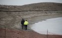
Travel Bag with Photo Identification Confirmed to be from Plane
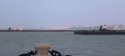
Six people on Plane Missing over Southern Part of Lake Erie - 29 Dec 2016
*26))
http://www.wkyc.com/news/local/cleveland/search-for-missing-plane-suspended-until-tuesday/381208795
27))
http://fox8.com/2017/01/04/crews-find-more-debris-in-search-for-missing-plane/
28))
Cessna 525C Citationjet CJ4 Specifications:
http://cessna.txtav.com/en/citation/cj4#_model-specs
https://twitter.com/flightradar24/status/814823855659319296
^^^ Zoom-In for Moment-to-Moment Flight Data ^^^
>>> Some Highlights of the Very-Brief Flight:
10:57:01 P.M.
::: 950 Ft. of Altitude
::: Tracking South-West (237°)
10:57:15 P.M.
::: 1750 Ft. of Altitude
::: Tracking West-South-West (252°)
10:57:30 P.M.
::: 3100 Ft. of Altitude
::: Tracking North-West (309°)
10:57:35 P.M.
::: 2925 Ft. of Altitude
::: Tracking North-West (320°)
10:57:40 P.M.
::: 2475 Ft. of Altitude
::: Tracking North-North-West (344°)
10:57:45 P.M. ::: 1750 Ft. of Altitude ::: Tracking North (010°)
10:57:51 P.M.
::: 1075 Ft. of Altitude
::: Tracking North-North-East (025°)
Last Known Location:
N 41.53574° ::: W -081.71591°
N 41° 32.144' ::: W -081° 42.955'
N 41° 32' 08.664'' ::: W -081° 42' 57.276''
UTM: 17T 440281E ::: 4598479N
**Just 2 Miles (3 Km), North-West (310°) from Airport,
over a Lake Water Depth of only 50Ft. (15m)
[[ Approximate Specifications: 50 Ft. Long :: 50 Ft. Wide :: 15 Feet High ]]
{{ Elevation of Burke Lakefront Airport = 580 Ft. (176m)
Elevation of Lake Erie = 570 Ft. (173m).
Elevation of Ohio State University Airport = 905 Ft (275m) }}
On-Board the Cessna Citationjet CJ4:
John T. Fleming, 46 - Pilot - Father
Suzanne Fleming, 46 - Mother
John R. "Jack" Fleming, 15 - Son
Andrew T. Fleming, 14 - Son
Brian E. Casey, 42 - Neighbor - Father
Megan Casey,19 - Neighbor - Daughter
ACARS = Aircraft Communications Addressing & Reporting System
AD = Airworthiness Directive
Altimeter = Displays
Calculated Distance above Ground
Altitude = Height above Ground
ATC = Air Traffic Control
CEO = Chief Executive Officer
CVR =
Cockpit Voice Recorder
Elevation = Height above Mean/Average Sea Level
ELT =
Emergency Locating Transmitter - "Pinger"
EMS = Emergency Medical Services
EST = Eastern Standard Time (5 Hours
Before GMT / UTC / Z)
ETA = Estimated Time of Arrival
FAA = Federal Aviation Administration
FDR =
Flight Data Recorder (Optional on these
CJ4 Models)
FSDO = Flight Standards District Office of FAA
GMT = Greenwich Mean Time
GPWS = Ground Proximity Warning System
IIRC = If I Recall Correctly
IMC = Instrument Meteorological Conditions
inHg = Barometric Pressure :: Inches of Mercury
LKL = Last Known Location
Magnetometer = Can Locate Metal Underwater
Mean = Arithmetic Average
NTSB = National Transportation Safety Board
Sonar = Sound Navigation and Ranging
Sortie = A Group sent on a Specific Mission
TCAS = Traffic Collision Avoidance System
UTC = Universal Time Coordinated
UTM = Universal Transverse Mercator
Z = Zulu Time = GMT = UTC
**Should the Search Area be further NW /
North-West than its Current 2 Mile (3kM) Limit?


 If the data is correct, the pilot's behavior would seem somewhat bizarre. Based on that data I would have to guess the cause was pilot error.