Australia Claremont Serial Killer, 1996 - 1997, Perth, Western Australia - #18

DNA Solves
DNA Solves
DNA Solves
Status
Not open for further replies.
attachment.php

Source: The West Australian Monday 20th June 1988

Note that the accurate temperature reported for Sunday 19[SUP]th[/SUP] June 1988: Temp min 13.6 at 8.50 pm and max 20.6 at 11.45 am.

At 8.50 pm on the Sunday 19th June the temperature was 13.6 degrees. This was only about three hours before Julie C disappeared.

As this was the minimum temperature for the 19th June, it would have got warmer until after midnight, when the minim temperature for the 20th June 1988 was 10.7 degrees at 7.30 am.

So, we can safely say based on the recorded minimum temperatures for Perth on the 19th and 20th June 1988, the overnight temperature was somewhere between 11 and 14 degrees.
 

Attachments

  • Weather_Mon_20_June_1988.JPG
    Weather_Mon_20_June_1988.JPG
    101.2 KB · Views: 134
https://s24.postimg.org/fdszikl4l/csk.png
BRE posted on his FB page on the day he was arrested that he thought the Eagles Nest would be a good nickname for the new Stadium in Perth. A person answered that an eagle's nest is called an eyrie. There is a lake Eyrie in WA. I wonder if he was trying to say he had buried ss there. MOO
 
Just as well I have the real temperature for 20th June 1988, and real weather map with weather description and forecast printed in The West Australian on 21st June 1988. This is inofrmation gathered from the 20th of June and published on the 21st June 1988. As state before the West was used extensively for its forecasts and local waters forecast and I've only captured about 3/4 of what is shown on the weather page.

I've published this particular map and others here three or four times.

This is accurate minimum and maximum temperature for Perth 20th June 1988. The information on min temp previously published for Subiaco was 8 degrees but the West information also gives the exact time of the minimum. Each day from 20 - 22nd June the minimum was around 10 to 11 degrees and around 7 to 7.30 am. Didn't stop the bobbies turning up every morning at 7 am and didn't stop any other regulars that I knew.

The minimum temperature for the 20 th June 1988 was 10.7 degrees at 7.30 am. This was the coldest it got any time after midnight on 20th June. The maximum temp was 18 degrees at 2.25 pm on 20th June 1988.

I saw the original micro phish and taken notes (description below) and photos. Images I've posted three or four times now. Not sure what you are trying to gain by posting unreadable or inaccurate interpretations.

attachment.php

Source: The West Australian Tuesday 21st June 1988

The front was fragmented in structure and rainfall was only expected to be light in inland districts.

The front had brought one of the few SW changes in recent weeks, consequently colder air of southern origin was extending through the SW. Pressures are expected to rise rapidly behind the front and fine weather was expected to develop in the SW.

SW winds at 10 to 15 knots easing to 10 knots by late morning.

Yes IC, thats correct about these old newspaper weather reports.
All different and inaccurate , thats how it was in 1988, nowhere near as good as nowadays with much more accuracy in 2017 .
Some are wrong and some are right and thats still the case nowadays, you figure out what source gives the best information .
 
https://s24.postimg.org/fdszikl4l/csk.png
BRE posted on his FB page on the day he was arrested. He thought the Eagles Nest would be a good nickname for the new Stadium in Perth. A person answered that an eagle's nest is called an eyrie. There is a lake Eyrie in WA. I wonder if he was trying to say he had buried ss there. MOO

Looked at from above the stadium does look a bit like a nest so that's just a fair comment, an eagles nest is an aerie corrupted to eyrie. What ever part if any this man plays in these assaults and killings he's given very little away to anyone outside of a close circle. I don't see him doing it on a forum.
 
attachment.php

Source: The West Australian Monday 20th June 1988

Note that the accurate temperature reported for Sunday 19[SUP]th[/SUP] June 1988: Temp min 13.6 at 8.50 pm and max 20.6 at 11.45 am.

At 8.50 pm on the Sunday 19th June the temperature was 13.6 degrees. This was only about three hours before Julie C disappeared.

As this was the minimum temperature for the 19th June, it would have got warmer until after midnight, when the minim temperature for the 20th June 1988 was 10.7 degrees at 7.30 am.

So, we can safely say based on the recorded minimum temperatures for Perth on the 19th and 20th June 1988, the overnight temperature was somewhere between 11 and 14 degrees.

Oh my god ,
Amazing charts !
With one more previously unseen synoptic map !

Thats a brutal front ,
it says possible hail for the southwest and thats for the monday the 20th even though the storm was supposedly gone past perth by Monday .
Fresh south west winds - Wow thats different from all of the other previous reports !
More inconsistencies .
454e17f839295ad120ed201959e3e616.jpg
 
Looked at from above the stadium does look a bit like a nest so that's just a fair comment, an eagles nest is an aerie corrupted to eyrie. What ever part if any this man plays in these assaults and killings he's given very little away to anyone outside of a close circle. I don't see him doing it on a forum.

Hi janwa - yes, you are right. I'm sure he wouldn't have left clues for people to chase around trying to find ss ( if he even did have anything to do with her disappearance). I wonder if he has told the police anything. Or if the police have found out anything from their searches of his home and car. I guess we will just have to wait it out. MOO
 
I just started watching the Mindhunter series on Netflix, produced by David Fincher and Charlize Theron and highly recommend it.

In the late 1970s two FBI agents expand criminal science by delving into the psychology of murder and getting uneasily close to all-too-real monsters.

The subject matter is not for the faint of heart but it's thoroughly engrossing and includes some eerily accurate portrayals of fascinating real life serial killers like Edmund Kemper.

http://www.imdb.com/title/tt5290382/
 
Oh my god ,
Amazing charts !
With one more previously unseen synoptic map !

Thats a brutal front ,
it says possible hail for the southwest and thats for the monday the 20th even though the storm was supposedly gone past perth by Monday .
Fresh south west winds - Wow thats different from all of the other previous reports !
More inconsistencies .
454e17f839295ad120ed201959e3e616.jpg

I've been wondering what made the dent on the left side of JC's car (seen on post 737 http://www.websleuths.com/forums/sh...r-1996-1997-Perth-Western-Australia-17/page50)

To me, it looks like it would have been made by a sudden highly forceful impact with rocks (i.e. at high speed). If it was the case that the car crashed into the groin before entering the water, you'd expect there would have been the car's paint on the rocks, which the police should have found. I guess the other thing is, could the storm front have pushed the car into the rocks, making the large dent?
 
So over the weather bull****. It's getting very boring you two... Can we please just stop?
Move on.

I've just started the Mindhunter series, it's a great watch.
 
Just as well I have the real temperature for 20th June 1988, and real weather map with weather description and forecast printed in The West Australian on 21st June 1988. This is inofrmation gathered from the 20th of June and published on the 21st June 1988. As state before the West was used extensively for its forecasts and local waters forecast and I've only captured about 3/4 of what is shown on the weather page.

I've published this particular map and others here three or four times.

This is accurate minimum and maximum temperature for Perth 20th June 1988. The information on min temp previously published for Subiaco was 8 degrees but the West information also gives the exact time of the minimum. Each day from 20 - 22nd June the minimum was around 10 to 11 degrees and around 7 to 7.30 am. Didn't stop the bobbies turning up every morning at 7 am and didn't stop any other regulars that I knew.

The minimum temperature for the 20 th June 1988 was 10.7 degrees at 7.30 am. This was the coldest it got any time after midnight on 20th June. The maximum temp was 18 degrees at 2.25 pm on 20th June 1988.

I saw the original micro phish and taken notes (description below) and photos. Images I've posted three or four times now. Not sure what you are trying to gain by posting unreadable or inaccurate interpretations.

attachment.php

Source: The West Australian Tuesday 21st June 1988

The front was fragmented in structure and rainfall was only expected to be light in inland districts.

The front had brought one of the few SW changes in recent weeks, consequently colder air of southern origin was extending through the SW. Pressures are expected to rise rapidly behind the front and fine weather was expected to develop in the SW.

SW winds at 10 to 15 knots easing to 10 knots by late morning.

"Didn't stop the bobbies turning up every morning at 7 am and didn't stop any other regulars that I knew." Quote IC.


Thank you very much for that IC ,
that is very important to know when the first people arrived at the beach each day .
I believe your right about that ,
Especially with the water temperature being extra warm with the 'la nina' weather and leeuwin current anomalously strong in 1988 .
Even with a 3 metre swell the swimmers would still go out and swim, although not as easily as the calm days.
Yes theyre dedicated, i can imagine regulars went every morning at dawn rain, hail or shine .
Plus surfers also would be chasing the waves, as the swell was up with good surfing weather permitting Mon (& tues).
A 3 metre swell decreasing with wind turning offshore, a surfers delight .

Yet the car wasnt found until the Weds 22nd.
The seat found South of the groyne? Monday .
Where was that Car Seat found monday and What time ?
Would really like to know
 
Oh my god ,
Amazing charts !
With one more previously unseen synoptic map !

Thats a brutal front ,
it says possible hail for the southwest and thats for the monday the 20th even though the storm was supposedly gone past perth by Monday .
Fresh south west winds - Wow thats different from all of the other previous reports !
More inconsistencies .
454e17f839295ad120ed201959e3e616.jpg

Incorrect. The only inconsistency is from you. You said there were NW winds. Every time I posted weather for 20th June 1988, I said SW winds at 10 to 15 knots easing to 10 knots by late morning.

You said there was a huge storm in Perth the weekend before JC disappeared. There wasn't. Read the charts, temperatures and BOM forecast.

You said temperatures overnight on 19th June were 2 degrees. They weren't. Minimum temperatures were 14 to 11 degrees from midnight until 7.30 am on the 20th June 1988.

Possible hail for the SW is a general summary report in the diagram (which you snipped out of the above post) for the Lower SW, which is pointing to around Albany. Suggests scattered showers and possible hail.

I have posted this particular chart and forecast around 4 times now. Are you saying that the official BOM forecast in The West Australian is inaccurate? The Bureau of Meteorology (BOM) wouldn't be too happy that you think their PhD trained officers that reported in 1988 did not know how to interpret synoptic charts. If you can't see the official BOM forecast on the right circled read the simple forecast in the big picture of Australia. You snipped the image without permission and without referencing the source, so not not only you can't see the official BOM forecast, no one can.

The front was fragmented in structure and rainfall was only expected to be light in inland districts. The front had brought one of the few SW changes in recent weeks, consequently colder air of southern origin was extending through the SW. Pressures are expected to rise rapidly behind the front and fine weather was expected to develop in the SW.

There was no storm in the weekend before the disappearance of Julie C. I have said this many times and provided evidence many times. You agreed with me. The front you see is centered well off the south of Australia and is weak and fragmented according to the BOM reports reported in The West Australian. The front had front brought one of the few SW changes in recent weeks.

There was a storm that started to come in from the 24th June 1988 as further information I posted previously from The West Australian showed....and don't get me started on the waves cause that's were I do have expertise!!

attachment.php
 

Attachments

  • Weather_20Jun_close.jpg
    Weather_20Jun_close.jpg
    129.6 KB · Views: 159
"Didn't stop the bobbies turning up every morning at 7 am and didn't stop any other regulars that I knew." Quote IC.


Thank you very much for that IC ,
that is very important to know when the first people arrived at the beach each day .
I believe your right about that ,
Especially with the water temperature being extra warm with the 'la nina' weather and leeuwin current anomalously strong in 1988 .
Even with a 3 metre swell the swimmers would still go out and swim, although not as easily as the calm days.
Yes theyre dedicated, i can imagine regulars went every morning at dawn rain, hail or shine .
Plus surfers also would be chasing the waves, as the swell was up with good surfing weather permitting Mon (& tues).
A 3 metre swell decreasing with wind turning offshore, a surfers delight .

Yet the car wasnt found until the Weds 22nd.
The seat found South of the groyne? Monday .
Where was that Car Seat found monday and What time ?
Would really like to know

I never said the bobbies were the first to arrive on the beach. Ever! 5.30 am or 6.00 am in winter would be when the first people would be arriving at Cott to exercise. IMO. Possibly earlier for joggers. I posted images recently of a supposed 2.5 to 3 m swell in SW condition at Cott. These were from 1st - 3rd June 2017. Cott is very protected and although there were a few surfers you saw the waves.

Car seat was found Monday afternoon south of groyne by beach walkers who handed it in to the Ranger. The Ranger was the paid beach inspector or paid lifeguard who is at the beach every weekday morning at 6.00 am until 6.00pm (could be 7.00 am in winter) See your mybeach_Cott link. This was reported in one of the articles I recently posted, which I'm sure you can find as it was only a few days ago.
 
Incorrect. The only inconsistency is from you. You said there were NW winds. Every time I posted weather for 20th June 1988, I said SW winds at 10 to 15 knots easing to 10 knots by late morning.

You said there was a huge storm in Perth the weekend before JC disappeared. There wasn't. Read the charts, temperatures and BOM forecast.

You said temperatures overnight on 19th June were 2 degrees. They weren't. Minimum temperatures were 14 to 11 degrees from midnight until 7.30 am on the 20th June 1988.

Possible hail for the SW is a general summary report in the diagram (which you snipped out of the above post) for the Lower SW, which is pointing to around Albany. Suggests scattered showers and possible hail.

I have posted this particular chart and forecast around 4 times now. Are you saying that the official BOM forecast in The West Australian is inaccurate? The Bureau of Meteorology (BOM) wouldn't be too happy that you think their PhD trained officers that reported in 1988 did not know how to interpret synoptic charts. If you can't see the official BOM forecast on the right circled read the simple forecast in the big picture of Australia. You snipped the image without permission and without referencing the source, so not not only you can't see the official BOM forecast, no one can.

The front was fragmented in structure and rainfall was only expected to be light in inland districts. The front had brought one of the few SW changes in recent weeks, consequently colder air of southern origin was extending through the SW. Pressures are expected to rise rapidly behind the front and fine weather was expected to develop in the SW.

There was no storm in the weekend before the disappearance of Julie C. I have said this many times and provided evidence many times. You agreed with me. The front you see is centered well off the south of Australia and is weak and fragmented according to the BOM reports reported in The West Australian. The front had front brought one of the few SW changes in recent weeks.

There was a storm that started to come in from the 24th June 1988 as further information I posted previously from The West Australian showed....and don't get me started on the waves cause that's were I do have expertise!!

attachment.php

The statistics in the old newspaper articles are all from different metro weather stations, different areas different temperatures typical.
They are all BoM and its ancient technology most certainly .
Its obvious theyre inaccurate, see how all different news clippings are contradicting the other .
The best info is the information that i sourced from the most modern technology available nowadays .
Obviously that is by far the most accurate .
The Oceanographer was positive about that .
 
I never said the bobbies were the first to arrive on the beach. Ever! 5.30 am or 6.00 am in winter would be when the first people would be arriving at Cott to exercise. IMO. Possibly earlier for joggers. I posted images recently of a supposed 2.5 to 3 m swell in SW condition at Cott. These were from 1st - 3rd June 2017. Cott is very protected and although there were a few surfers you saw the waves.

Car seat was found Monday afternoon south of groyne by beach walkers who handed it in to the Ranger. The Ranger was the paid beach inspector or paid lifeguard who is at the beach every weekday morning at 6.00 am until 6.00pm (could be 7.00 am in winter) See your mybeach_Cott link. This was reported in one of the articles I recently posted, which I'm sure you can find as it was only a few days ago.

"Car seat was found Monday afternoon south of groyne by beach walkers who handed it in to the Ranger.
The Ranger was the paid beach inspector or paid lifeguard who is at the beach every weekday morning at 6.00 am until 6.00pm (could be 7.00 am in winter)"

Thank you IC .

Thats really interesting .
How Far South of the groyne ???
 
Incorrect. The only inconsistency is from you. You said there were NW winds. Every time I posted weather for 20th June 1988, I said SW winds at 10 to 15 knots easing to 10 knots by late morning.
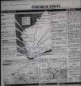
You said there was a huge storm in Perth the weekend before JC disappeared. There wasn't. Read the charts, temperatures and BOM forecast.

You said temperatures overnight on 19th June were 2 degrees. They weren't. Minimum temperatures were 14 to 11 degrees from midnight until 7.30 am on the 20th June 1988.

Possible hail for the SW is a general summary report in the diagram (which you snipped out of the above post) for the Lower SW, which is pointing to around Albany. Suggests scattered showers and possible hail.

I have posted this particular chart and forecast around 4 times now. Are you saying that the official BOM forecast in The West Australian is inaccurate? The Bureau of Meteorology (BOM) wouldn't be too happy that you think their PhD trained officers that reported in 1988 did not know how to interpret synoptic charts. If you can't see the official BOM forecast on the right circled read the simple forecast in the big picture of Australia. You snipped the image without permission and without referencing the source, so not not only you can't see the official BOM forecast, no one can.

The front was fragmented in structure and rainfall was only expected to be light in inland districts. The front had brought one of the few SW changes in recent weeks, consequently colder air of southern origin was extending through the SW. Pressures are expected to rise rapidly behind the front and fine weather was expected to develop in the SW.

There was no storm in the weekend before the disappearance of Julie C. I have said this many times and provided evidence many times. You agreed with me. The front you see is centered well off the south of Australia and is weak and fragmented according to the BOM reports reported in The West Australian. The front had front brought one of the few SW changes in recent weeks.

There was a storm that started to come in from the 24th June 1988 as further information I posted previously from The West Australian showed....and don't get me started on the waves cause that's were I do have expertise!!

attachment.php

Quote IC : "There was a storm that started to come in from the 24th June 1988 as further information I posted previously from The West Australian showed....and don't get me started on the waves cause that's were I do have expertise !! "


Big wave surfers often downplay their heroics, nonchalantly saying that the waves weren't big , when in fact they really were .
3 metres , Wow how many metres until you start to admit that its a big wave ?
 
I've been wondering what made the dent on the left side of JC's car (seen on post 737 http://www.websleuths.com/forums/sh...r-1996-1997-Perth-Western-Australia-17/page50)

To me, it looks like it would have been made by a sudden highly forceful impact with rocks (i.e. at high speed). If it was the case that the car crashed into the groin before entering the water, you'd expect there would have been the car's paint on the rocks, which the police should have found. I guess the other thing is, could the storm front have pushed the car into the rocks, making the large dent?
As the large dent was on the passengers side, it may have landed on a rock on the passengers side. Or perhaps the car was involved in a crash beforehand and was t-boned.

Perhaps JC was a victim of road rage and she picked the wrong person to mess with! JMO
 
Quote : "Unsurprisingly, all these clouds bring rain which is why lows are usually associated with cold, wet and windy weather.
And we all know when it’s windy the isobars on the chart are close together.
So it’s you see the isobar lines close together along with an ‘L’ expect it to be rainy and windy.
On a weather map (synoptic chart), a low is denoted by an ‘L’ with the central pressure underneath."

http://www.news.com.au/technology/e...s/news-story/ba0674b2ac9ca47dcc5c8cb3db49b9b6

Those are fronts (circled) and thats why the waves were big .

That one synoptic chart at bottom right had never ever been posted until yesterday.
It was cropped out of the original picture. The bigger portion of the picture was posted in the first post, in the series of ICs newspaper weather & reports maps .

If its been posted, where?


a57c7e0360f376b4fe8e18dacbca71ee.jpg
fdfb966e1ef3eaccff4bb55db860fe45.jpg
new map - circled [emoji652]
a48ae6c8056874f8139cb6d4a4f9d877.jpg
55e166a360d5164bfe09bbc4d5a7f71c.jpg
 
Incorrect. The only inconsistency is from you. You said there were NW winds. Every time I posted weather for 20th June 1988, I said SW winds at 10 to 15 knots easing to 10 knots by late morning.

You said there was a huge storm in Perth the weekend before JC disappeared. There wasn't. Read the charts, temperatures and BOM forecast.

You said temperatures overnight on 19th June were 2 degrees. They weren't. Minimum temperatures were 14 to 11 degrees from midnight until 7.30 am on the 20th June 1988.

Possible hail for the SW is a general summary report in the diagram (which you snipped out of the above post) for the Lower SW, which is pointing to around Albany. Suggests scattered showers and possible hail.

I have posted this particular chart and forecast around 4 times now. Are you saying that the official BOM forecast in The West Australian is inaccurate? The Bureau of Meteorology (BOM) wouldn't be too happy that you think their PhD trained officers that reported in 1988 did not know how to interpret synoptic charts. If you can't see the official BOM forecast on the right circled read the simple forecast in the big picture of Australia. You snipped the image without permission and without referencing the source, so not not only you can't see the official BOM forecast, no one can.

The front was fragmented in structure and rainfall was only expected to be light in inland districts. The front had brought one of the few SW changes in recent weeks, consequently colder air of southern origin was extending through the SW. Pressures are expected to rise rapidly behind the front and fine weather was expected to develop in the SW.

There was no storm in the weekend before the disappearance of Julie C. I have said this many times and provided evidence many times. You agreed with me. The front you see is centered well off the south of Australia and is weak and fragmented according to the BOM reports reported in The West Australian. The front had front brought one of the few SW changes in recent weeks.

There was a storm that started to come in from the 24th June 1988 as further information I posted previously from The West Australian showed....and don't get me started on the waves cause that's were I do have expertise!!

attachment.php

Quote Innerchild : "I have posted this particular chart and forecast around 4 times now.
Are you saying that the official BOM forecast in The West Australian is inaccurate?
The Bureau of Meteorology (BOM) wouldn't be too happy that you think their PhD trained officers that reported in 1988 did not know how to interpret synoptic charts. If you can't see the official BOM forecast on the right circled read the simple forecast in the big picture of Australia."

Yes
in 1988 , the Tools weren't as available as nowadays, it is much more accurate.
Bom is good , the trove link claims to be Bom too .
Your saying they are good , i have found inaccuracies, but thats typical as thats what i do in my trade .
I look for errors in forecasts and use hindcasts to confirm them .
Plus , Bom also said 3 Metre swell too (20th).
Theres a serious contradiction there , a flawed theory, because Bom are accurate right, you said ?
 
Quote : "Unsurprisingly, all these clouds bring rain which is why lows are usually associated with cold, wet and windy weather.
And we all know when it’s windy the isobars on the chart are close together.
So it’s you see the isobar lines close together along with an ‘L’ expect it to be rainy and windy.
On a weather map (synoptic chart), a low is denoted by an ‘L’ with the central pressure underneath."

http://www.news.com.au/technology/e...s/news-story/ba0674b2ac9ca47dcc5c8cb3db49b9b6

Those are fronts (circled) and thats why the waves were big .

That one synoptic chart at bottom right had never ever been posted until yesterday.
It was cropped out of the original picture. The bigger portion of the picture was posted in the first post, in the series of ICs newspaper weather & reports maps .

If its been posted, where?


a57c7e0360f376b4fe8e18dacbca71ee.jpg
fdfb966e1ef3eaccff4bb55db860fe45.jpg
new map - circled [emoji652]
a48ae6c8056874f8139cb6d4a4f9d877.jpg
55e166a360d5164bfe09bbc4d5a7f71c.jpg
Back in the 1980s the weather bureau was often wrong, stating it would rain when often it didn’t. Then the bureau changed to there’s a “chance of a shower”. Nowadays it’s just the predicted percentage of chance that it perhaps, might rain.

The other day the radio announced that it “may” rain, which was surprising because at the time it was absolutely pouring down - raining cats and dogs!

Wish they’d just get the rain forecasts right!
 
Status
Not open for further replies.

Members online

Online statistics

Members online
131
Guests online
2,185
Total visitors
2,316

Forum statistics

Threads
601,990
Messages
18,132,995
Members
231,205
Latest member
Neejo
Back
Top