I agree, this is definitely not about following some nice folks to a campfire or party on the beach, nor an accident.I think someone was playing with him/his belongings to get him to follow them.
Maybe took his hat/wallet something after a quick interaction at Tennyson, taunted him a bit and said he could have it back if he went with them or something. Lots of youth with attitude who mess with tourists here.
Turning off the gps makes sense if you’re trying to save battery but the bit where it’s off/in airplane mode is highly suspicious.
I think he’s with the phone trying to play it cool at least until 1am.
Watching the show on YouTube almost implies he was alone for a bit and entertaining himself until the people he was with came back or something similar.

You are using an out of date browser. It may not display this or other websites correctly.
You should upgrade or use an alternative browser.
You should upgrade or use an alternative browser.
Australia Australia - Theo Hayez, 18, Belgian backpacker, Byron Bay, 31 May 2019 #4
- Thread starter Beagle
- Start date


couldn't the persistent "checking location/maps" just be someone else making sure the phone screen remains activated in order to prevent the locking of the phone? Sorry, this has probably been asked before but there are so many messages and threads ....

This is Theo walking with his phone, I don't have a photo with the previous GPS and activity marks, but here you see 5 consecutive location marks without any map viewing at all, after his arrival at the sports field the way the phone is used changes.
Hello Sleuths,
The attached photos are from various dates in 2019. As you can see the cricket nets were also used as a parking space for numerous locals. There is one car in particular that has been frequently photographed parking here throughout 2019. Has there been any investigation into this? Could Theo have possibly met someone at a car for 7 minutes before heading to the beach?
These photos are from satellite images from NEARMAP. The dates of photos are at the bottom of the images.
Thanks,
View attachment 453879View attachment 453880View attachment 453881
Apart from that dark blue car, there is a white truck or van in two of the pictures:


HinterlandObserver
Well-Known Member
- Joined
- May 5, 2020
- Messages
- 528
- Reaction score
- 3,116
There were residences across the road, before they all mostly became accomodations. It is possible cars belong to them but also at that time it was possible to “live” there in a car and just move your car around.Apart from that dark blue car, there is a white truck or van in two of the pictures:
View attachment 459017
View attachment 459018
There were residences across the road, before they all mostly became accomodations. It is possible cars belong to them but also at that time it was possible to “live” there in a car and just move your car around.
There´s plenty of space to park in front of those residences, these vehicles don't seem to belong to them.

I've marked the same spot on these photos:


Theo had been walking along Tennyson St in the direction of the playground, we know it is him at that time because of the CCTV footage leaving CM. He had been walking 2 blocks without checking his phone and its at this location that he checks googlemaps again.
Theo had been walking along Tennyson St in the direction of the playground, we know it is him at that time because of the CCTV footage leaving CM. He had been walking 2 blocks without checking his phone and its at this location that he checks googlemaps again.
Last edited:
In this illustration the arrows represent the yellow pins for theo's location walking up to the area behind the cricket nets, where 7 minutes pass and then his phone moves quickly accross the play ground, a movement not consistent with the previous pattern of Theo walking.

Is it possible that Theo is in the area of the sports field, perhaps attacked right there and his phone and hat dumped in the area where they were found? speculation, imo.
Yes, it think it's definitely possible.
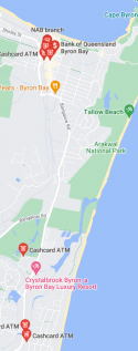
When I google "atm byron bay" I get plenty of options in town and then only a few quite a long way to the south of byron bay. I read on the page lookingfortheo that his bank card was last used in CM the night he disappeared but if this was a robbery they might have tried to access his card. Has the CCTV footage at those ATM including the ones to the south and maybe other nearby locations west and north been checked if there's any?
Attachments
HinterlandObserver
Well-Known Member
- Joined
- May 5, 2020
- Messages
- 528
- Reaction score
- 3,116
Depends how many people were living there. I’m 50/50 cause usually the vehicle dwellers are in vans/station wagons or busses.There´s plenty of space to park in front of those residences, these vehicles don't seem to belong to them.
View attachment 459085
Either way they should have been interviewed.
Also note there is a “walkway” behind the houses from Middleton to Tennyson, which comes out between those houses. I believe they plays a role. It looks almost like thats the first direction he was going before heading back over the field.

more space to park!
from the NSW coroner's report "The area surrounding the cricket nets was searched on 9 June 2019. Policecanvasses were done of the residential areas surrounding the recreationalgrounds and the Youth Activity Centre and no information of value gathered.Leaflets were also dropped in the area by volunteers seeking information aboutTheo. A person who camped in the area near the cricket nets long term was49interviewed by the police and said that he had not seen Theo and was not awareof anything occurring there on the night in question. He was not himself a personof interest. Detective Parker gave evidence that this area is not a “site of concern”for police in terms of it being a site of violent crime or drug use."
Gives me the impression they didn't interview many people in that area.
Depends how many people were living there. I’m 50/50 cause usually the vehicle dwellers are in vans/station wagons or busses.
Either way they should have been interviewed.
Also note there is a “walkway” behind the houses from Middleton to Tennyson, which comes out between those houses. I believe they plays a role. It looks almost like thats the first direction he was going before heading back over the field.
View attachment 459171
from the NSW coroner's report "The area surrounding the cricket nets was searched on 9 June 2019. Policecanvasses were done of the residential areas surrounding the recreationalgrounds and the Youth Activity Centre and no information of value gathered.Leaflets were also dropped in the area by volunteers seeking information aboutTheo. A person who camped in the area near the cricket nets long term was49interviewed by the police and said that he had not seen Theo and was not awareof anything occurring there on the night in question. He was not himself a personof interest. Detective Parker gave evidence that this area is not a “site of concern”for police in terms of it being a site of violent crime or drug use."
Gives me the impression they didn't interview many people in that area.
HinterlandObserver
Well-Known Member
- Joined
- May 5, 2020
- Messages
- 528
- Reaction score
- 3,116
I doubt highly they did much work to interview people who were in the area at all.more space to park!
from the NSW coroner's report "The area surrounding the cricket nets was searched on 9 June 2019. Policecanvasses were done of the residential areas surrounding the recreationalgrounds and the Youth Activity Centre and no information of value gathered.Leaflets were also dropped in the area by volunteers seeking information aboutTheo. A person who camped in the area near the cricket nets long term was49interviewed by the police and said that he had not seen Theo and was not awareof anything occurring there on the night in question. He was not himself a personof interest. Detective Parker gave evidence that this area is not a “site of concern”for police in terms of it being a site of violent crime or drug use."
Gives me the impression they didn't interview many people in that area.
I believe the man who camped there that “was questioned” was the man who passed a couple of months ago.
Yeah it was never looked at as a crime scene.I doubt highly they did much work to interview people who were in the area at all.
I believe the man who camped there that “was questioned” was the man who passed a couple of months ago.
It's impossible. And the argument that he was alone because there´s no record of other cell phones making a handshake with theo's phone is also poor. And it appears the torch on theo's phone wasn't used either. I saw a photo of a group of young people on that beach, supposedly the same day or the day before, one of the guys wares a headlamp. to walk those dense bushes at night that's the equipment you'd need.Once again here are the 4 options Theo was presented with while he waited for 3 or 4 mins I think it was and then searched for WU.
1- the fire trail from where Theo came down at 7.5kms an hour
2- the left hand turn that continues the fire trail out directly to tallow beach road
3- the path straight ahead that I believe goes to cosy corner car park
4- the infamous right turn! It is down this path that he travels for 560m, that’s 5 and a half football fields, out eventually onto tallow beach directly next to what was later found to be an abandoned camp
Once again, he not only was there after midnight, but with little or no moon on a cold night! Just try and imagine that scenario for a second? You have google maps open and you wait for 4 mins, but then decide to go through real thick scrub for over 500 meters?
when a pathed tallow beach road was 50 yards to his left? Cmon? Really?
could anyone who lives in Byron Bay go to the playground and check out if that white van is still there?
 www.websleuths.com
On Google street view it looks like that same van is still parked there, next to the tree. Date on the google street view images is April 2023.
Australia - Australia - Theo Hayez, 18, Belgian backpacker, Byron Bay, 31 May 2019 #4
I think someone was playing with him/his belongings to get him to follow them. Maybe took his hat/wallet something after a quick interaction at Tennyson, taunted him a bit and said he could have it back if he went with them or something. Lots of youth with attitude who mess with tourists here...
On Google street view it looks like that same van is still parked there, next to the tree. Date on the google street view images is April 2023.
HinterlandObserver
Well-Known Member
- Joined
- May 5, 2020
- Messages
- 528
- Reaction score
- 3,116
Can you post a pic? I can try to check it out soon.could anyone who lives in Byron Bay go to the playground and check out if that white van is still there?
Australia - Australia - Theo Hayez, 18, Belgian backpacker, Byron Bay, 31 May 2019 #4
I think someone was playing with him/his belongings to get him to follow them. Maybe took his hat/wallet something after a quick interaction at Tennyson, taunted him a bit and said he could have it back if he went with them or something. Lots of youth with attitude who mess with tourists here...
On Google street view it looks like that same van is still parked there, next to the tree. Date on the google street view images is April 2023.
DNASolves
Online statistics
- Members online
- 170
- Guests online
- 1,985
- Total visitors
- 2,155
Totals may include hidden visitors.