Malaysia airlines plane may have crashed 239 people on board #14

DNA Solves
DNA Solves
DNA Solves
Status
Not open for further replies.
A friend of mine who was in the Navy for 20 years being a navigator in the back of a plane that flew off of an aircraft carrier believes it was a flight 93 scenario.

bbm, For some reason I don't think your friend and I share the same scenario about flight 93. With that said, did your friend say where they think the plane ended up?
 
LATEST PRESS STATEMENT https://www.facebook.com/pages/Ministry-of-Transport-Malaysia/178566888854999

MH370 PRESS STATEMENT

BY MINISTRY OF TRANSPORT, MALAYSIA

SUNDAY, 23 MARCH 2014, 5:30PM


1. Search and rescue operational update

a. The search and rescue operation remains an international effort, co-ordinated by Malaysia. A number of countries are leading in their respective search areas and all countries involved are displaying unprecedented levels of co-operation.

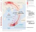
b. This morning, Malaysia received new satellite images from the French authorities showing potential objects in the vicinity of the southern corridor. Malaysia immediately relayed these images to the Australian rescue co-ordination centre.

<modsnip>

3. Update on ACARS transmission

a. The last ACARS transmission, sent at 1.07am, showed nothing unusual. The 1.07am transmission showed a normal routing all the way to Beijing.-ENDS-

bbm

:facepalm:

Changing stories AGAIN, I see? :facepalm:

What about all the "pre-programming"?

Was that all just lies?

Or is this new information the lie?

It can't both be true. Either ACARS transmission showed pre-programming of change of course, or it showed "normal routing all the way to Beijing."

So WHICH was is the truth, Malaysian officials?
 
But the southern path indicated does not traverse Indonesia.

At 2:15am, the last Thai and Malay military radar blip showed MH-370 leaving the Malacca Strait on a northwest heading toward the Andaman Sea.

The flight path on that published map shows the potential southern turn out at sea far off the Indonesian coast.

If Slate/CNN are right and the southern path should have shown up on Indonesian military radar, it seems like it should have passed much closer to Indonesia than the map indicates.

Going back to my post yesterday [ame="http://www.websleuths.com/forums/showpost.php?p=10366576&postcount=895"]here[/ame], (see attached graphic) I wrote "looking closer at 2:11 and 3:11, southern path passes right over Indonesia and the northern path over Myanmar (Burma), Bangaladesh, India may need to be shifted right a little but I can see how the pings could still fit."

Now, I realize both trajectory paths need to shift right. To clarify, I had visualized the plane taking an angular position at 2:11. After reading the Slate article again, I understand your point. The pings traveled away form the Inmarsat satellite, "never changed its heading in a direction that took it closer — at least for very long," which suggests fewer circles for plotting the pings and possibly overlapping! This could explain (Najib's?) statement early last week suggesting the plane landed before taking off again - the pings would have stayed on the same circle for a period of time (couple of hours) before traveling onto the 8:11 circumference. May also explain the Andaman Islands rumor.
 

Attachments

  • attachment_zps077ebb51.jpg
    attachment_zps077ebb51.jpg
    171.3 KB · Views: 16
SBM.
Because Google Earth also has those Street View cars that drive up and down the streets snapping pictures. That's why those images are so crisp. They're literally outside the house taking photos. Yes, they also use satellites, but they won't achieve the same effect. The images would be just like the ones China, Australia, France have-blurry.

Actually Googles regular old street maps (not street VIEW maps) are pretty darn good if you zoom in. I have seen our cars in the driveway (or parked out front) at times when I checked out our house.
The thing is they only do that once a year or so, it's not a daily imaging.

Example, this is just a random view in Kuala Lumpur, I just zoomed in to the max-

KL.jpg

27ymvs.jpg


ETA- And I think if you put in a specific address, you get an even closer view. The shot of my house looked like I could reach down and touch it. Now that I think about it, does google possibly do the pics taken from planes thing for some of their mapping?
 
Does anyone know what that dudes T-Shirt says? I'm guessing something like "My friend from Iran went to Malaysia and all I got was this lousy T-Shirt!."

The writing on this shirt is Persian, and was translated through a chum in Lebanon as saying

"The rumors that say there are terrorist Iranian passengers are denied"

Hope this helps?
 
Okay new (official) map; same old question...


Why are we concentrating looking for dubious debris in the "wastebin capital" part of the ocean hundreds (thousands?) of miles away from the last known radar showing a northwesterly flight path...respectfully snipped for space

Yeah, I think most of us agree with you that the northern route deserves equal attention at least. After so much misinformation, we won't believe the plane is found until it is, in fact, actually found.

If it took a northern route, the prevailing satellite-ping-backed theory is that perhaps it skirted India's shoreline radar via Bangladesh/Burma. But you're right, it beggars belief none of the countries picked it up on radar or shot it down along the way. Strange.

As for the southern route, well, look at all the wild heading changes MH-370 made on your map before it left radar at 2:15am. No proof the incident ended then -- the plane could have continued to change directions again, whether it ultimately tracked north or south...
 
The writing on this shirt is Persian, and was translated through a chum in Lebanon as saying

"The rumors that say there are terrorist Iranian passengers are denied"

Hope this helps?

*BBM*

Immensely. Thank You.
 
The writing on this shirt is Persian, and was translated through a chum in Lebanon as saying

"The rumors that say there are terrorist Iranian passengers are denied"

Hope this helps?

He wore that on the plane???

(I'm being in shock...I know he did, just incredulous)
 
A friend of mine who was in the Navy for 20 years being a navigator in the back of a plane that flew off of an aircraft carrier believes it was a flight 93 scenario.

IF they find wreckage in the Indian Ocean (still not totally convinced it has crashed), I think this is a very plausible explanation. But it doesn't shed any light on why the plane was headed that way in the first place.

I also keep thinking how awful it would be if some people survived the crash, but weren't found in time because everyone was looking in the wrong place initially
 
bbm, For some reason I don't think your friend and I share the same scenario about flight 93. With that said, did your friend say where they think the plane ended up?

No.

The writing on this shirt is Persian, and was translated through a chum in Lebanon as saying

"The rumors that say there are terrorist Iranian passengers are denied"

Hope this helps?

Well that's certainly odd given the circumstances. :waitasec: :eek:
 
He wore that on the plane???

(I'm being in shock...I know he did, just incredulous)

The person with the writing IMPOSED over the shirt was not even on the plane.
IIRC it was the man in the middle with his face blurred out (The one who bought the plane tickets, I think).


ETA- The writing is not actually ON the shirt. It is a headline superimposed onto the picture.
 
The TEE SHIRT

The photo of four men has writing on it that was translated and posted above.

The man on the far right of that group photo is one of the men traveling on a stolen passport. His tee shirt does have writing on it, but I don't know what it says. Looks maybe french? The first word is "Mer"?

And no one got on a plane wearing a tee shirt that says There Are No Iranian Hijackers On This Plane or whatever... that's the writing that someone added to that group photo.
 
I have never had a pilot say "copy that" to ATC.
I've listened to numerous ATC recordings in the last 2 weeks, and I haven't heard that be said.
Then I read the transcript of the last ATC conversation with MH370 and everything looked pretty typical of an ATC conversation.


Sent from my iPad using Tapatalk

I understand, but this co-pilot, IMO, always said "copy that" when he received instrucitons from ATC.

We see that in the communications which were released.

Every single time (except the last one), when the pilots were asked to do something, he would reply with "copy that," to show them he understood.

It would have been different if he had NOT said "copy that" to the other instructions that ATC gave him.

Then it would be no big deal.

But IMO, it is a red flag to me that he said it every other time (in this segment of communications we have), but did NOT say it one time, the last time.

I woudl be very interested in reading transcripts of his communications with ATC from other flights. That would shed a lot of light, IMO, on the transcript we have of this flight.

However, I doubt that Malaysian officials will EVER release something like that.

JMO.
 
Thanks, both of you.
My eye brows are back down in their normal position. Lol
 
bbm

:facepalm:

Changing stories AGAIN, I see? :facepalm:

What about all the "pre-programming"?

Was that all just lies?

Or is this new information the lie?

It can't both be true. Either ACARS transmission showed pre-programming of change of course, or it showed "normal routing all the way to Beijing."

So WHICH was is the truth, Malaysian officials?

BBM
OMG! If I thought I was confused before, I have just thrown my hands up in utter despair. I give up. I just caught the tail end of CNN discussing this ("flight path not altered, normal all the way to Beijing")

If the flight path was not altered, then there was no left turn? is everyone looking in the wrong area? What is going on? Someone tell me I am misunderstanding this flight path route.
 
bbm

:facepalm:

Changing stories AGAIN, I see? :facepalm:

What about all the "pre-programming"?

Was that all just lies?

Or is this new information the lie?

It can't both be true. Either ACARS transmission showed pre-programming of change of course, or it showed "normal routing all the way to Beijing."

So WHICH was is the truth, Malaysian officials?

BBM.
I guess we'll never know :facepalm:
Last week it was said the plane was pre-programmed. Now this?! It WASN'T pre-programmed?!
The truth would be verrrry helpful in figuring out what happened to this plane!
 
As a Canadian, I wish OUR navy (though small) was helping in the effort too! But maybe there were no assets in the area.

I will venture a guess and say the Royal Canadian Navy assets are being utilized for United Nation duties..and other multi nation operations...
 
(snipped for space)Now, I realize both trajectory paths need to shift right.

Agreed! (At least to fit what Inmarsat says now).

The pings traveled away form the Inmarsat satellite, "never changed its heading in a direction that took it closer — at least for very long,"which suggests fewer circles for plotting the pings and possibly overlapping! This could explain (Najib's?) statement early last week suggesting the plane landed before taking off again - the pings would have stayed on the same circle for a period of time (couple of hours) before traveling onto the 8:11 circumference. May also explain the Andaman Islands rumor.

Since the plane moved steadily away from the satellite every hour, I doubt it had time to land anywhere and take off again before 8:11am. If it landed and took off later, it was after 8:11am, and maybe even days later, when someone expert got in the avionics bay and disabled the ACARS pings coming from the Inmarsat box. If the ping data is right, the plane passed the Andaman Islands around 12:30am local time March 8 and was never near there again.
 
Status
Not open for further replies.

Members online

Online statistics

Members online
156
Guests online
2,372
Total visitors
2,528

Forum statistics

Threads
599,842
Messages
18,100,187
Members
230,936
Latest member
earworm
Back
Top