Sentencing and beyond- JA General Discussion #7

DNA Solves
DNA Solves
DNA Solves
Status
Not open for further replies.
You mentioned before (yesterday?) that she had been to the Grand Canyon, would she have had to go over the Hoover Dam to get there?

Agree, she's never lacked in self confidence.


No, she'd have travelled 17 north to Flagstaff to get to Grand Canyon, which is about 170 miles east of Kingman.

She went over the dam, and thus via 93, not 95, in February 2008, returning from visiting Gus in Vegas.
 
Uploads work again! Here is 95 north before crossing into Nevada. Black Mountains on the right.
 

Attachments

  • IMG_20160724_193547.jpg
    IMG_20160724_193547.jpg
    34.2 KB · Views: 58
I don't think it matters too much what EF said to her, 93 or 95 - Verizon's Joey Citizen testified the ping was located 27 miles south of the NV border - in AZ - north of Kingman (likely the nearest town located in that vicinity). She was in that location at least until 12:09 a.m. as she called T's number at 11:53 p.m. and the call lasted 16 minutes.

When I was searching out the routes there were also maps that showed the cell towers, they seemed to be few and far between(possibly due to how much of the land seemed to be reserve), which would explain why you might ping off one that you would never expect.
 
TA's house on left, the park across his street on the right. (Driveway with white vehicles).
 

Attachments

  • IMG_20160724_013458.jpg
    IMG_20160724_013458.jpg
    82.8 KB · Views: 176
No, she'd have travelled 17 north to Flagstaff to get to Grand Canyon, which is about 170 miles east of Kingman.

She went over the dam, and thus via 93, not 95, in February 2008, returning from visiting Gus in Vegas.

So she would be somewhat familiar with crossing over the Dam, and what sort of security check she'd have to go through.
 
When I was searching out the routes there were also maps that showed the cell towers, they seemed to be few and far between(possibly due to how much of the land seemed to be reserve), which would explain why you might ping off one that you would never expect.

Thanks Val, I'll have to watch Citizen's testimony again and see what kind of details he gives about pinpointing her pings.
 
TA's house, left side (faces west, front faces south).
 

Attachments

  • IMG_20160724_013617.jpg
    IMG_20160724_013617.jpg
    124.5 KB · Views: 80
Closer in, left side. Living room window? And notice how close the house behind TA's is, sliding glass door would face that house.
 

Attachments

  • IMG_20160724_013402.jpg
    IMG_20160724_013402.jpg
    118.4 KB · Views: 77
Side gate and side garage door..(right side).
 

Attachments

  • IMG_20160724_013154.jpg
    IMG_20160724_013154.jpg
    113.6 KB · Views: 77
Uploading working on and off. Will try again later. Am trying in particular to post a pic of the border street possible parking place (several blocks away).
 
If she was in NV while pinging in AZ, she would also have been pinging in NV. That's the issue.

However, I did have a thought that JA made those calls in AZ because she just couldn't help herself and then for whatever reason--maybe it was Val who suggested this--backtracked to avoid Hoover Dam, and ended up on 95.


I don't think there was enough time, but that's based on the (unsubstantiated) premise she travelled 60 to 17 to 40. It took me 4 hours to get from Mesa to Kingman, midday on a Saturday, not during week day rush hour congestion.

Fastest possible case, and I think unrealistically fast: Let's say she left Mesa at 6, arrived Kingman at 10, went halfway to the dam and turned back, which would make it around 11. (71 miles between Kingman and the dam).

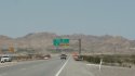
It took me 45 minutes to cut across to laughlin NV on 68, and if she went on 95 then, she was lost too, and driving in the wrong direction, towards Needles. (and the ping would be way further south than 27 south of Hoover dam NV; a Kingman tower would be closer).

BTW, because it's relevant to gauging time, I confess to routinely driving 5-6 miles over the speed limit when I'm driving long distances, and on deserted stretches, up to 10 miles over, which on some of those roads means 80-85 miles an hour. ;)
 
Merger of 93 and 95, driving north on 95. Henderson and Las Vegas are on the other side of mountains.
 

Attachments

  • IMG_20160724_142215432.jpg
    IMG_20160724_142215432.jpg
    34.7 KB · Views: 58
Crossing into Nevada in Laughlin.
 

Attachments

  • IMG_20160724_193446.jpg
    IMG_20160724_193446.jpg
    62.2 KB · Views: 57
Merger of 93 and 95, driving north on 95. Henderson and Las Vegas are on the other side of mountains.

According to this one map, if you go east on 93 at the 93/95 junction, then north on Lakeshore Rd, you can bypass Las Vegas and have a handy lake on your right which would definitely allow for pings hitting any towers on the east side of the lake, which would still be south of the AZ border. Anyway, great pics and hope you're taking breaks too! :)

http://www.travelmath.com/drive-distance/from/Mesa,+AZ/to/Las+Vegas,+NV
 
I hope I can post this... thought it might be useful to this discussion:

http://www.websleuths.com/forums/sh...he-Unresolved-Questions&p=9748395#post9748395

08-12-2013, 08:33 AM #254
Tuba

"Mesa Det. Larry Gladysh testified that C.M.'s tel. records show she was 27 miles from the Nevada border, 45 miles north of Kingman when she made a 31" call to Travis (deceased). She had traveled 256 miles in 4 hours & 33 minutes. That means leaving Mesa at 7:04 p.m., June 4. She had avoided, in the most conspicuous way, leaving her mark anywhere in Arizona. I think she believed she had exited the state when she still had 27 miles to go. Eleven minutes later she left the longer voice mail, recording her disgust at going over 100 miles out of her way because she got lost. I also think she is in a bit of panic because she has realized that she is traceably in Arizona, so that is explained by going astray, a lie. Of course, we are pretty sure she did not leave Mesa at 7 o'clock, there is lost time to account for on the road, therefor. Was she franticly disposing of contaminated clothes, belongings and the gun? Or about to do that, just inside Nevada?"
-------------------------------

So basically, does that mean she pinged a tower that was 45 miles north of Kingman but only 27 miles east of the Nevada border? How does that compute with that break in the mountains you noted H4M?
 
Going back to my notes at the time:

http://www.hlntv.com/slideshow/2013/02/11/jodi-arias-trial-tragic-roadtrip

Jodi Arias trial: The tragic road trip
By
Graham Winch and Emily Kean
Updated 2:53 PM EST,
Wed February 25, 2015
"At 10:30 p.m., Arias calls Burns to tell him she got lost but she's on her way and will be in Utah by the morning.

In the 11 p.m. hour, Arias calls Alexander's phone three times:

The first call is at 11:37 p.m. and is 31 seconds long.

The second call is at 11:48 p.m. and she leaves a voicemail.

The third call was at 11:53 p.m. It was 16 minutes long.

Investigators say Arias may have accessed Alexander's voicemail account on June 4. Phone records show Arias was between Kingman, Arizona, and the Nevada border when she made the calls."
 
According to this one map, if you go east on 93 at the 93/95 junction, then north on Lakeshore Rd, you can bypass Las Vegas and have a handy lake on your right which would definitely allow for pings hitting any towers on the east side of the lake, which would still be south of the AZ border. Anyway, great pics and hope you're taking breaks too! :)

http://www.travelmath.com/drive-distance/from/Mesa,+AZ/to/Las+Vegas,+NV


The route now near Hoover Dam is different than in 2008, so current maps and signs are different too. The bypass you noticed is interesting. I didn't see any signs for it coming up north on 95, but she might have if she travelled on 93. On my map the bypass begins near the visitors center, which if in same place would be a very logical place to pull into to make calls, IMO.

I don't think she had any need to bypass Las Vegas, but she could have. I disagree with Tuba's analysis of a missing hour, btw. I think the timeline is extremely tight for making those calls when she did, and that they were likely made near the dam, either at the visitor's center (if she went via 93), or near the gap before 93 and 95 merge (less likely, because there is no place to pull over/into there other than the side of the road).

Again, there is no way she could have mistaken being in Nevada if she drove on 93 from Kingman. Every mileage sign on the road (and they are plentiful) marks the distance to Hoover dam, and she had travelled that road just a few months earlier.
 
The unaccounted for time I see comes after her phone calls. She bought gas in Mesquite, NV at 4 AM, and the driving time between Hoover Dam and Mesquite is only one hour and 45 minutes, tops (via 15, which has a 75mph speed limit and is a fast, uncongested, multi lane highway).

Her driving time between Mesquite and Ryan's house seems about right, though, as in, no noticeable time gaps, if she arrived around 10AM.
 
Status
Not open for further replies.

Members online

Online statistics

Members online
196
Guests online
2,810
Total visitors
3,006

Forum statistics

Threads
603,648
Messages
18,160,142
Members
231,797
Latest member
chefk
Back
Top