

You are using an out of date browser. It may not display this or other websites correctly.
You should upgrade or use an alternative browser.
You should upgrade or use an alternative browser.
CA - Jonathan Gerrish, Ellen Chung, daughter, 1 & dog, suspicious death hiking area, Aug 2021 #5
- Thread starter dalsglen
- Start date
- Status
- Not open for further replies.
- Joined
- Sep 9, 2021
- Messages
- 213
- Reaction score
- 2,115
Yeah, getting lost is easy. Navigating the loop to the point where they were found doesn't seem like something an inept hiker could do. An inept hiker would miss the turns, so I think he knew where he was going, however he did it. Maybe that is partly why the Sheriff said they were "well prepared", he found their map. I too wonder when they realized they were in trouble. I suspect it was after they reached the river, if it was before then, I could see continuing to the river, but I'd want to take the shortest and safest route back to the truck- the way I just came- rather than go farther and take an unfamiliar trail. One other thing I thought of- fires are bad for trails. You get erosion and downed trees. That really slows you down, you can imagine trees across the trail, branches sticking up, getting over or around them. MOOI would give JG some credit for being familiar with maps and direction, having some sense of where they were going, but you never know. They must have had a plan that, at a minimum, entailed hiking down HC Trail to the river (MOO), so it's possible that there may have been some confusion from that juncture. I would assume they planned on ending the hike back at the truck, which would have entailed taking the hike they actually took back up SL trail. I think the speculation of being confused as to direction is a red herring. The main focus as far as I'm concerned, is WHEN did they realize they were getting in over their head? I assume it was at some point going down HC to the river. By the time they reached the river it was at least an hour into the hike and it was HOT at that location at the time. I think (MOO) at that point the hike became problematic for them and was no longer a pleasant excursion. They knew what they were facing hiking back up HC and that must have been daunting, so they took the path of least resistance going forward down the river to SL, but SL was an *unknown* for them at the time (MOO). Perhaps they thought SL back up would be tolerable vs hiking back up HC?
- Joined
- Sep 9, 2021
- Messages
- 213
- Reaction score
- 2,115
The trees along the Hites Cove OHV road also burned in 2018, so really the whole thing is inhospitable. Well, you can get fantastic wildflower displays after a fire, but even in spring, the lack of shade would get to you.Looking at SAR photo of recovery shows area is still barren. The entire SL trail looks inhospitable ! I don't know who would want to hike this under ANY conditions. I'm not convinced it was part of their original plan, but a result of an aborted hike down and back HC trail to the river. MOO
- Joined
- Jun 9, 2013
- Messages
- 11,289
- Reaction score
- 89,528
The conditions would be different in a different season, though. And hikers carry [paper/Tyvek] topos exactly so they can see stuff like how steep an ascent is. A small screen as on a cell phone won't help you with stuff like this: the detail isn't fine enough, you can't get enough context on the screen, etc.Savage being apropos as to trail name and conditions. If they had ascended the HC back to their car, would tree cover have helped despite the heat and extra exertion required?
I can see a need for signage at both ends of SL re: conditions and climb in elevation. Scorched earth and an elevation gain clearly noted might have made them turn back.
But having an infant really put the pressure on to find a way back to the truck. I doubt they were prepared for an overnight.
I would like to see a memorial for this family be placed at a beautiful wildflower overlook.
JMO
All of a sudden, I see a sequence of events that I hadn't thought of until now...why relying on electronic mapping could be disastrous in this specific location as well as in those conditions.
Here's the problem, and why you'd have to have a paper map to supplement your phone. There are many areas—like this one—that don't have cell coverage, so you'd need to orient yourself with a paper map. This is potentially the reason why the family would end up on the S-L trail: they simply didn't have any access to information because there was no cell service. They might have relied solely on their phone and never anticipated the implications of having no cell service when you're on a hike and it's your map source. They might have thought the hike was a lot shorter. They might never have guessed it was so steep. They might have thought the HC trail, having gone down it, was steeper than they wanted to go up again, and thought they'd remembered you could go another way, never anticipating that it was significantly more steep than the HC trail. It might not have occurred to them there were no trees. They might have wandered along the river and randomly come across the S-L trail. They might have kind of remembered another trail, but the one they were thinking of was actually on the other side of the river, so they had to continue on until they found one on their side of the river, which was unfortunately the S-L trail... All of this could have happened if they planned on orienting themselves with a cell phone and had no back up for the information on it (e.g. a topo map) if the cell phone was inoperable or irrelevant.
All of a sudden, I can totally see this happening. They could have got into a fix because they had no information about the trails at the point when they needed it, and decisions had to be made. And why didn't they? They scurried down to the river on the HC trail (which is pretty obvious, so neither map nor serious navigation was needed), and didn't realize until they got to the bottom that they had no cell service and therefore no map. They would have had no way from there to know the best return route. They guessed wrong.
This scenario might also explain why it's so hard to believe they made a decision to do the whole loop in those conditions. They had to guess the best way because they didn't have a map, and they didn't have a map because there was no cell service.
Those mapping apps require cell service IME; they also work from the phone's GPS, but actually the GPS would not have been functioning correctly, because there was no satellite access, either (we know that because LE couldn't get their satellite phone to work because the mountains obstructed the satellite view.).
Also, the phone would not work properly in that heat, IME. (I made the mistake of leaving my brand new iphone on the car dash in the low 90 degrees, and it was inoperable until I cooled it down, so I know this happens.)
I guess I'm saying there are 3 different ways the technology could have failed them when they needed it. And they needed it after they'd taken the obvious route to descend to the river, namely the HC route.
Last edited:
- Joined
- Sep 9, 2021
- Messages
- 213
- Reaction score
- 2,115
A few trees appear to be left along the HC OHV trail, but it's pretty barren too. Having just come down it, they would have known what it was like. They could have started up it after it cooled off and the sun was no longer a factor. Being a road, it would be a lot easier to go up it in twilight or dark than the SLT. A memorial is a good idea, might save other lives too.Savage being apropos as to trail name and conditions. If they had ascended the HC back to their car, would tree cover have helped despite the heat and extra exertion required?
I can see a need for signage at both ends of SL re: conditions and climb in elevation. Scorched earth and an elevation gain clearly noted might have made them turn back.
But having an infant really put the pressure on to find a way back to the truck. I doubt they were prepared for an overnight.
I would like to see a memorial for this family be placed at a beautiful wildflower overlook.
JMO
- Joined
- Feb 9, 2016
- Messages
- 91
- Reaction score
- 752
I don't know.They had to guess the best way because they didn't have a map, and they didn't have a map because there was no cell service.
Those mapping apps require cell service IME; they also work from the phone's GPS, but actually the GPS would not have been functioning correctly, because there was no satellite access
Every "experienced hiker" has downloaded offline maps like OSM.
And GPS is different compared to a satellite phone. There are so many GPS satellites that GPS works reasonably well almost everywhere.
I haven't read yesterdays or todays posts but hopefully will be able to soon. I was thinking the only way I could accept that this family died of HS (the obvious reason due to the temp.) is if they somehow suddenly lost their ability to judge risk. From the little we know about this family is that they were responsible people whose professions required them to have certain characteristics such as in EC's case as a yoga instructor she had to keep in mind her clients well being. With JG he had to work with a team to help Snapchat operate as it should (MOO.) So I find it uncharacteristic of either JG/EC to put themselves and their vulnerable dependents at risk of death. However, it is possible that they did this hike in a mind altered state, unintentionally where in their mind at the time they were thinking that this hike was alright to do and did it fully as has been suggested by LE (I believe) or if not fully as much as they could in severe heat. Here there are quite a few possibilities. But these would all be before they even started their hike, possibly hours earlier. These are from suggestions made by others on these five WBS threads. Particularly overdose situations, toxic substances and prescription medication/illegal drugs. But these would be all accidental and unknown on the part of JG & EC. The water bladder they had with them could be a culprit. My question here is what caused them to lose their ability to protect themselves and their vulnerable dependents to start that hike in the first place when they should have been of sound mind at that time?
I would like to see a memorial for this family be placed at a beautiful wildflower overlook.
JMO
I am aware of a memorial to the ill-fated Donner Party, their wagon train of 80 pioneers stranded during a brutal Sierra winter 175 years ago. Or a lovely memorial shelter at Muir Pass for John, ‘Father of the National Parks’. There are various monuments for the heroic efforts of SAR personnel giving their life in the saving of others. And memorial groves in honor of generous benefactors donating land for public use.
I am not aware, however, of any memorials to the dozens of souls who perish yearly in our mountains due to accident. As tragic as this event is, I am uncertain what we would be lionizing.
As a hiker I can attest that you often have to hike through some pretty inhospitable terrain to get to an area of beauty.Looking at SAR photo of recovery shows area is still barren. The entire SL trail looks inhospitable ! I don't know who would want to hike this under ANY conditions. I'm not convinced it was part of their original plan, but a result of an aborted hike down and back HC trail to the river. MOO
- Joined
- Jul 22, 2021
- Messages
- 1,197
- Reaction score
- 10,083
LE did not give a deadline to my knowledge, MOO. This time frame seems fairly typical, esp given the number of victims.Am I the only one wondering what is taking toxicology so long? Did I miss something? They said it would take ~ two weeks for toxicology?
- Joined
- Apr 16, 2018
- Messages
- 943
- Reaction score
- 10,138
@RickshawFan . . .precisely.
D
Deleted member 222031
Guest
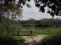
I always appreciate a bench along a trail for rest and reflection. Many benches in parks and open spaces have a memorial plaque to honor a life lost. It really doesn't matter how or why the death occurred. And a bench is just one type of outdoor memorial.I am aware of a memorial to the ill-fated Donner Party, their wagon train of 80 pioneers stranded during a brutal Sierra winter 175 years ago. Or a lovely memorial shelter at Muir Pass for John, ‘Father of the National Parks’. There are various monuments for the heroic efforts of SAR personnel giving their life in the saving of others. And memorial groves in honor of generous benefactors donating land for public use.
I am not aware, however, of any memorials to the dozens of souls who perish yearly in our mountains due to accident. As tragic as this event is, I am uncertain what we would be lionizing.
Pic is from a trail I walked in Texas.
MOO
Attachments
- Joined
- Jul 22, 2021
- Messages
- 1,197
- Reaction score
- 10,083
Looking up from the river to the top of Devil's Gulch, one would understand a significant change in elevation, the hike DOWN into the deep canyon on any trail would signify a steep climb back out. The switchbacks on SL might make the change in elevation slightly easier, in fact.Savage being apropos as to trail name and conditions. If they had ascended the HC back to their car, would tree cover have helped despite the heat and extra exertion required?
I can see a need for signage at both ends of SL re: conditions and climb in elevation. Scorched earth and an elevation gain clearly noted might have made them turn back.
But having an infant really put the pressure on to find a way back to the truck. I doubt they were prepared for an overnight.
I would like to see a memorial for this family be placed at a beautiful wildflower overlook.
JMO
Looking down into the canyon from HC also makes the depth clear, there are many photos, GE and a reviews on AT and elsewhere of people turning around. So I don't think it was a surprise. I think that it can be easy to overestimate ability to handle a factor such as heat but the human body and canines are simply not designed to discharge heat when the core temp starts to be too elevated. It causes brain damage and organ failure. With the direct sun, not only was the air temp 109+ but the canyon would also be radiating heat up, SAR dogs burned their paws on the trail and had to be pulled. I suspect, like Kreycik, they were moving quickly and when they found themselves becoming impaired due to heat they were too far from help with no one around (as others were not on that trail in August, they were not found for days). MOO. How heat can make your body melt down from the inside out (theconversation.com)
"But when this temperature gradient is reduced, for example due to an increase in temperature and humidity, your body has a harder and harder time getting rid of this heat fast enough. And it’s a poorly recognised fact that, just like paper, our vital organs have an equivalent self-combustion point - that is, a temperature that they stop working.
Once your core body temperature reaches 40°C, your organs begin to fail, and unless you get into cooler conditions immediately, you will die."
14 heat safety tips for L.A. hiking during hot weather - Los Angeles Times (latimes.com)
I suspect their house had air conditioning and they drove to the trail in an air conditioned truck. It was very hot in the preceding days, 105 on Saturday, so the temps were not a surprise, but rather, minimized or discounted or not particularly factored in, as with Kreycik. It was possibly more about trail location and wanting to get a hike in, perhaps. Humans need to be better educated about the dangers of heat. Ironically, per someone who looked it up, it was hotter in DG that day than when they were on their adventure tour in Gobi. But they did not think about it the same way, nor were there guides or safety protocols built in. Humans also discount risk closer to home and per SAR more rescues are needed for those on day trips than overnights, again the perception of danger is different > more risks discounted or not planned for. MOO.
Last edited:
- Joined
- Jul 22, 2021
- Messages
- 1,197
- Reaction score
- 10,083
Yeah, getting lost is easy. Navigating the loop to the point where they were found doesn't seem like something an inept hiker could do. An inept hiker would miss the turns, so I think he knew where he was going, however he did it. Maybe that is partly why the Sheriff said they were "well prepared", he found their map. I too wonder when they realized they were in trouble. I suspect it was after they reached the river, if it was before then, I could see continuing to the river, but I'd want to take the shortest and safest route back to the truck- the way I just came- rather than go farther and take an unfamiliar trail. One other thing I thought of- fires are bad for trails. You get erosion and downed trees. That really slows you down, you can imagine trees across the trail, branches sticking up, getting over or around them. MOO
The trails were just recently re-opened after significant work following the fire. There are lots of photos on the Mariposa Trails FB page, for one. The trails were cleared and filled in, the deep root systems burned too, creating holes under the trails. The photos really give an idea of the depth of the canyon, people on the switchbacks are tiny.
I agree that they were likely following a planned route. MOO. Their truck was parked between the trailhead where LE believes they started and the trailhead for the trail they were found on, as if they intended the loop, as LE has stated.
Tragic accident. MOO.
- Joined
- Jul 22, 2021
- Messages
- 1,197
- Reaction score
- 10,083
I think your imagery is from 2017, on the toolbar at the top of Google Earth is a clock icon, select that to get historical imagery. Using that you can get the most recent which is 8/8/2018, right after the Ferguson Fire. The image quality is not nearly as good as the 2017 images, but you can see a lot burned. It is still green down by the river, so at least some of the trees down there probably survived. Probably some vegetation has started re-growing in the three years since, but the last two were drought years, so I'm sure it is struggling. Attached is an image of the Savage Lundy Trail in 2018, you can barely make out some of the switchbacks. It was really barren after the 2018 fire.
Thanks for the GE info and the photo.
Pumphouse363
Well-Known Member
- Joined
- Sep 17, 2021
- Messages
- 234
- Reaction score
- 1,054
I’m sorry to labour the point but, I can find no maps that show any trail between Hites Cove and the base of the Savage Lundy Trail. If they were intending to do a loop I can’t understand what they were thinking because, as far as I can tell, if they actually reached Hite Cove they would then have to return some ways on the trail they came on then, instead of going to Marble Point they would have had to get back down to the river and follow it along until they reached the point of the SL trail. It doesn’t make any sense to do that. MOOThe trails were just recently re-opened after significant work following the fire. There are lots of photos on the Mariposa Trails FB page, for one. The trails were cleared and filled in, the deep root systems burned too, creating holes under the trails. The photos really give an idea of the depth of the canyon, people on the switchbacks are tiny.
I agree that they were likely following a planned route. MOO. Their truck was parked between the trailhead where LE believes they started and the trailhead for the trail they were found on, as if they intended the loop, as LE has stated.
Tragic accident. MOO.
Last edited:
- Joined
- Jul 22, 2021
- Messages
- 1,197
- Reaction score
- 10,083
I would give JG some credit for being familiar with maps and direction, having some sense of where they were going, but you never know. They must have had a plan that, at a minimum, entailed hiking down HC Trail to the river (MOO), so it's possible that there may have been some confusion from that juncture. I would assume they planned on ending the hike back at the truck, which would have entailed taking the hike back up HC trail OR back up SL trail. I think the speculation of being confused as to direction is a red herring. The main focus as far as I'm concerned, is WHEN did they realize they were getting in over their head? I assume it was at some point going down HC to the river. By the time they reached the river it was at least an hour into the hike and it was HOT at that location at the time. I think (MOO) at that point the hike became problematic for them and was no longer a pleasant excursion. They knew what they were facing hiking back up HC and that must have been daunting, so they took the path of least resistance going forward down the river to SL, but SL was an *unknown* for them at the time (MOO). Perhaps they thought SL back up would be tolerable vs hiking back up HC? Ironically, I think turning back up HC from the river may have been a better option and possibly survivable.
Possibly the switchbacks seemed an "easier" way to handle the elevation gains? MOO.
D
Deleted member 222031
Guest
I’m sorry too about the point but, I can find no maps that show any trail between Hites Cove and the base of the Savage Lundy Trail. If they were intending to do a loop I can’t understand what they were thinking because, as far as I can tell, if they actually reached Hite Cove they work then have to return some ways on the trail they came on then, instead of going to Marble Point they would have had to get back down to the river and follow it along until they reached the point of the SL trail. It doesn’t make any sense to do that. MOO
Are you saying the loop map attached to above post has no trail thru Devil Gulch? When I view that area on Google Earth, it looks like there might be. Surely they wouldn't have bushwhacked up to the SL trail?@LifeIsAMystery the date for the image I am using is defined as "2017-newer."
I still maintain that without compass (which we don't know if they had) or a topo map, we can't be certain if the GCs had any idea where they were once they got to the Merced River. They may not have known location or direction. Even if Jon downloaded a trail map to his phone, I can't imagine it did him much good. They may have followed the vegetation, river or what they thought was a way out or up.
Hmmmmm....
MOO
- Joined
- Jul 22, 2021
- Messages
- 1,197
- Reaction score
- 10,083
Looking up from the river to the top of Devil's Gulch, one would understand a significant change in elevation, the hike DOWN into the deep canyon on any trail would signify a steep climb back out. The switchbacks on SL might make the change in elevation slightly easier, in fact.
Looking down into the canyon from HC also makes the depth clear, there are many photos, GE and a reviews on AT and elsewhere of people turning around. So I don't think it was a surprise. I think that it can be easy to overestimate ability to handle a factor such as heat but the human body and canines are simply not designed to discharge heat when the core temp starts to be too elevated. It causes brain damage and organ failure. With the direct sun, not only was the air temp 109+ but the canyon would also be radiating heat up, SAR dogs burned their paws on the trail and had to be pulled. I suspect, like Kreycik, they were moving quickly and when they found themselves becoming impaired due to heat they were too far from help with no one around (as others were not on that trail in August, they were not found for days). MOO. How heat can make your body melt down from the inside out (theconversation.com)
"But when this temperature gradient is reduced, for example due to an increase in temperature and humidity, your body has a harder and harder time getting rid of this heat fast enough. And it’s a poorly recognised fact that, just like paper, our vital organs have an equivalent self-combustion point - that is, a temperature that they stop working.
Once your core body temperature reaches 40°C, your organs begin to fail, and unless you get into cooler conditions immediately, you will die."
14 heat safety tips for L.A. hiking during hot weather - Los Angeles Times (latimes.com)
I suspect their house had air conditioning and they drove to the trail in an air conditioned truck. It was very hot in the preceding days, 105 on Saturday, so the temps were not a surprise, but rather, minimized or discounted or not particularly factored in, as with Kreycik. It was possibly more about trail location and wanting to get a hike in, perhaps. Humans need to be better educated about the dangers of heat. Ironically, per someone who looked it up, it was hotter in DG that day than when they were on their adventure tour in Gobi. But they did not think about it the same way, nor were there guides or safety protocols built in. Humans also discount risk closer to home and per SAR more rescues are needed for those on day trips than overnights, again the perception of danger is different > more risks discounted or not planned for. MOO.
To clarify 40C = approximately 104F. As core temp increases, there is a very short time window to reverse it or brain damage and death become likely. I and others have spoken of being packed in ice or put in ice baths, interventions that would not be available on the trail. Heat exhaustion can turn to heat stroke very quickly. No amount of water or fitness or determination can override the basic parameters under which the human body operates, when the core gets too hot there is organ failure, including the brain. When ambient temps are 109+ the body will overheat. Those more vulnerable will likely overheat sooner, but the body cannot operate when heat limits are exceeded. MOO.
- Status
- Not open for further replies.
Similar threads
- Locked
- Replies
- 1,027
- Views
- 115K
- Locked
- Replies
- 839
- Views
- 85K
- Locked
- Replies
- 1,059
- Views
- 142K
- Locked
- Replies
- 965
- Views
- 137K
- Locked
- Replies
- 970
- Views
- 158K
Guardians Monthly Goal

Goal Reached! We hit our target of 75 new Guardians!
New stretch goal: 100!
Our goal for the month is 75 new Guardians members to sign up. Have you been thinking about becoming a member?
Click here to find out how!
Online statistics
- Members online
- 94
- Guests online
- 2,261
- Total visitors
- 2,355
Totals may include hidden visitors.
Forum statistics
Community Rules
-
Be CivilTreat all members with respect. No personal attacks, harassment, or inflammatory language.
-
Victim FriendlyAlways show respect for victims and their families. No victim blaming or insensitive speculation.
-
Fact-based SourcingProvide credible sources for claims. Distinguish between verified facts and personal theories.
-
Social Media UseDo not post direct links to personal social media profiles of private individuals.
-
Copyright and PaywallsDo not copy full articles. Summarize and link to the original source instead.
-
Privacy and Personal InformationDo not post personal information such as addresses, phone numbers, or workplaces.
-
Registered Sex-OffendersDo not name or speculate about RSOs unless officially named in connection to a case.
-
Stay On TopicKeep discussions relevant to the case or topic at hand. Avoid off-topic tangents.
-
Accounts, Moderation, and DisputesOne account per person. Contact moderators privately for disputes or concerns.
-
Solicitation and FundraisingNo solicitation, fundraising, or promotion of personal ventures without approval.